
MyTopo
Steve Arkansas US Topo Map
Couldn't load pickup availability
Also explore the Steve Forest Service Topo of this same quad for updated USFS data
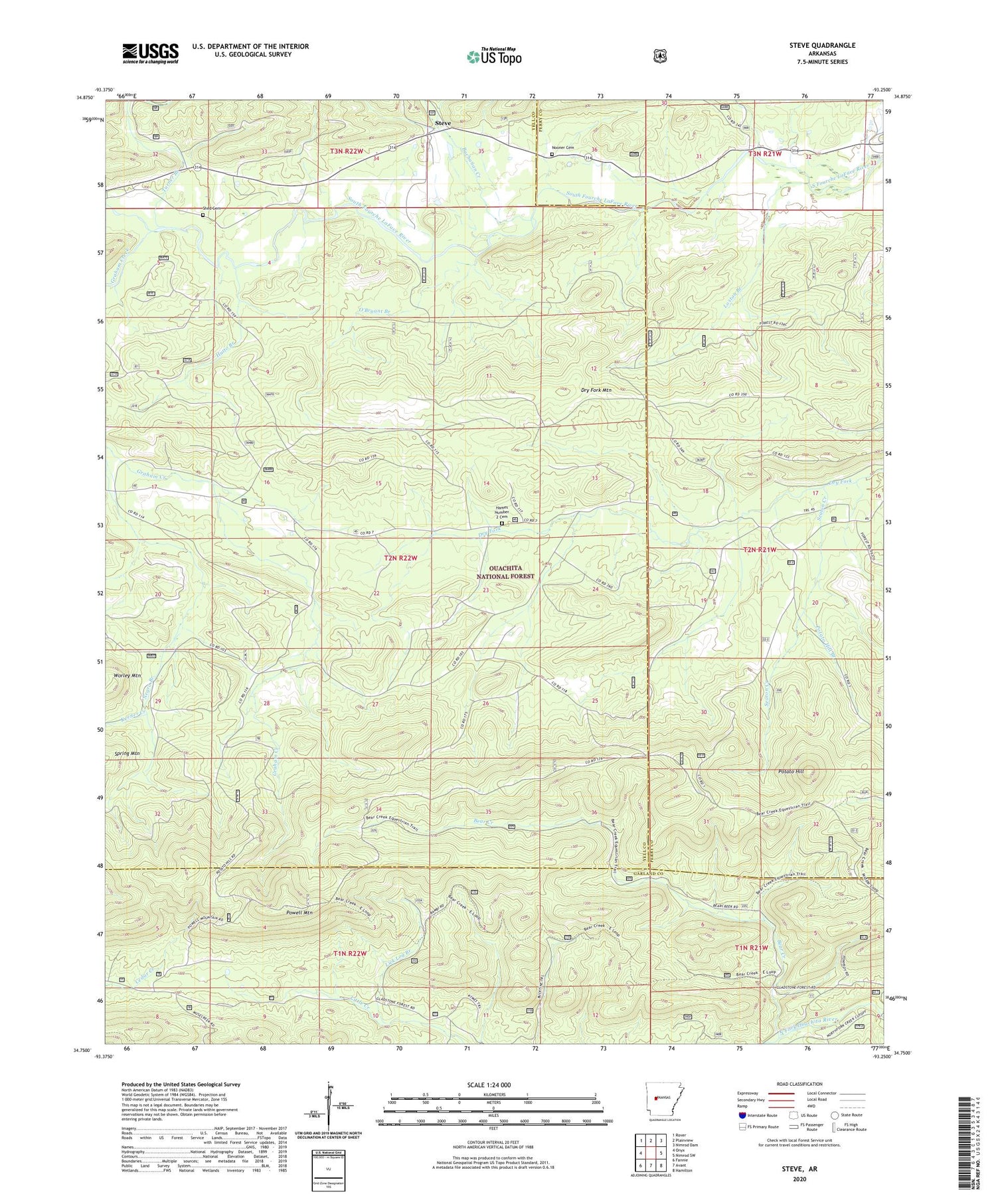
2024 topographic map quadrangle Steve in the state of Arkansas. Scale: 1:24000. Based on the newly updated USGS 7.5' US Topo map series, this map is in the following counties: Yell, Perry, Garland. The map contains contour data, water features, and other items you are used to seeing on USGS maps, but also has updated roads and other features. This is the next generation of topographic maps. Printed on high-quality waterproof paper with UV fade-resistant inks.
Quads adjacent to this one:
West: Onyx
Northwest: Rover
North: Plainview
Northeast: Nimrod Dam
East: Nimrod SW
Southeast: Hamilton
South: Avant
Southwest: Fannie
This map covers the same area as the classic USGS quad with code o34093g3.
Contains the following named places: Ava School, Bear Creek, Buchanan Creek, Crawford School, Graham Creek, Graham School, Hames Number 2 Cemetery, Hutto Branch, Keener Creek, Lick Log Branch, Loston Branch, Nooner Cemetery, O'Bryant Branch, Potato Hill, Potato Hill Branch, Powell Mountain, Seaton Creek, Shed Cemetery, Steve, Steve Church, Township of Crawford, Turner Branch, ZIP Code: 72857


