MyTopo
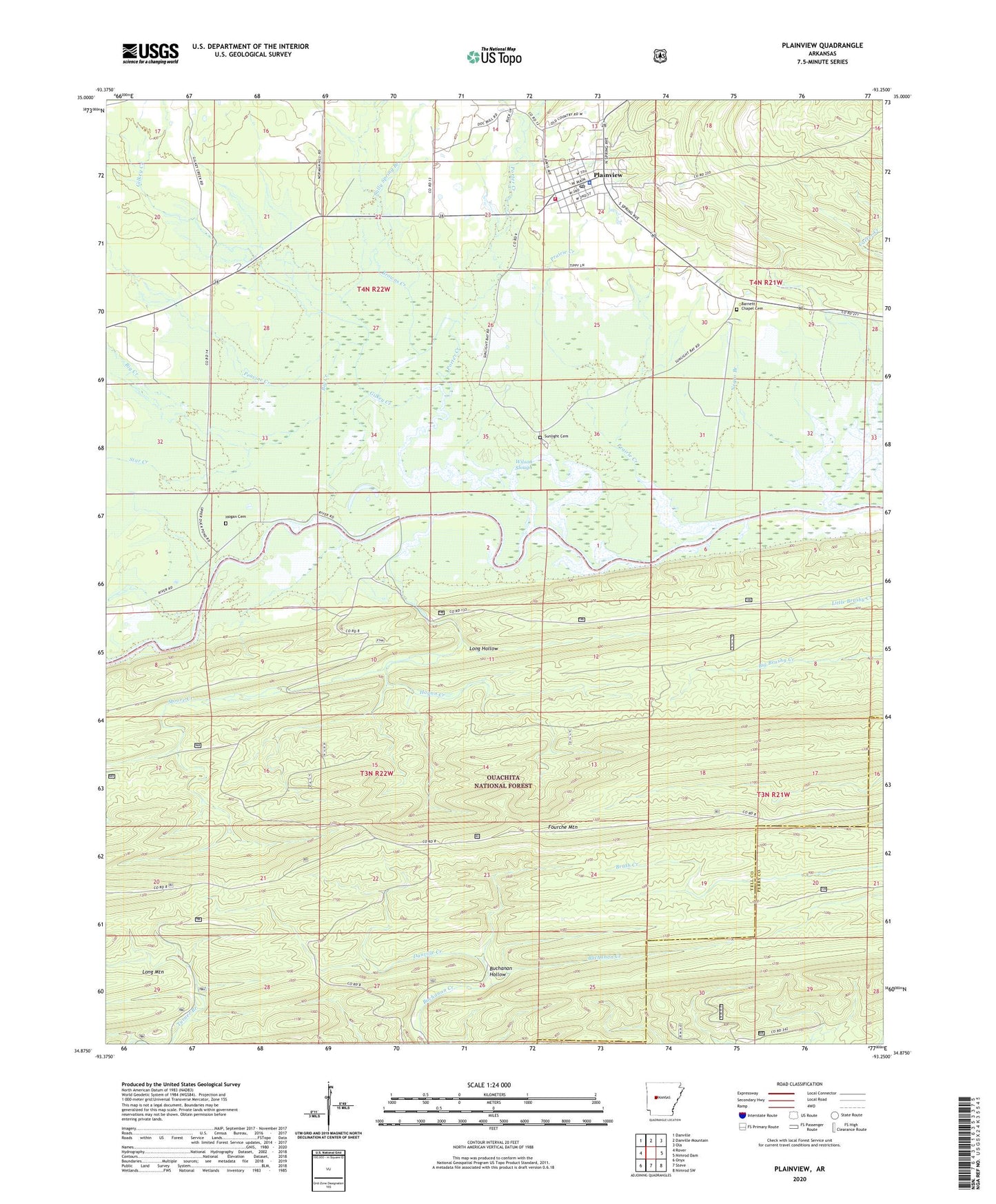
Plainview Arkansas US Topo Map
Couldn't load pickup availability
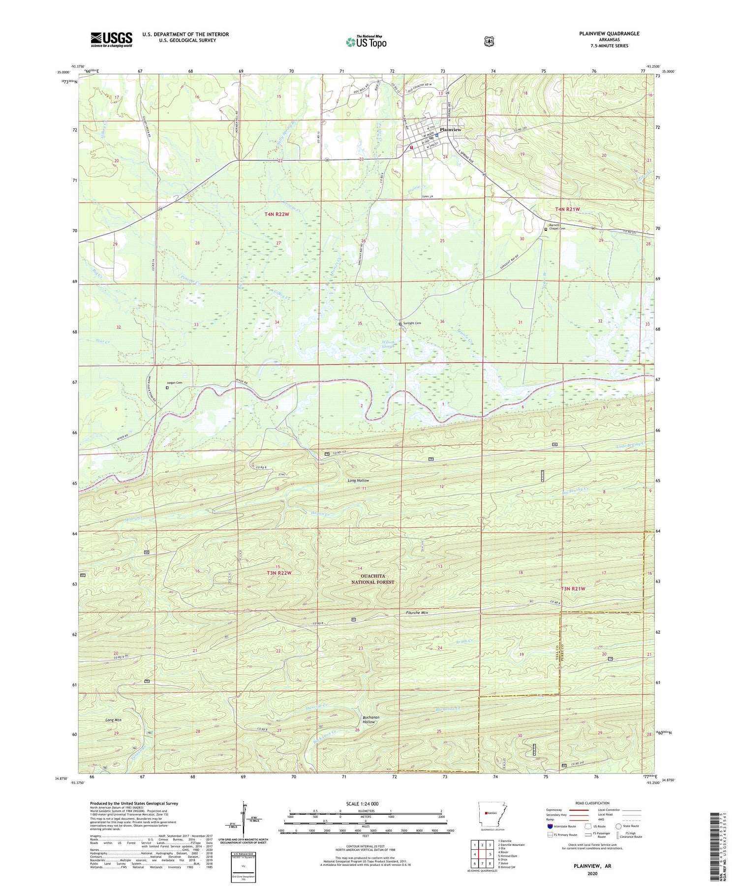
Also explore the Plainview Forest Service Topo of this same quad for updated USFS data
2024 topographic map quadrangle Plainview in the state of Arkansas. Scale: 1:24000. Based on the newly updated USGS 7.5' US Topo map series, this map is in the following counties: Yell, Perry. The map contains contour data, water features, and other items you are used to seeing on USGS maps, but also has updated roads and other features. This is the next generation of topographic maps. Printed on high-quality waterproof paper with UV fade-resistant inks.
Quads adjacent to this one:
West: Rover
Northwest: Danville
North: Danville Mountain
Northeast: Ola
East: Nimrod Dam
Southeast: Nimrod SW
South: Steve
Southwest: Onyx
This map covers the same area as the classic USGS quad with code o34093h3.
Contains the following named places: Barnett Chapel Cemetery, Big Creek, Bridgeport School, Browns Creek, Buchanan Hollow, City of Plainview, Danville Creek, Fourche Mountain, Gilkey Creek, Hogan Cemetery, Hogan Creek, Moore Creek, Negro Branch, Peavine Creek, Plainview, Plainview - Rover Elementary School, Plainview - Rover High School, Plainview Fire Station, Plainview Police Department, Plainview Post Office, Porter Creek, Prairie Creek, Sally Spring Branch, Star Creek, Sunlight Bay Public Use Area, Sunlight Cemetery, Township of Gilkey, Township of Lamar, Township of Lower La Fave, Ward School, Wards Crossing, Wilson Slough