MyTopo
Antoine Arkansas US Topo Map
Couldn't load pickup availability
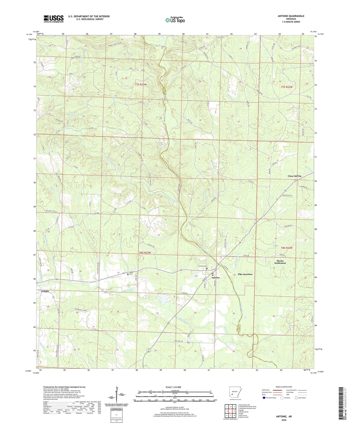
2024 topographic map quadrangle Antoine in the state of Arkansas. Scale: 1:24000. Based on the newly updated USGS 7.5' US Topo map series, this map is in the following counties: Pike, Clark. The map contains contour data, water features, and other items you are used to seeing on USGS maps, but also has updated roads and other features. This is the next generation of topographic maps. Printed on high-quality waterproof paper with UV fade-resistant inks.
Quads adjacent to this one:
West: Delight
Northwest: Murfreesboro NE
North: Chalybeate Mountain West
Northeast: Chalybeate Mountain East
East: Okolona North
Southeast: Okolona South
South: Piney Grove
Southwest: Pisgah
This map covers the same area as the classic USGS quad with code o34093a4.
Contains the following named places: Antoine, Antoine Cemetery, Antoine Post Office, Antoine Volunteer Fire Department, Big Branch, Brushy Creek, Chinquapin Branch, Clear Spring, Clear Spring Camp, Coon Creek, Delight High School, Happy Hill Church, Harrison Church, Kirkham Branch, Lamb Cemetery, Little Antoine Creek, Meeks Settlement, Mill Creek, Pike Junction, Rosewald School, Suck Creek, Town of Antoine, Township of Wolf Creek, Wolf Creek, ZIP Code: 71922