MyTopo
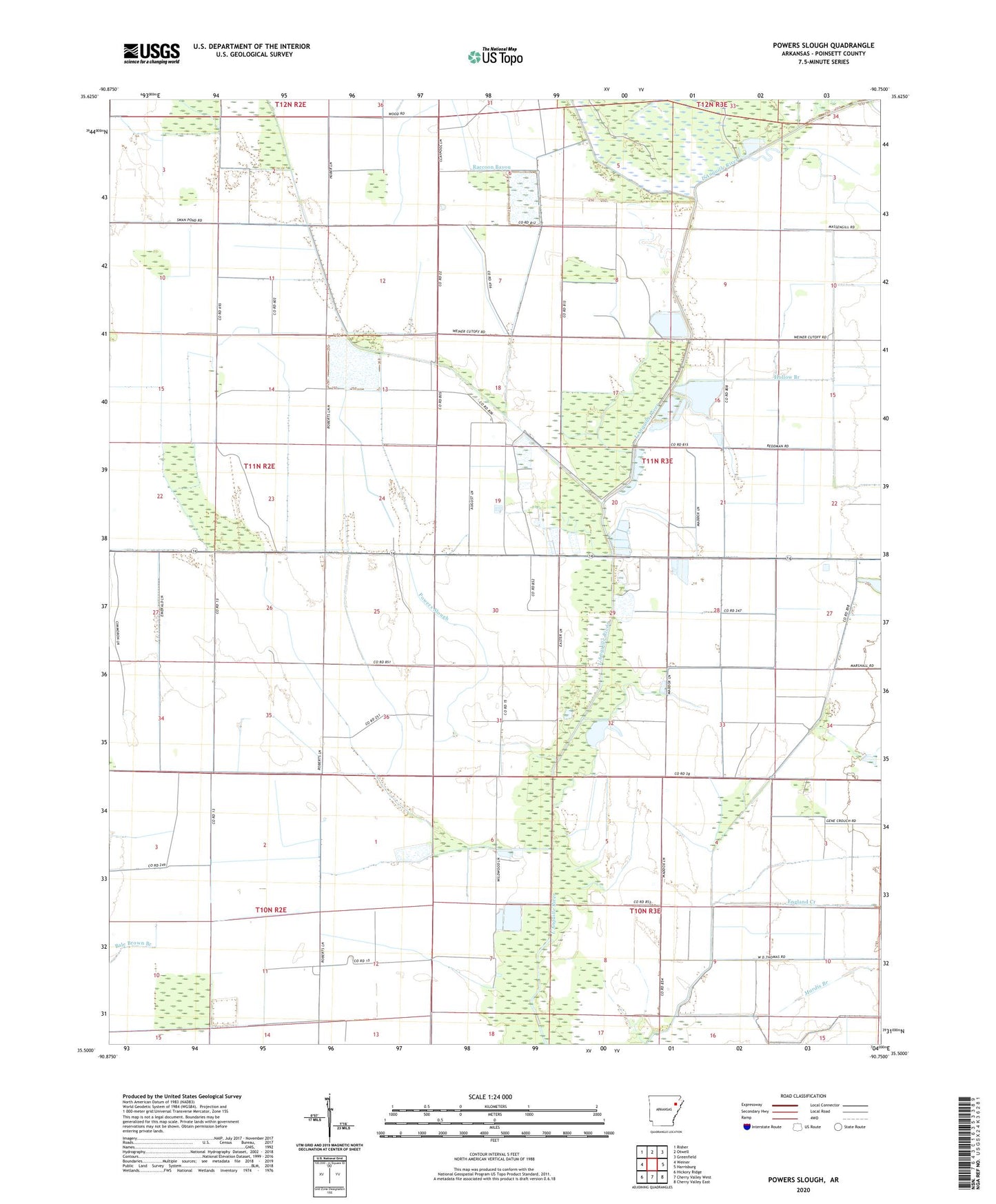
Powers Slough Arkansas US Topo Map
Couldn't load pickup availability
2024 topographic map quadrangle Powers Slough in the state of Arkansas. Scale: 1:24000. Based on the newly updated USGS 7.5' US Topo map series, this map is in the following counties: Poinsett. The map contains contour data, water features, and other items you are used to seeing on USGS maps, but also has updated roads and other features. This is the next generation of topographic maps. Printed on high-quality waterproof paper with UV fade-resistant inks.
Quads adjacent to this one:
West: Weiner
Northwest: Risher
North: Otwell
Northeast: Greenfield
East: Harrisburg
Southeast: Cherry Valley East
South: Cherry Valley West
Southwest: Hickory Ridge
This map covers the same area as the classic USGS quad with code o35090e7.
Contains the following named places: Bear Branch, Bolivar Creek, Claypool Reservoir, England Creek, Hickory Grove School, Hollow Branch, John Kocher Lake, John Kocher Lake Dam, Landers Ditch, L'Anguille School, Mardis Branch, McCracken Ditch, Powers Ditch, Powers Slough, Raccoon Bayou, Swan Pond Ditch