MyTopo
Weiner Arkansas US Topo Map
Couldn't load pickup availability
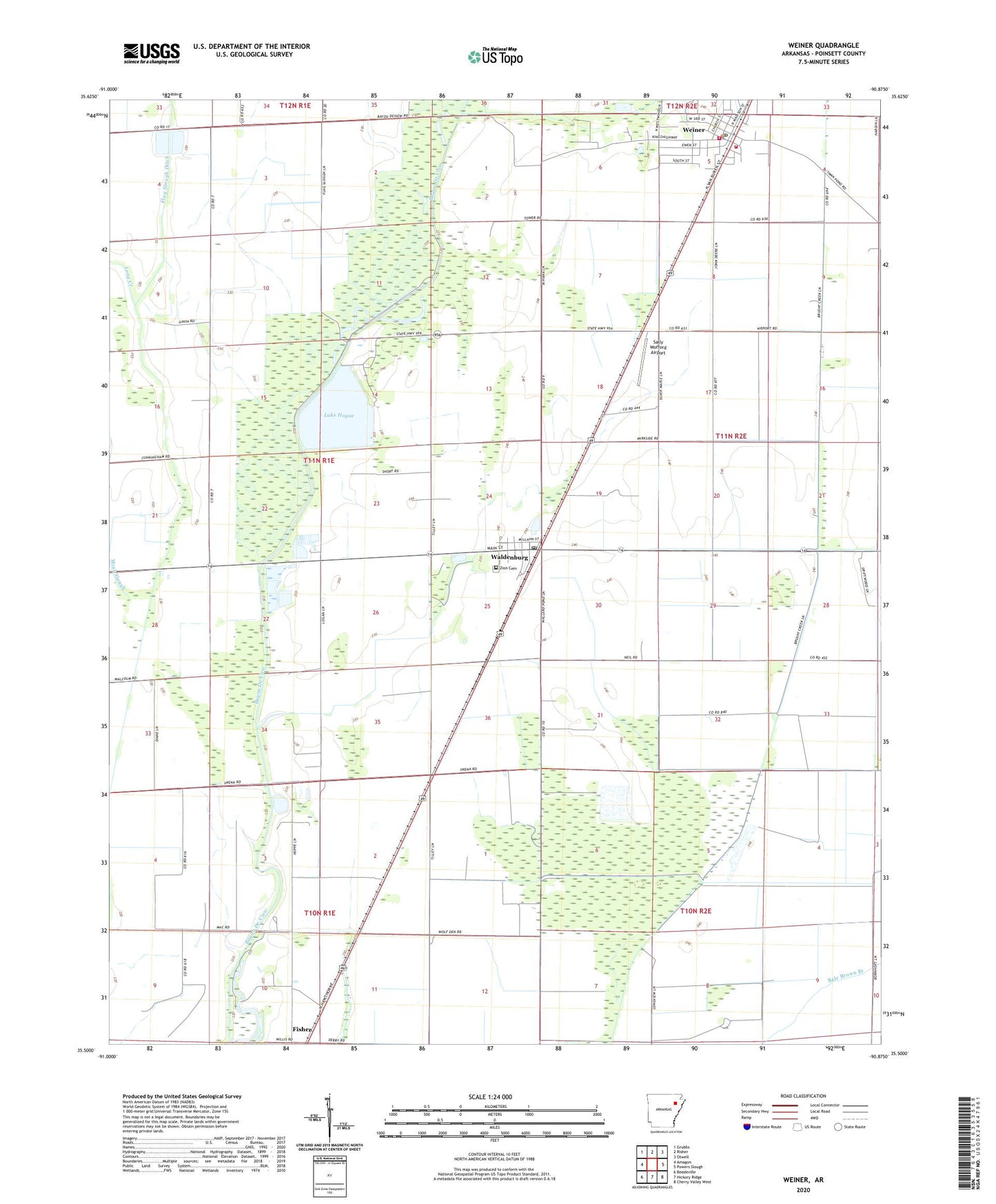
2024 topographic map quadrangle Weiner in the state of Arkansas. Scale: 1:24000. Based on the newly updated USGS 7.5' US Topo map series, this map is in the following counties: Poinsett. The map contains contour data, water features, and other items you are used to seeing on USGS maps, but also has updated roads and other features. This is the next generation of topographic maps. Printed on high-quality waterproof paper with UV fade-resistant inks.
Quads adjacent to this one:
West: Amagon
Northwest: Grubbs
North: Risher
Northeast: Otwell
East: Powers Slough
Southeast: Cherry Valley West
South: Hickory Ridge
Southwest: Beedeville
This map covers the same area as the classic USGS quad with code o35090e8.
Contains the following named places: Bayou De View State Wildlife Management Area, Bayou DeView Public Hunting Area, Beautiful Home School, Brushy Lake School, City of Weiner, Flag Slough Ditch, Harmony Grove Church, Horst Landing Strip, Lake Hogue, Lake Hogue Dam, Long Creek, Mink Slough, Sally Wofford Airport, Town of Waldenburg, Township of Owen, Ukana School, Waldenburg, Waldenburg Post Office, Weiner, Weiner Elementary School, Weiner Fire Department Station 1, Weiner Fire Department Station 2, Weiner High School, Weiner Police Department, Weiner Post Office, Zion Cemetery, ZIP Code: 72429