MyTopo
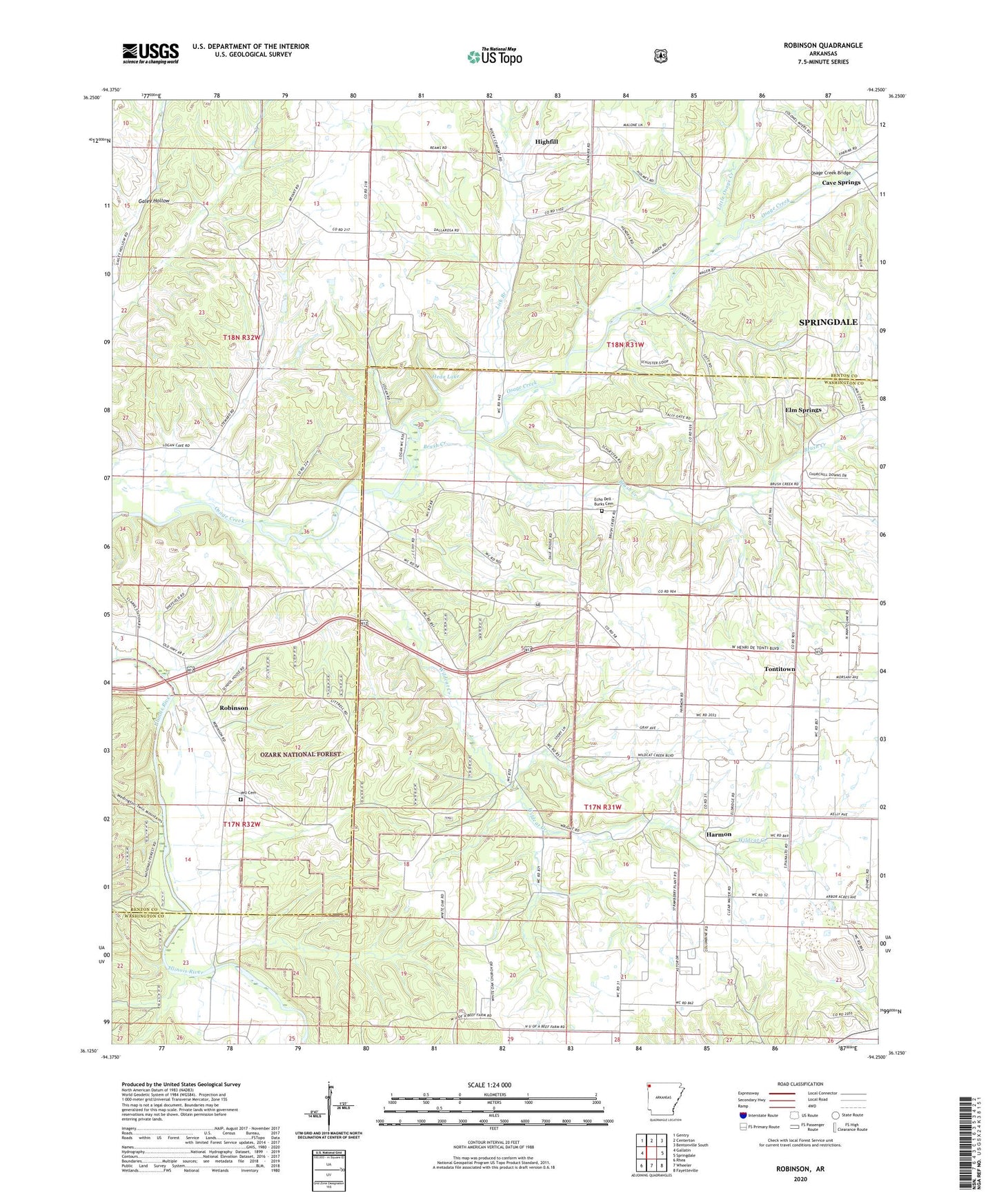
Robinson Arkansas US Topo Map
Couldn't load pickup availability
Also explore the Robinson Forest Service Topo of this same quad for updated USFS data
2024 topographic map quadrangle Robinson in the state of Arkansas. Scale: 1:24000. Based on the newly updated USGS 7.5' US Topo map series, this map is in the following counties: Washington, Benton. The map contains contour data, water features, and other items you are used to seeing on USGS maps, but also has updated roads and other features. This is the next generation of topographic maps. Printed on high-quality waterproof paper with UV fade-resistant inks.
Quads adjacent to this one:
West: Gallatin
Northwest: Gentry
North: Centerton
Northeast: Bentonville South
East: Springdale
Southeast: Fayetteville
South: Wheeler
Southwest: Rhea
This map covers the same area as the classic USGS quad with code o36094b3.
Contains the following named places: Blewford, Blewford Post Office, Brush Creek, Brush Creek Baptist Church, Christian Church, Echo Dell - Burks Cemetery, Harmon, Harmon Church, Heda Lake, Heda Lake Dam, KMCK-FM (Siloam Springs), Lick Branch, Little Osage Creek, Logan Special School, Osage Creek Bridge, Pleasant Hill Church, Robinson, Robinson School, Rocky Comfort, Rocky Comfort Church, Rocky Comfort School, Thornsberry Church, Township of Elm Springs, Township of Harmon, Township of Wager, University of Arkansas Agricultural Experimental Station, Wager, Wager School, Wagers Mill, Wheeler Post Office, White Oak Church, Wildcat Creek, Yell Cemetery