MyTopo
Centerton Arkansas US Topo Map
Couldn't load pickup availability
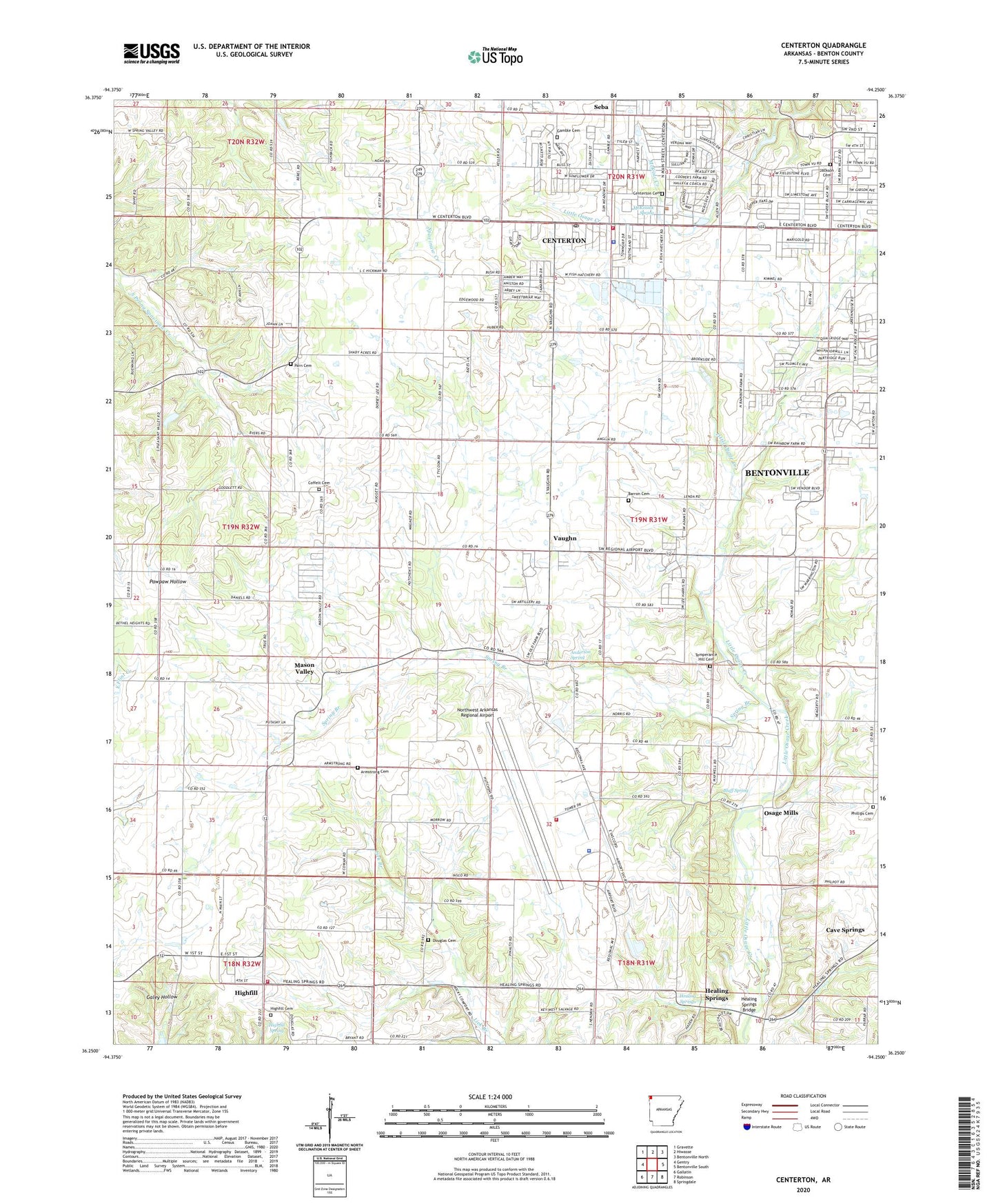
2024 topographic map quadrangle Centerton in the state of Arkansas. Scale: 1:24000. Based on the newly updated USGS 7.5' US Topo map series, this map is in the following counties: Benton. The map contains contour data, water features, and other items you are used to seeing on USGS maps, but also has updated roads and other features. This is the next generation of topographic maps. Printed on high-quality waterproof paper with UV fade-resistant inks.
Quads adjacent to this one:
West: Gentry
Northwest: Gravette
North: Hiwasse
Northeast: Bentonville North
East: Bentonville South
Southeast: Springdale
South: Robinson
Southwest: Gallatin
This map covers the same area as the classic USGS quad with code o36094c3.
Contains the following named places: Anderson Spring, Ardis Ann Middle School, Armstrong Cemetery, Barron Cemetery, Benton County, Benton County - Northwest Arkansas National Airport Fire Department, Bergin School, Bethlehem Baptist Church, Bluff Spring, Castleville, Centerton, Centerton Cemetery, Centerton Fire Station, Centerton Hatchery Upper Pond Dam, Centerton Police Department, Centerton Post Office, Centerton State Fish Hatchery, Christian Church, City of Centerton, Coffelt Cemetery, Council Grove Methodist Church, Douglas Cemetery, Douglas School, Eagle Corner, Eagle Corner School, Evening Star School, Gamble Cemetery, Healing Springs, Healing Springs Bridge, Highfill, Highfill Baptist Church, Highfill Cemetery, Highfill Fire Department, Highfill Methodist Church, Highfill Spring, Hoover, Jackson Cemetery, Mason Valley, Mason Valley Baptist Church, Mason Valley Methodist Church, Mason Valley School, McKissick Spring, Northwest Arkansas Regional Airport, Northwest Arkansas Regional Airport Police Department, Osage Mills, Osage Mills Dam, Osage Valley School, Parn, Parn Cemetery, Phillips Cemetery, Pruitt Farm, Seba, Spring Branch, Sunshine School, Temperance Hill Cemetery, Temperence Hill Baptist Church, Town of Highfill, Township 9, Township of Anderson, Township of Hoover, Township of Mason Valley, Upper Pond, Vaughn, Vaughn Presbyterian Church, Vaughn School, Webb Farm, ZIP Codes: 72712, 72719