MyTopo
Steprock Arkansas US Topo Map
Couldn't load pickup availability
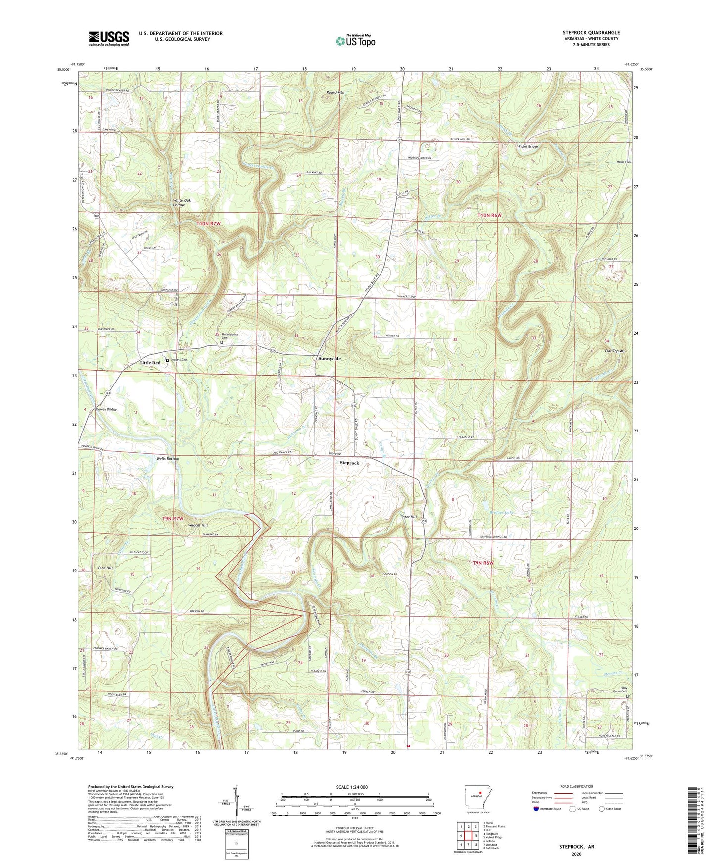
2024 topographic map quadrangle Steprock in the state of Arkansas. Scale: 1:24000. Based on the newly updated USGS 7.5' US Topo map series, this map is in the following counties: White. The map contains contour data, water features, and other items you are used to seeing on USGS maps, but also has updated roads and other features. This is the next generation of topographic maps. Printed on high-quality waterproof paper with UV fade-resistant inks.
Quads adjacent to this one:
West: Pangburn
Northwest: Floral
North: Pleasant Plains
Northeast: Huff
East: Velvet Ridge
Southeast: Bald Knob
South: Judsonia
Southwest: Letona
This map covers the same area as the classic USGS quad with code o35091d6.
Contains the following named places: Bare Stone, Bridges Lake, Bridges Lake Dam, Cedar Branch, Chavell Lake Two, Chavell Lake Two Dam, Cypress Creek, Davenport, Dewey Bridge, Doyleville, Dripping Springs Church, Fisher Bridge, Flat Top Mountain, Fourmile Creek, Fourteenmile Creek, Friendship Church, Hill Lake, Hill Lake Dam, Holcomb Branch, Holly Grove Cemetery, Holly Springs Church, Leggett Cemetery, Little Red, Lost Branch, Maddock, March Branch, Morris Branch, Mount Olive Church, North White County Volunteer Fire Department, Onion Creek, Philadelphia Cemetery, Pine Hill, Potter Branch, Pumpkin Branch, Roosevelt Church, Round Mountain, Spring Valley Church, Steprock, Steprock Church, Steprock Post Office, Stevens Creek, Sunnydale, Tater Hill, Tenmile Creek, Township of Guthrie, Township of Hartsell, Township of Jackson, Wells Bottom, White Oak Hollow, Wildcat Hill, ZIP Code: 72081