MyTopo
Floral Arkansas US Topo Map
Couldn't load pickup availability
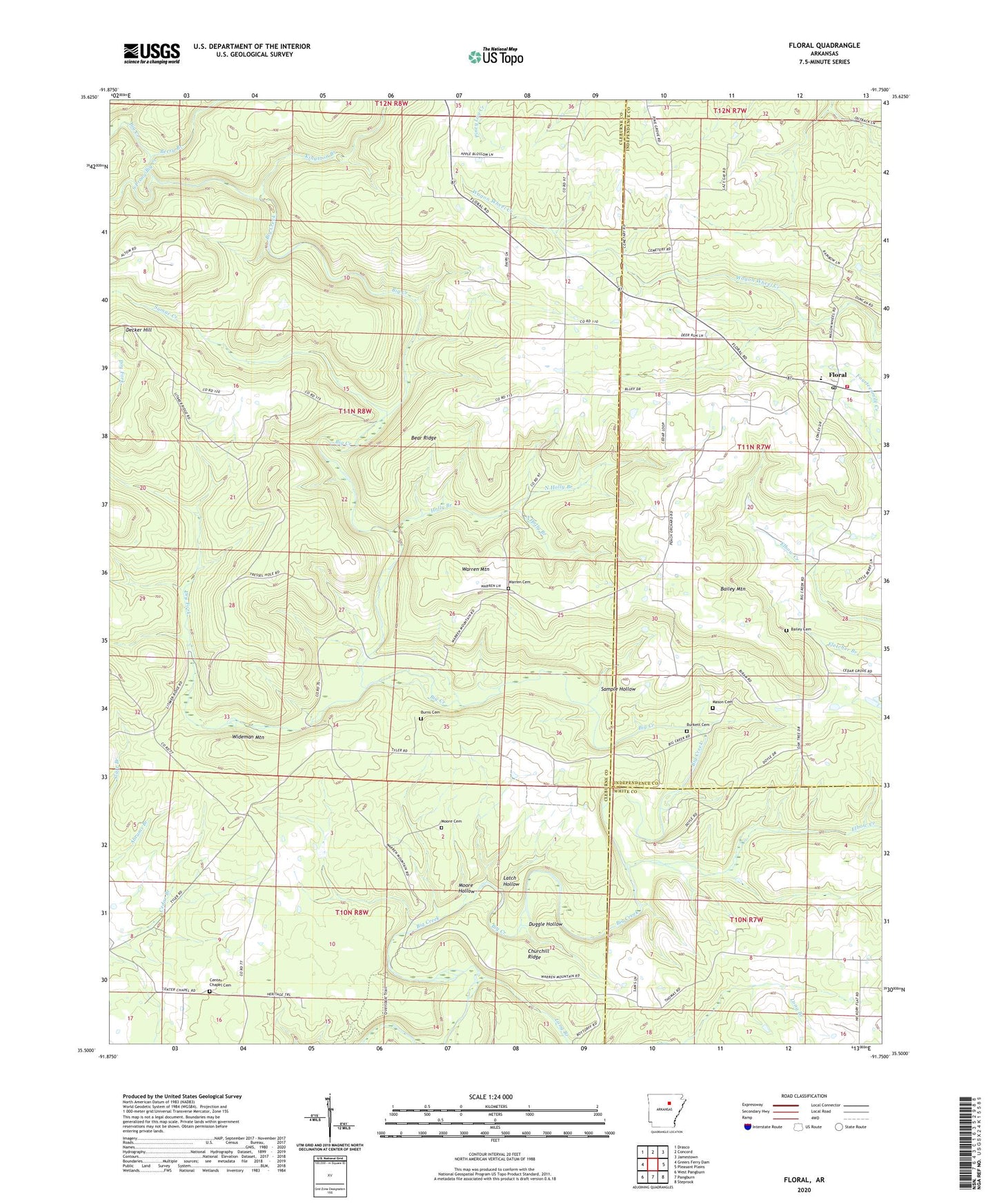
2024 topographic map quadrangle Floral in the state of Arkansas. Scale: 1:24000. Based on the newly updated USGS 7.5' US Topo map series, this map is in the following counties: Cleburne, Independence, White. The map contains contour data, water features, and other items you are used to seeing on USGS maps, but also has updated roads and other features. This is the next generation of topographic maps. Printed on high-quality waterproof paper with UV fade-resistant inks.
Quads adjacent to this one:
West: Greers Ferry Dam
Northwest: Drasco
North: Concord
Northeast: Jamestown
East: Pleasant Plains
Southeast: Steprock
South: Pangburn
Southwest: West Pangburn
This map covers the same area as the classic USGS quad with code o35091e7.
Contains the following named places: Bailey Cemetery, Bailey Mountain, Banner Church, Bear Ridge, Berry Branch, Burkett Cemetery, Burns Cemetery, Center Chapel Cemetery, Center Chapel Missionary Baptist Church, Churchill Ridge, Decker Hill, Dry Fork, Duggle Hollow, Elbow Creek, Floral, Floral Baptist Church, Floral Census Designated Place, Floral Fire Station, Floral Post Office, Harris Chapel, Holly Branch, Kingston Branch, Latch Hollow, Long Branch, Mason Cemetery, Midland Elementary School, Moore Cemetery, Moore Hollow, North Holly Branch, Pine Grove Church, Sample Hollow, South Holly Branch, South Prong Big Creek, Sumac Creek, Township of Big Creek, Township of Liberty, Township of Wilburn, Trestle Hole, Tyler, Warren Cemetery, Warren Mountain, Wideman Mountain, ZIP Code: 72179