MyTopo
Pleasant Plains Arkansas US Topo Map
Couldn't load pickup availability
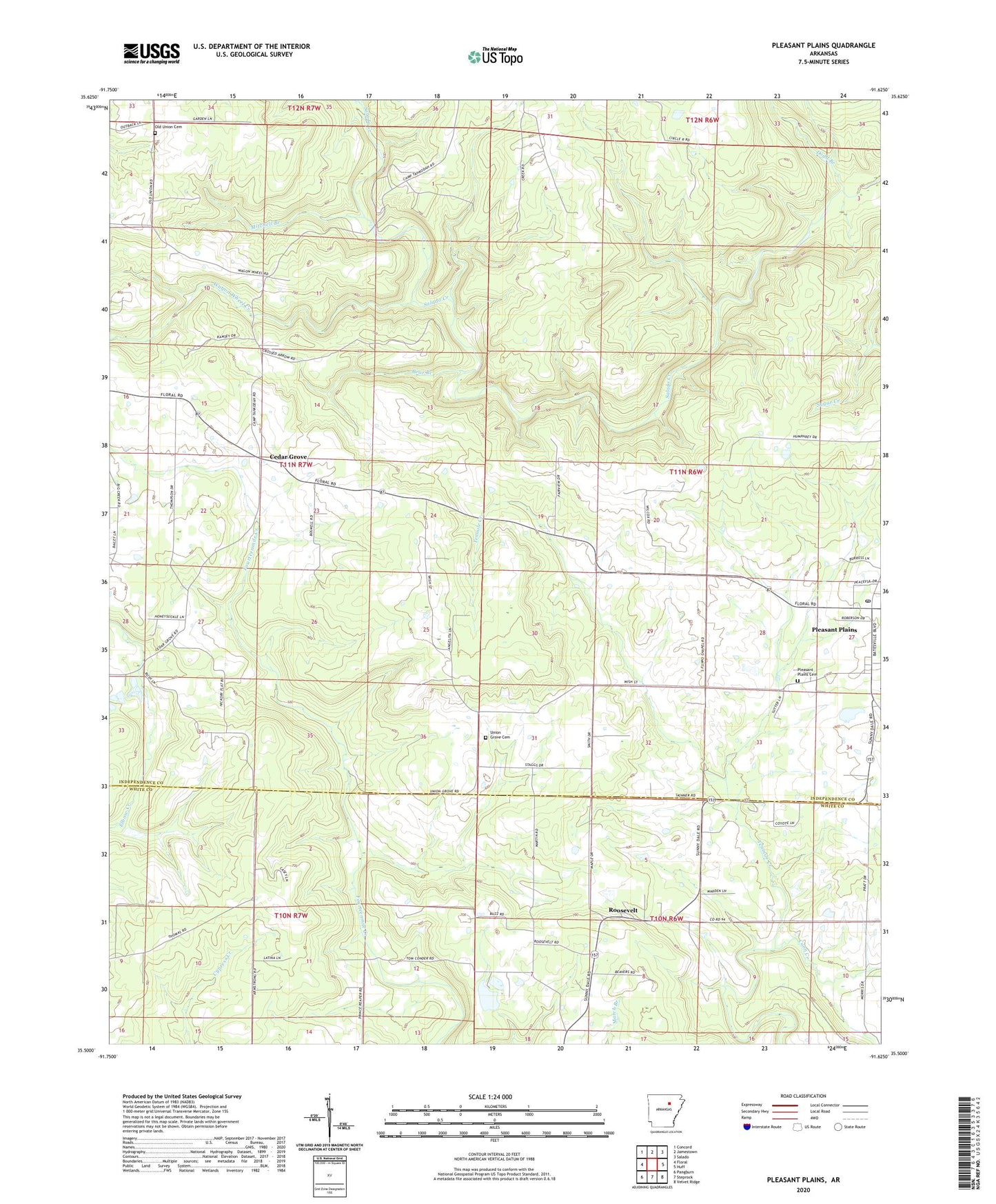
2024 topographic map quadrangle Pleasant Plains in the state of Arkansas. Scale: 1:24000. Based on the newly updated USGS 7.5' US Topo map series, this map is in the following counties: Independence, White. The map contains contour data, water features, and other items you are used to seeing on USGS maps, but also has updated roads and other features. This is the next generation of topographic maps. Printed on high-quality waterproof paper with UV fade-resistant inks.
Quads adjacent to this one:
West: Floral
Northwest: Concord
North: Jamestown
Northeast: Salado
East: Huff
Southeast: Velvet Ridge
South: Steprock
Southwest: Pangburn
This map covers the same area as the classic USGS quad with code o35091e6.
Contains the following named places: Bear Branch, Board Shanty Church, Camp Crossed Arrows, Camp Tahkodah, Cedar Grove, Church of Christ, Coon Creek, Dodd Branch, Fletcher Branch, Flippo Chapel, Floral Fire Department, Mitchell Branch, New Bethel Church, Old Union Cemetery, Pleasant Plains, Pleasant Plains Cemetery, Pleasant Plains Post Office, Roosevelt, Town of Pleasant Plains, Township of Fairview, Union Grove Cemetery, Wagon Wheel Creek, Wrenton, ZIP Code: 72534