MyTopo
Swifton East Arkansas US Topo Map
Couldn't load pickup availability
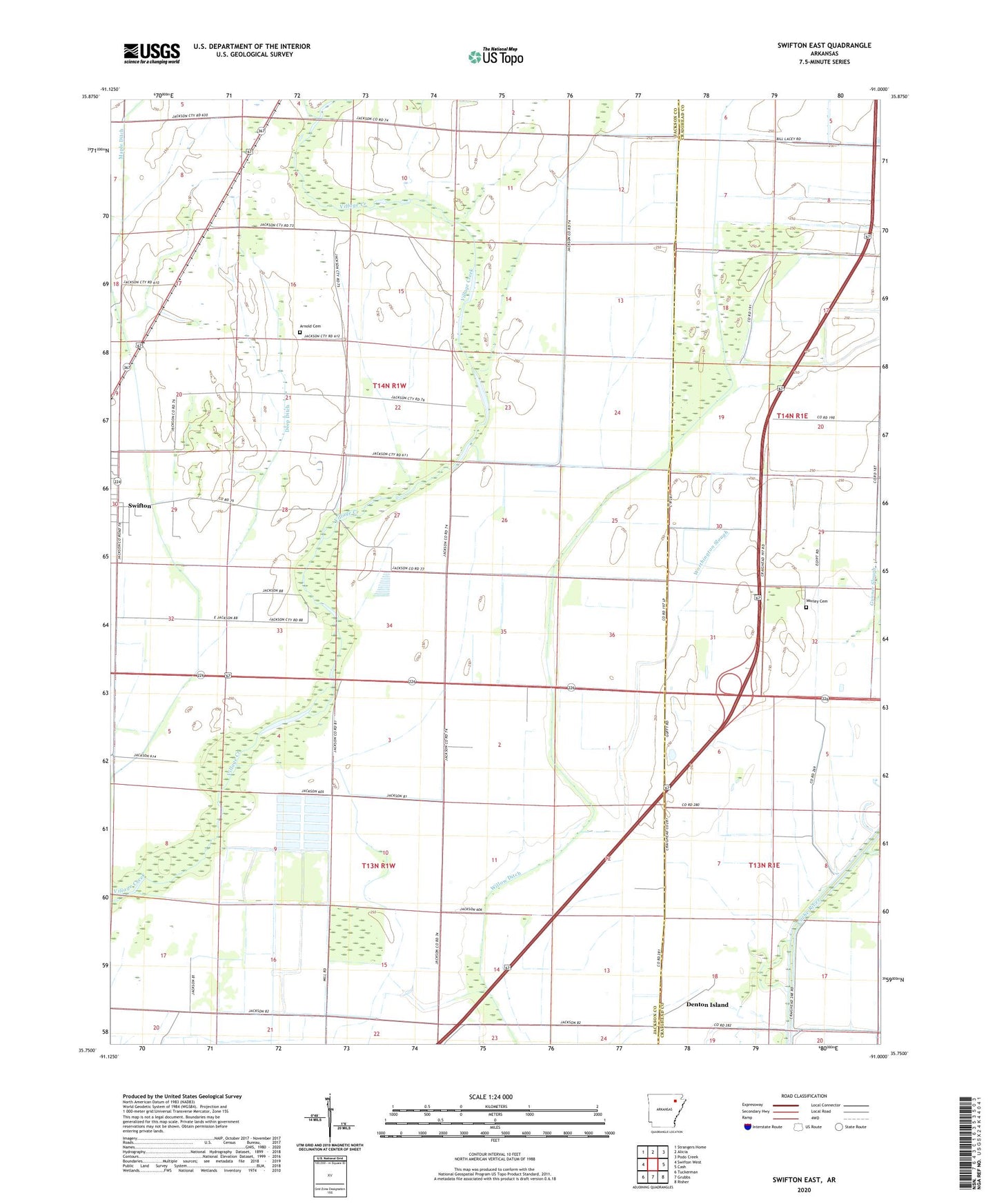
2024 topographic map quadrangle Swifton East in the state of Arkansas. Scale: 1:24000. Based on the newly updated USGS 7.5' US Topo map series, this map is in the following counties: Jackson, Craighead. The map contains contour data, water features, and other items you are used to seeing on USGS maps, but also has updated roads and other features. This is the next generation of topographic maps. Printed on high-quality waterproof paper with UV fade-resistant inks.
Quads adjacent to this one:
West: Swifton West
Northwest: Strangers Home
North: Alicia
Northeast: Podo Creek
East: Cash
Southeast: Risher
South: Grubbs
Southwest: Tuckerman
This map covers the same area as the classic USGS quad with code o35091g1.
Contains the following named places: Arnold Cemetery, Arnold Church, Arnold School, Bridge School, Browns Mill, Deep Ditch, Denton Island, Earnest Chapel, Elm Grove School, Fisher School, Goetz School, Gunner Slough, Hales Chapel, Maple Ditch, Murphys Chapel, Oak Grove School, Page School, Sneed Church, Sneed School, Sunny Valley Church, Township of Glass, Willow Creek, Willow Ditch, Worley Cemetery, Worthington Slough, ZIP Code: 72471