MyTopo
Turner Arkansas US Topo Map
Couldn't load pickup availability
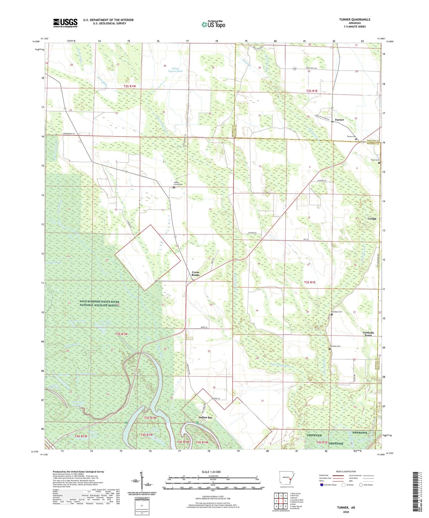
2024 topographic map quadrangle Turner in the state of Arkansas. Scale: 1:24000. Based on the newly updated USGS 7.5' US Topo map series, this map is in the following counties: Monroe, Phillips, Arkansas. The map contains contour data, water features, and other items you are used to seeing on USGS maps, but also has updated roads and other features. This is the next generation of topographic maps. Printed on high-quality waterproof paper with UV fade-resistant inks.
Quads adjacent to this one:
West: Crocketts Bluff
Northwest: Holly Grove
North: Pine City
Northeast: Marvell
East: Watkins Corner
Southeast: Lambrook
South: Indian Bay SE
Southwest: Ethel
This map covers the same area as the classic USGS quad with code o34091d1.
Contains the following named places: Bellknap Lake, Big Cypress Creek, Branch Church, Buck Lake, Connells Cemetery, Connells Point, Connells Point Church, Connells Point School, Creigh, Cross Roads, Crowfoot Lake, Dawson Slough, Eagle Nest Lake, Givins Branch, Goose Lake, Hill Bayou, Hog Thief Lake, Indian Bay, Indian Bay Census Designated Place, Indian Bayou, Israel Chapel Cemetery, Jacobs Slash, Little Moon Lake, Mayos, Neicy Slash, Saint John Church, Saint Matthew Church, Sandy Bayou, Smalley Cemetery, Township of Cypress, Township of Montgomery, Township of Montgomery-Smalley, Township of Smalley, Turner, Turner Cemetery, Turner Church, Turner Post Office, Turner School, Twin Slough, Valley Grove Cemetery, Valley Grove Church, Valley Grove School, Water Bayou Dam, Water Bayou Reservoir, ZIP Code: 72383