MyTopo
Crocketts Bluff Arkansas US Topo Map
Couldn't load pickup availability
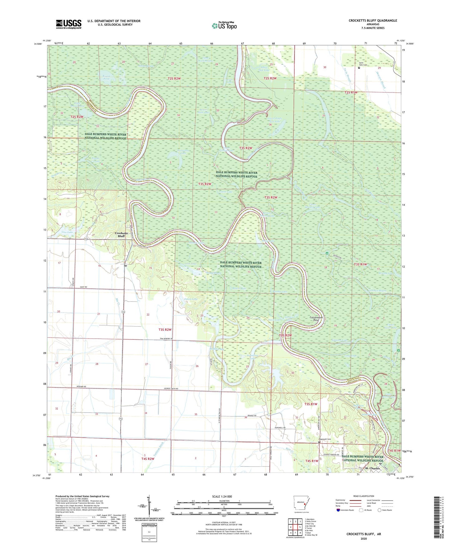
2024 topographic map quadrangle Crocketts Bluff in the state of Arkansas. Scale: 1:24000. Based on the newly updated USGS 7.5' US Topo map series, this map is in the following counties: Arkansas, Monroe. The map contains contour data, water features, and other items you are used to seeing on USGS maps, but also has updated roads and other features. This is the next generation of topographic maps. Printed on high-quality waterproof paper with UV fade-resistant inks.
Quads adjacent to this one:
West: De Witt NE
Northwest: Aberdeen
North: Holly Grove
Northeast: Pine City
East: Turner
Southeast: Indian Bay SE
South: Ethel
Southwest: De Witt
This map covers the same area as the classic USGS quad with code o34091d2.
Contains the following named places: Anderson Bay, Anderson Chute, Bark Shanty Lake, Beaver Dam Lake, Browns Shanty Lake, Brushy Lake, Cottonwood Point, Crab Lake, Crockett Lake, Crocketts Bluff, Crocketts Bluff Post Office, Dale Bumpers White River National Wildlife Refuge, Dillard Landing, Ditch Lake, Eason Lake, Eason Lake Dam, Goose Lake, Goosefoot Lake, Gordon Lake, Holly Lake, Hopewell Cemetery, Hopewell Church, Hopewell School, Horseshoe Lake, Kansas Lake, Lambert Bayou, Lambert Landing, Leak Lake, Little Lake, Little Round Pond, Long Lake, Lower Eagle Nest Lake, Lower Forked Lake, Maddox Bay, Polecat Lakes, Poplar Creek, Poplar Creek Lake, Round Lake, Round Pond, Saint Charles Post Office, Saint John Cemetery, Sandy Bayou, Simpson Lake, Southern Lake, Southern Lake Dam, Stinking Bay, Stinking Bay Dam, Stinking Bay Reservoir, Tarleton Ditch, Township of Crockett, Tupelo Lake, United States Fish and Wildlife White River National Wildlife Refuge Park Security, Upper Forked Lake, Upper Hooked Lake, Upper Swan Lake, Voss Lake, Voss Lake Dam, White Oak Lake, Willow Lake, ZIP Code: 72038


