MyTopo
Ethel Arkansas US Topo Map
Couldn't load pickup availability
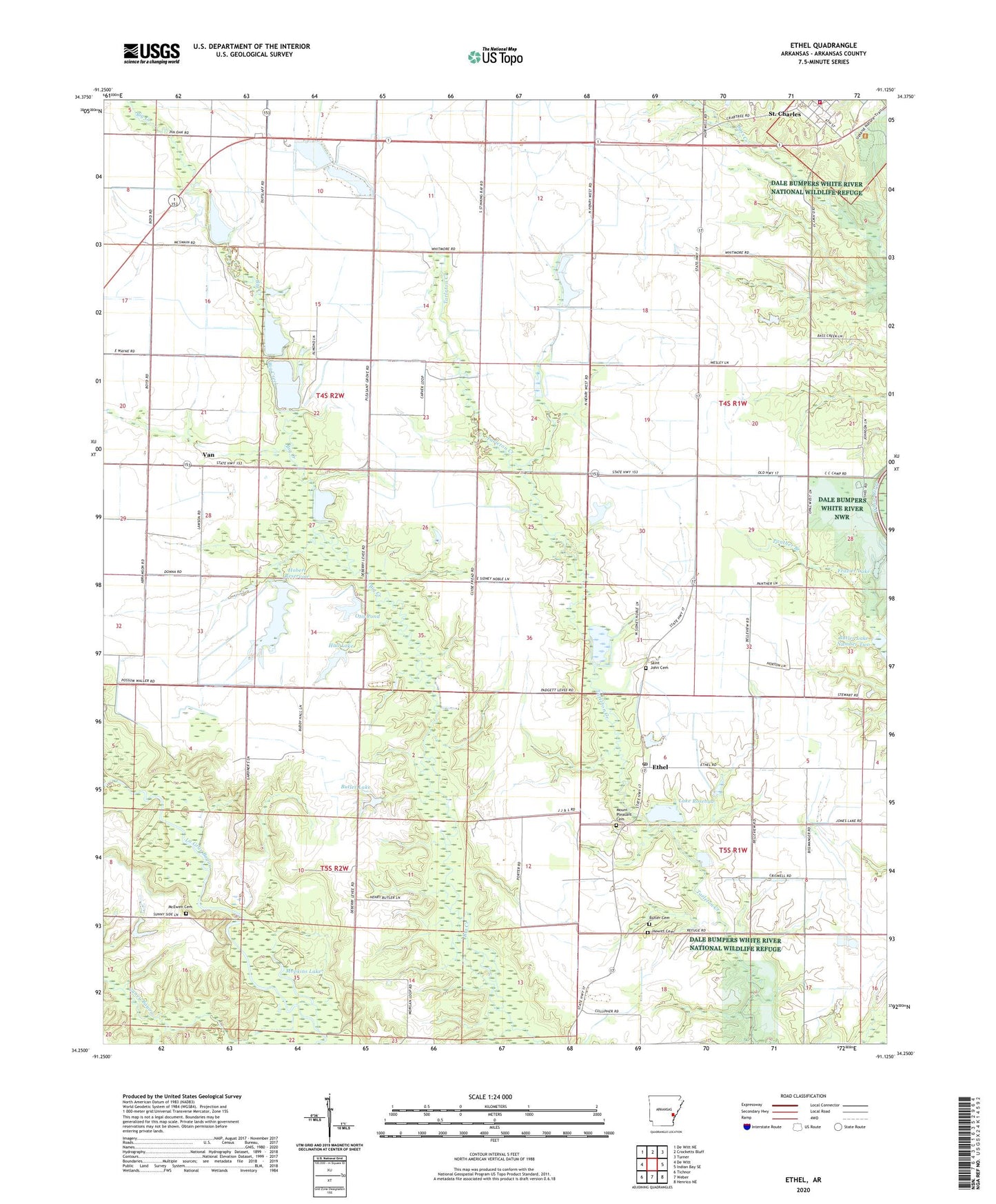
2024 topographic map quadrangle Ethel in the state of Arkansas. Scale: 1:24000. Based on the newly updated USGS 7.5' US Topo map series, this map is in the following counties: Arkansas. The map contains contour data, water features, and other items you are used to seeing on USGS maps, but also has updated roads and other features. This is the next generation of topographic maps. Printed on high-quality waterproof paper with UV fade-resistant inks.
Quads adjacent to this one:
West: De Witt
Northwest: De Witt NE
North: Crocketts Bluff
Northeast: Turner
East: Indian Bay SE
Southeast: Henrico NE
South: Weber
Southwest: Tichnor
This map covers the same area as the classic USGS quad with code o34091c2.
Contains the following named places: Belleview Church, Bellevue School, Big La Grue Church, Butler Cemetery, Butler Lake, Butler Lake Dam, Butler Lake Number Two, Butler Lake Number Two Dam, Clabe Chapel School, Ethel, Ethel Post Office, Frazier Lake, Frazier Lake Dam, Hall Lake, Hall Lake Dam, Hewitt Cemetery, Hill Chapel, Hill Chapel School, Hobert Reservoir, Hobert Reservoir Dam, Lake Rosebud, Lake Rosebud Dam, Lee Branch, McKewen Cemetery, Mopkins Lake, Mount Pleasant Cemetery, New Hope Church, Oak Flat School, Otis Pond, Otis Pond Dam, Parker School, Pin Point School, Pleasant Grove Church, Pleasant Grove School, Pleasant View School, Prairie View School, Saint Charles, Saint Charles Fire Station, Saint Charles Police Department, Saint John Cemetery, Saint John Church, Town of Saint Charles, Township of Prairie, Van, Van Church, ZIP Code: 72140