MyTopo
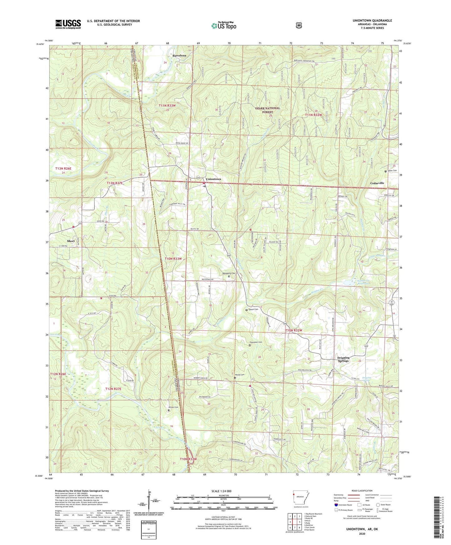
Uniontown Arkansas US Topo Map
Couldn't load pickup availability
Also explore the Uniontown Forest Service Topo of this same quad for updated USFS data
2024 topographic map quadrangle Uniontown in the states of Arkansas, Oklahoma. Scale: 1:24000. Based on the newly updated USGS 7.5' US Topo map series, this map is in the following counties: Crawford, Sequoyah. The map contains contour data, water features, and other items you are used to seeing on USGS maps, but also has updated roads and other features. This is the next generation of topographic maps. Printed on high-quality waterproof paper with UV fade-resistant inks.
Quads adjacent to this one:
West: Nicut
Northwest: Big Round Mountain
North: Natural Dam
Northeast: Rudy NE
East: Rudy
Southeast: Van Buren
South: Fort Smith
Southwest: Muldrow
Contains the following named places: Allison Cemetery, Barcelona, Butterfield District 5 Volunteer Fire Department Shiloh, Dripping Spring, Dripping Springs, Dripping Springs Cumberland Presbyterian Church, KISR-FM (Fort Smith), Lee Creek Volunteer Fire Department Station 1, Lee Creek Volunteer Fire Department Station 2, Little Webber Creek, Macedonia Cemetery, New Home Church, Salem Cemetery, Short, Short Census Designated Place, Spears Cemetery, Strang Airpark, Sulphur Creek, Thompson Cemetery, Township of Jasper, Township of Union, Township of Uniontown, Uniontown, Uniontown Census Designated Place, Uniontown Post Office, Uniontown Rural Fire District 5, Webber Creek, Webber Creek Reservoir, Webber Creek Rural Fire District 5, Woods Cemetery, ZIP Codes: 72932, 72955