MyTopo
Nicut Oklahoma US Topo Map
Couldn't load pickup availability
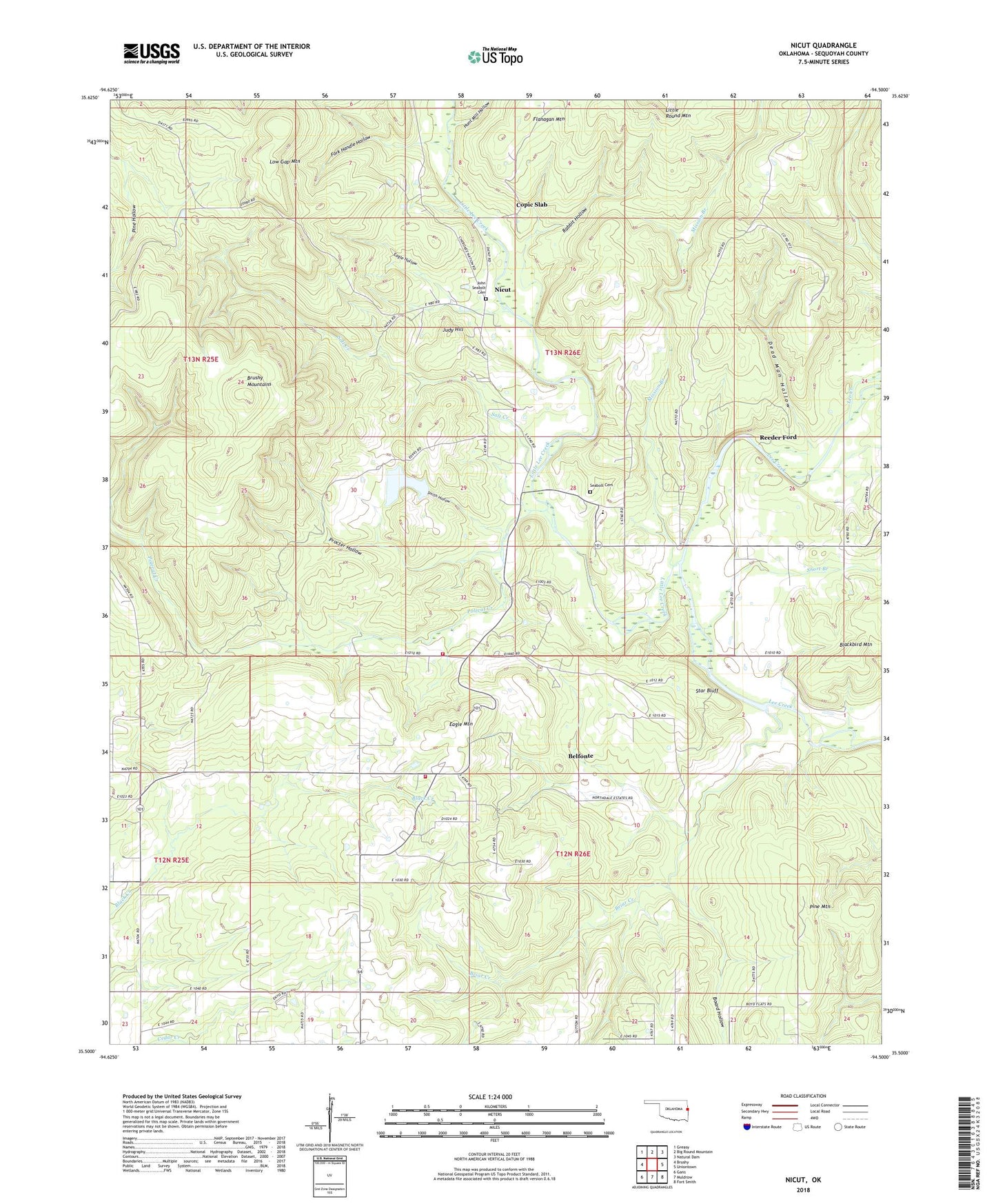
2022 topographic map quadrangle Nicut in the state of Oklahoma. Scale: 1:24000. Based on the newly updated USGS 7.5' US Topo map series, this map is in the following counties: Sequoyah. The map contains contour data, water features, and other items you are used to seeing on USGS maps, but also has updated roads and other features. This is the next generation of topographic maps. Printed on high-quality waterproof paper with UV fade-resistant inks.
Quads adjacent to this one:
West: Brushy
Northwest: Greasy
North: Big Round Mountain
Northeast: Natural Dam
East: Uniontown
Southeast: Fort Smith
South: Muldrow
Southwest: Gans
This map covers the same area as the classic USGS quad with code o35094e5.
Contains the following named places: Belfonte, Belfonte Census Designated Place, Belfonte Elementary School, Blackbird Mountain, Board Hollow, Briar Creek, Copic Church, Copic Slab, Curts Ranch, Dead Man Hollow, Eagle Hollow, Eagle Mountain, Flanagan Mountain, Fork Handle Hollow, Hunt Mill Hollow, John Seabolt Cemetery, Judy Hill, Lee Church, Little Lee Creek, Low Gap Mountain, Mission Branch, New Hope Church, Nicut, Nicut Census Designated Place, Nicut Volunteer Fire Department Station 1, Nicut Volunteer Fire Department Station 2, Nicut Volunteer Fire Department Station 3, Pine Mountain, Polecat Creek, Procter Hollow, Rabbit Hollow, Reeder Ford, Roland Division, Salt Creek, Seabolt Cemetery, Short, Short Branch, Short Church, Smith Hollow, Star Bluff, Township of Long