MyTopo
Warren NE Arkansas US Topo Map
Couldn't load pickup availability
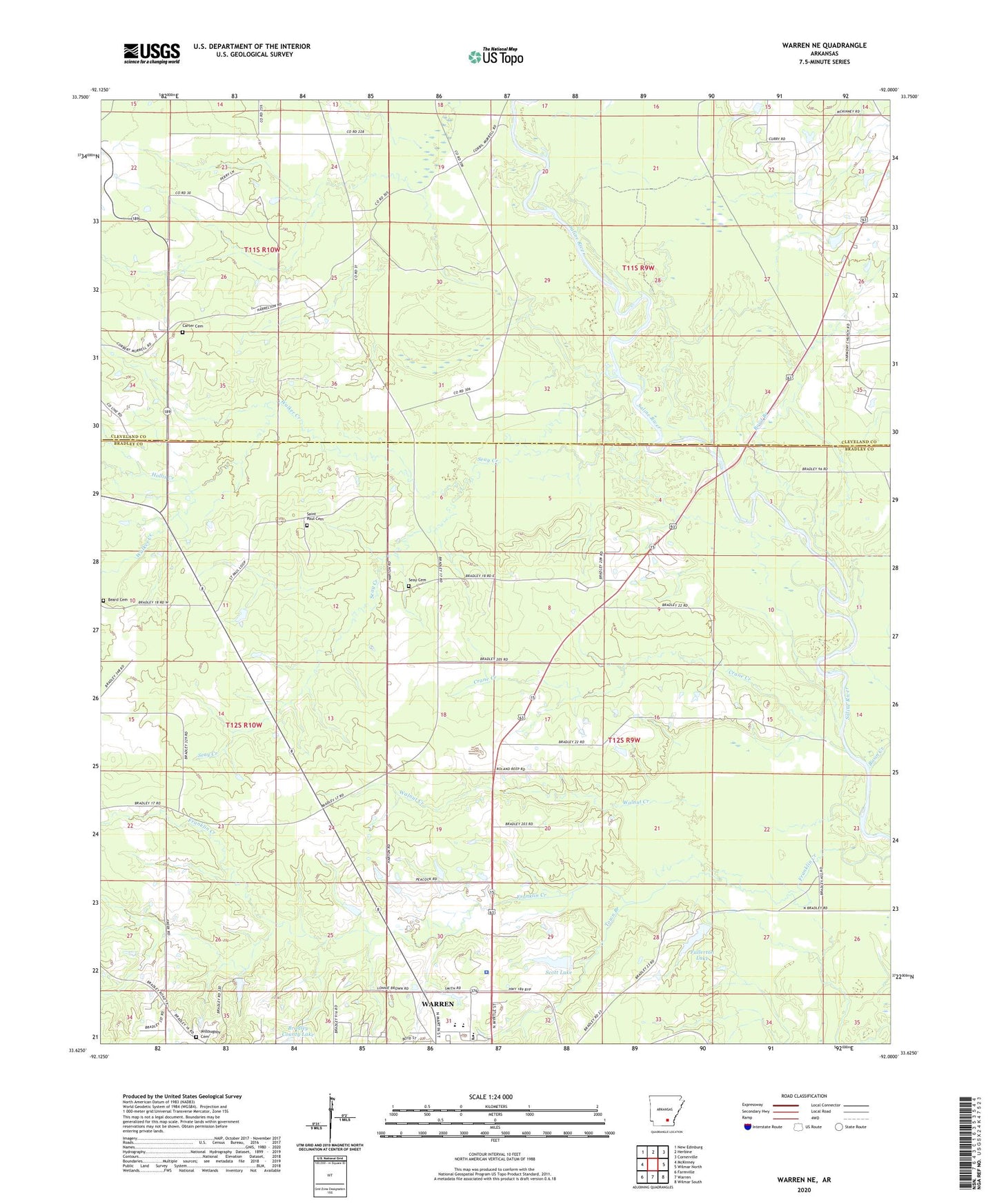
2024 topographic map quadrangle Warren NE in the state of Arkansas. Scale: 1:24000. Based on the newly updated USGS 7.5' US Topo map series, this map is in the following counties: Bradley, Cleveland. The map contains contour data, water features, and other items you are used to seeing on USGS maps, but also has updated roads and other features. This is the next generation of topographic maps. Printed on high-quality waterproof paper with UV fade-resistant inks.
Quads adjacent to this one:
West: McKinney
Northwest: New Edinburg
North: Herbine
Northeast: Cornerville
East: Wilmar North
Southeast: Wilmar South
South: Warren
Southwest: Farmville
This map covers the same area as the classic USGS quad with code o33092f1.
Contains the following named places: Arkansas State Police Highway Patrol Troop F, Basin Creek, Beard Cemetery, Beard School, Boyd Branch, Bradley County Lake, Bradley County Lake Dam, Carter Cemetery, Crane Creek, Emmaus Church, Fair View Church, Fullerton Lake, Fullerton Lake Dam, Hollis Creek, KWRF-AM (Warren), KWRF-FM (Warren), Macedonia Baptist Church, Mount Zion Baptist Church, North Oak Grove School, Rubes Landing, Saint Paul Cemetery, Saint Paul Church, Scoby, Scott Lake, Scott Lake Dam, Seay Cemetery, Seay Creek, Thomas C Brunson Elementary School, Thompson Creek, Town Branch, Township of Lee, United Church, Walker Creek, Walnut Creek, Warren High School, Warren Middle School, Willoughby Baptist Church, Willoughby Cemetery