MyTopo
Wilmar South Arkansas US Topo Map
Couldn't load pickup availability
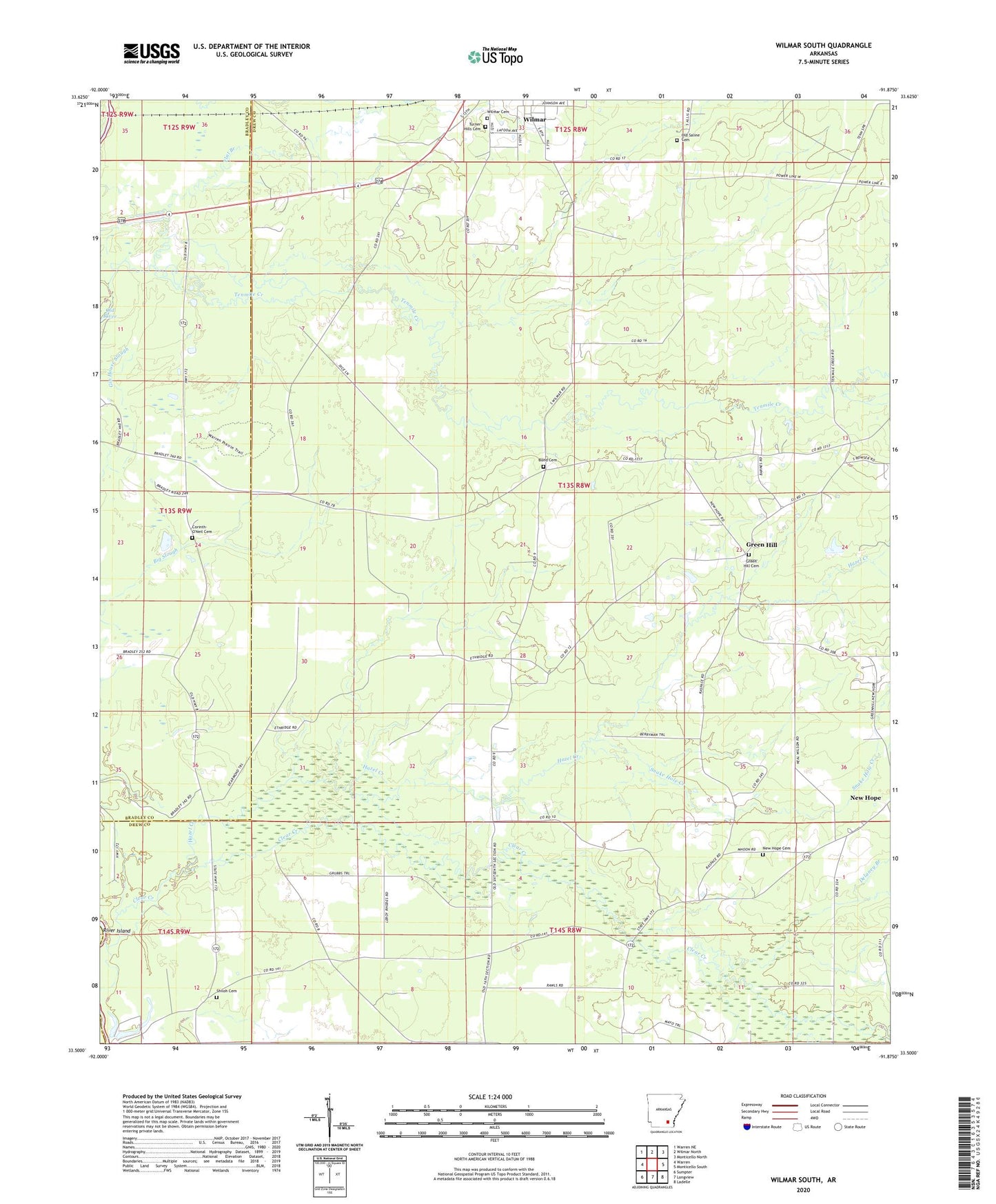
2024 topographic map quadrangle Wilmar South in the state of Arkansas. Scale: 1:24000. Based on the newly updated USGS 7.5' US Topo map series, this map is in the following counties: Drew, Bradley. The map contains contour data, water features, and other items you are used to seeing on USGS maps, but also has updated roads and other features. This is the next generation of topographic maps. Printed on high-quality waterproof paper with UV fade-resistant inks.
Quads adjacent to this one:
West: Warren
Northwest: Warren NE
North: Wilmar North
Northeast: Monticello North
East: Monticello South
Southeast: Ladelle
South: Longview
Southwest: Sumpter
This map covers the same area as the classic USGS quad with code o33091e8.
Contains the following named places: Bond Cemetery, Clear Creek, Corinth, Corinth Baptist Church, Corinth School, Corinth-O'Neil Cemetery, Delaney Branch, Flat Branch, Green Hill, Green Hill Cemetery, Green Hill School, Greenhill United Methodist Church, Hazel Creek, New Hope, New Hope Cemetery, New Hope Church, New Hope School, Old Saline Cemetery, Saline, Shiloh, Shiloh Cemetery, Shiloh Presbyterian Church, Snake Hole Creek, The Prairie, Township of Saline, Turner Hills Cemetery, Wilmar Cemetery, ZIP Code: 71675