MyTopo
Farmville Arkansas US Topo Map
Couldn't load pickup availability
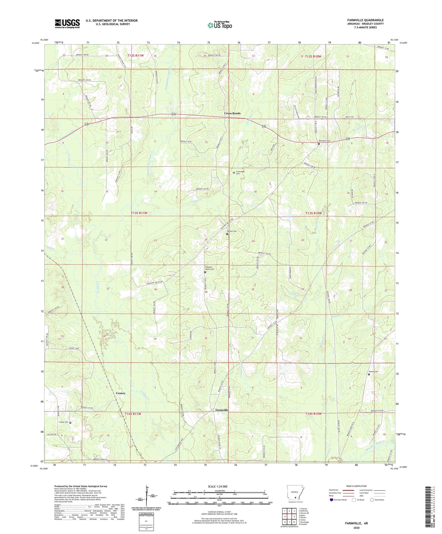
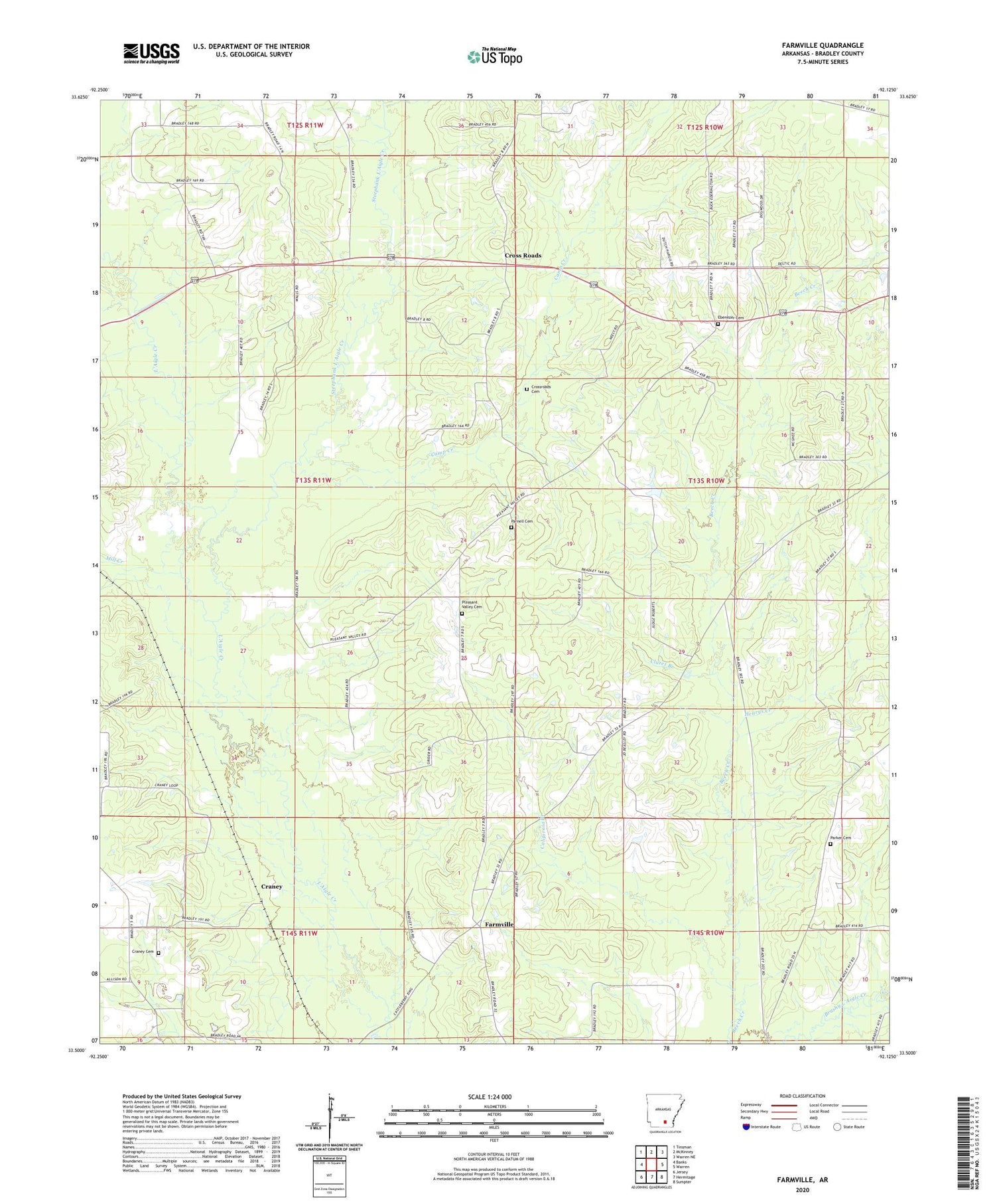
2024 topographic map quadrangle Farmville in the state of Arkansas. Scale: 1:24000. Based on the newly updated USGS 7.5' US Topo map series, this map is in the following counties: Bradley. The map contains contour data, water features, and other items you are used to seeing on USGS maps, but also has updated roads and other features. This is the next generation of topographic maps. Printed on high-quality waterproof paper with UV fade-resistant inks.
Quads adjacent to this one:
West: Banks
Northwest: Tinsman
North: McKinney
Northeast: Warren NE
East: Warren
Southeast: Sumpter
South: Hermitage
Southwest: Jersey
This map covers the same area as the classic USGS quad with code o33092e2.
Contains the following named places: Banks Lookout Tower, California Branch, Camp Creek, Claret Branch, Craney, Craney Cemetery, Cross Roads, Cross Roads Baptist Church, Crossroads Cemetery, Crossroads School, Ebenezer Baptist Church, Ebenezer Cemetery, Ebenezer School, Farmville, Farmville Missionary Baptist Church, Farmville School, Gin, Henrys Creek, Mill Creek, Oaklawn Church, Parker Cemetery, Parnell Cemetery, Pleasant Grove Baptist Church, Pleasant Hill Church, Pleasant Valley Cemetery, Pleasant Valley Church, Pleasant Valley School, Pleasantville Rural Volunteer Fire Department, Prospect School, South Oak Grove School, Steepbank L'Aigle Creek