MyTopo
Beedeville Arkansas US Topo Map
Couldn't load pickup availability
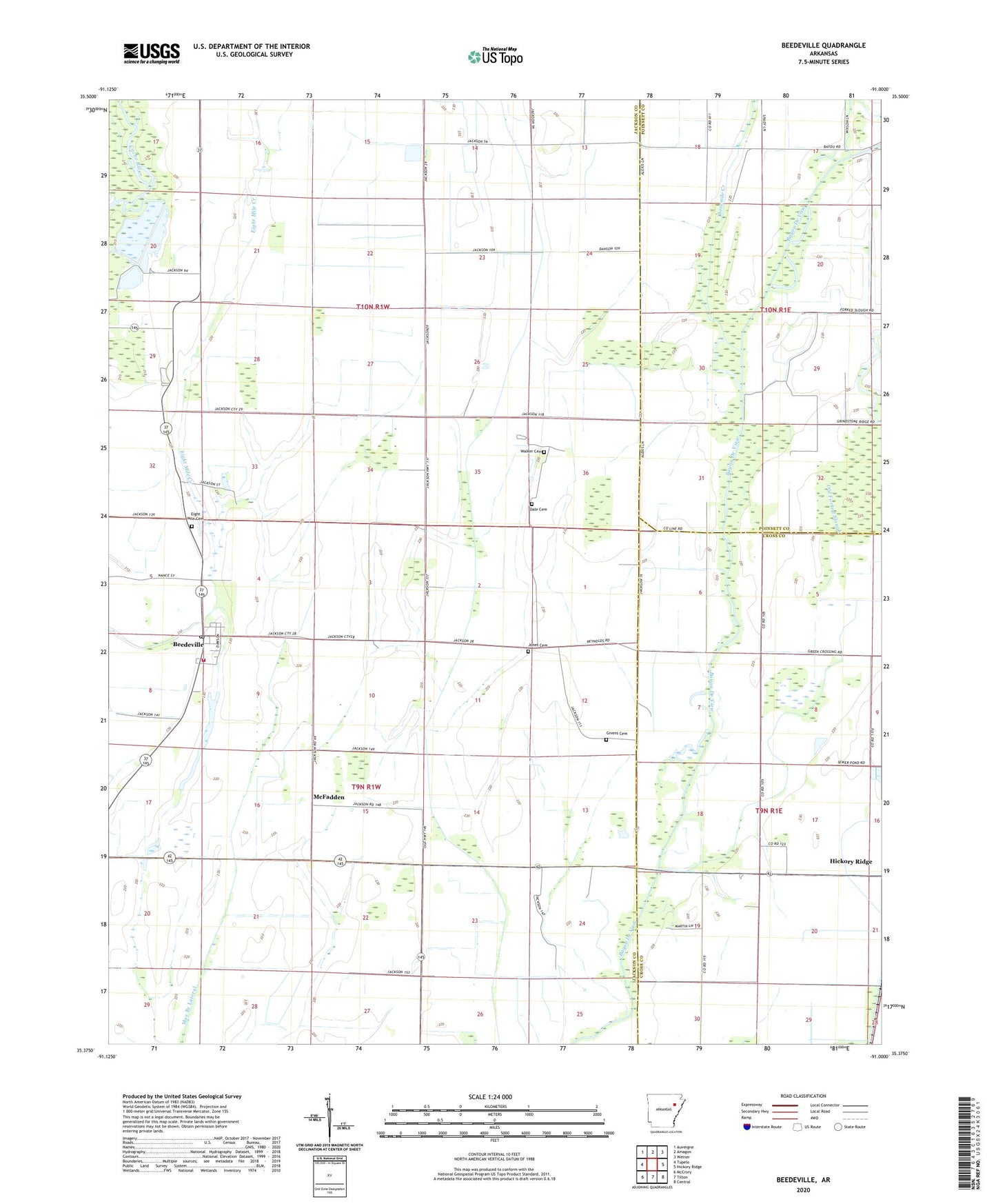
2024 topographic map quadrangle Beedeville in the state of Arkansas. Scale: 1:24000. Based on the newly updated USGS 7.5' US Topo map series, this map is in the following counties: Jackson, Cross, Poinsett. The map contains contour data, water features, and other items you are used to seeing on USGS maps, but also has updated roads and other features. This is the next generation of topographic maps. Printed on high-quality waterproof paper with UV fade-resistant inks.
Quads adjacent to this one:
West: Tupelo
Northwest: Auvergne
North: Amagon
Northeast: Weiner
East: Hickory Ridge
Southeast: Central
South: Tilton
Southwest: McCrory
This map covers the same area as the classic USGS quad with code o35091d1.
Contains the following named places: Beedeville, Beedeville Church, Beedeville Post Office, Citizenship Church, Citizenship School, Cow Lake, Cow Lake Church, Cow Lake Ditch, Dale Cemetery, Eight Mile Cemetery, Eight Mile Fire Department Station, Eight Mile Fire Department Station - Storage Garage, Eightmile, Givens Cemetery, Jones Cemetery, Love Chapel, May Branch Lateral, McFadden, Old Forked Slough, Proctor School, Threemile Creek, Town of Beedeville, Township of Cow Lake, Walker Cemetery, ZIP Codes: 72014, 72347