MyTopo
West Point Arkansas US Topo Map
Couldn't load pickup availability
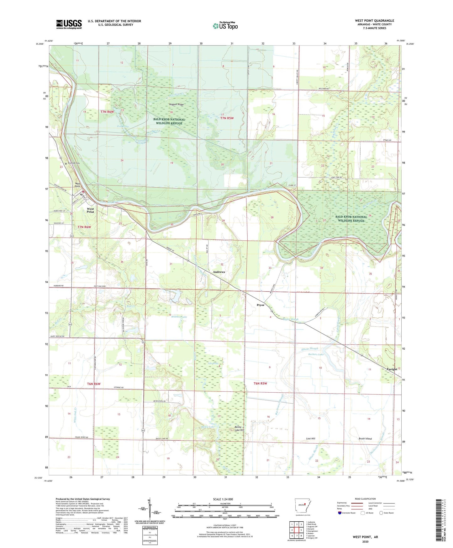
2024 topographic map quadrangle West Point in the state of Arkansas. Scale: 1:24000. Based on the newly updated USGS 7.5' US Topo map series, this map is in the following counties: White. The map contains contour data, water features, and other items you are used to seeing on USGS maps, but also has updated roads and other features. This is the next generation of topographic maps. Printed on high-quality waterproof paper with UV fade-resistant inks.
Quads adjacent to this one:
West: Kensett
Northwest: Judsonia
North: Bald Knob
Northeast: Augusta SW
East: Georgetown
Southeast: Gregory SW
South: Jasmine
Southwest: Walker
This map covers the same area as the classic USGS quad with code o35091b5.
Contains the following named places: Andrews, Bailey Lake, Bailey Lake Hill, Bald Knob National Wildlife Refuge, Barber, Barbers Lake, Barbers Lake Slough, Beaver Pond, Big Gravel Slough, Big Mingo Creek, Brush Island, Crooked Slough, Cutoff Slough, Cypress Slough, Elbow Slough, Ellen, Enright, Glenwood School, Hogpen Ridge, Lateral Number 10, Lateral Number 11, Lateral Number 22, Liles Brake, Little Gravel Slough, Lost Hill, Milliken Lake, New Hope United Methodist Church, Overflow Creek, Pole Brake, Pryor, Redman Lake, Rescue Church, Riverside Cemetery, Taylor Slough, Town of West Point, Township of Red River, West Point, West Point Elementary School, West Point Post Office, West Point Volunteer Fire Department, Wranes