
MyTopo
Witter Arkansas US Topo Map
Couldn't load pickup availability
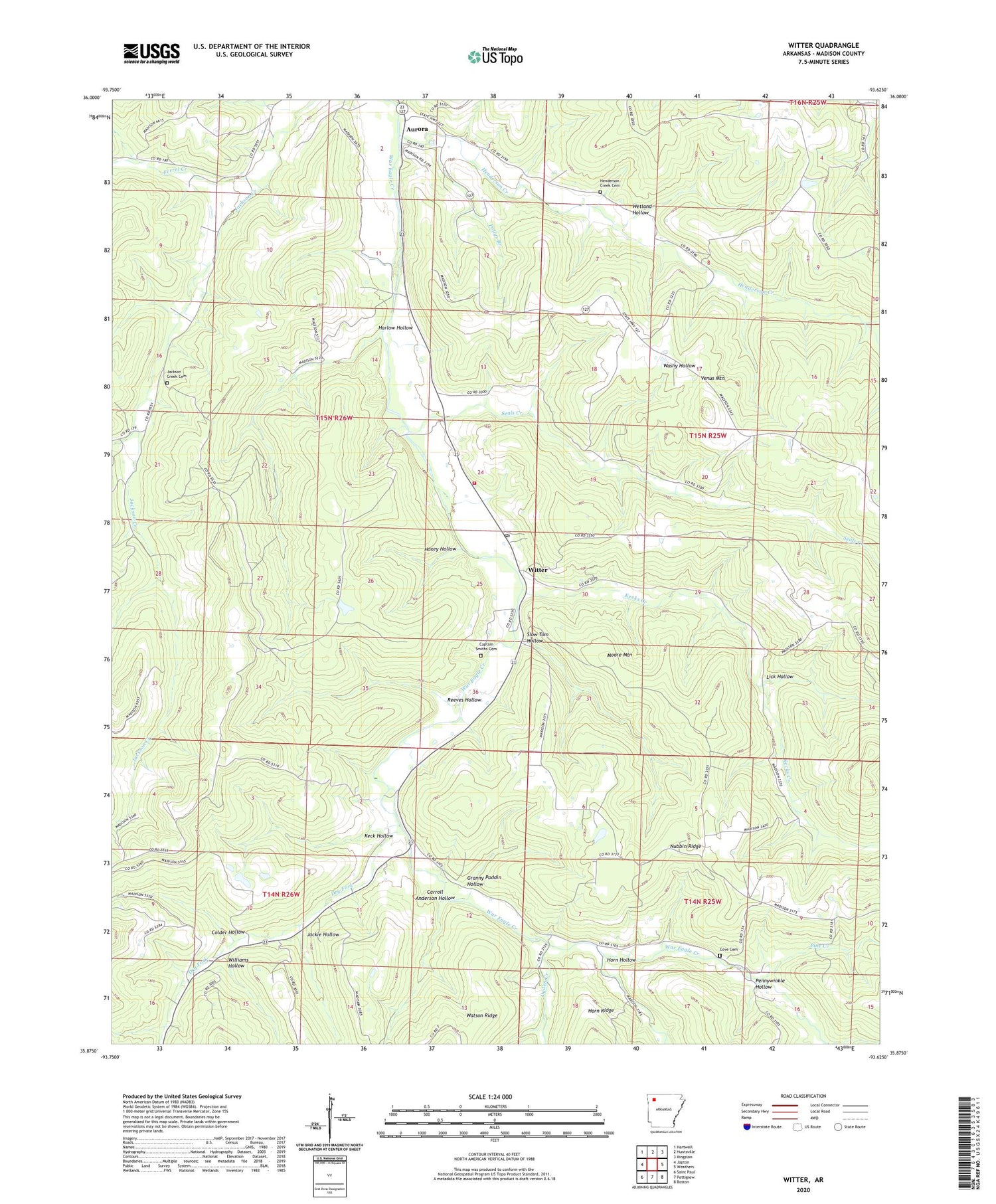
2024 topographic map quadrangle Witter in the state of Arkansas. Scale: 1:24000. Based on the newly updated USGS 7.5' US Topo map series, this map is in the following counties: Madison. The map contains contour data, water features, and other items you are used to seeing on USGS maps, but also has updated roads and other features. This is the next generation of topographic maps. Printed on high-quality waterproof paper with UV fade-resistant inks.
Quads adjacent to this one:
West: Japton
Northwest: Hartwell
North: Huntsville
Northeast: Kingston
East: Weathers
Southeast: Boston
South: Pettigrew
Southwest: Saint Paul
This map covers the same area as the classic USGS quad with code o35093h6.
Contains the following named places: Aurora, Captain Smiths Cemetery, Carroll Anderson Hollow, Colder Hollow, Cove Cemetery, Dry Fork, Ferrel Creek, Granny Paddin Hollow, Harlow Hollow, Henderson Creek, Henderson Creek Cemetery, Horn Hollow, Hoxey Hollow, Jackie Hollow, Jackson Creek Cemetery, Jordan, Keck Hollow, Kecks Creek, Lick Hollow, Mitchell Branch, Moore Mountain, Nubbin Ridge, Ogden Church, Ogden Creek, Pennywinkle Hollow, Pine Creek, Pollys Branch, Reeves Hollow, Seals Creek, Slow Tom Hollow, Township of Bowen, Township of Lincoln, Venquin, Washy Hollow, Wetland Hollow, Williams Hollow, Witter, Witter - Aurora Volunteer Fire Department, Witter Post Office, ZIP Code: 72776


