MyTopo
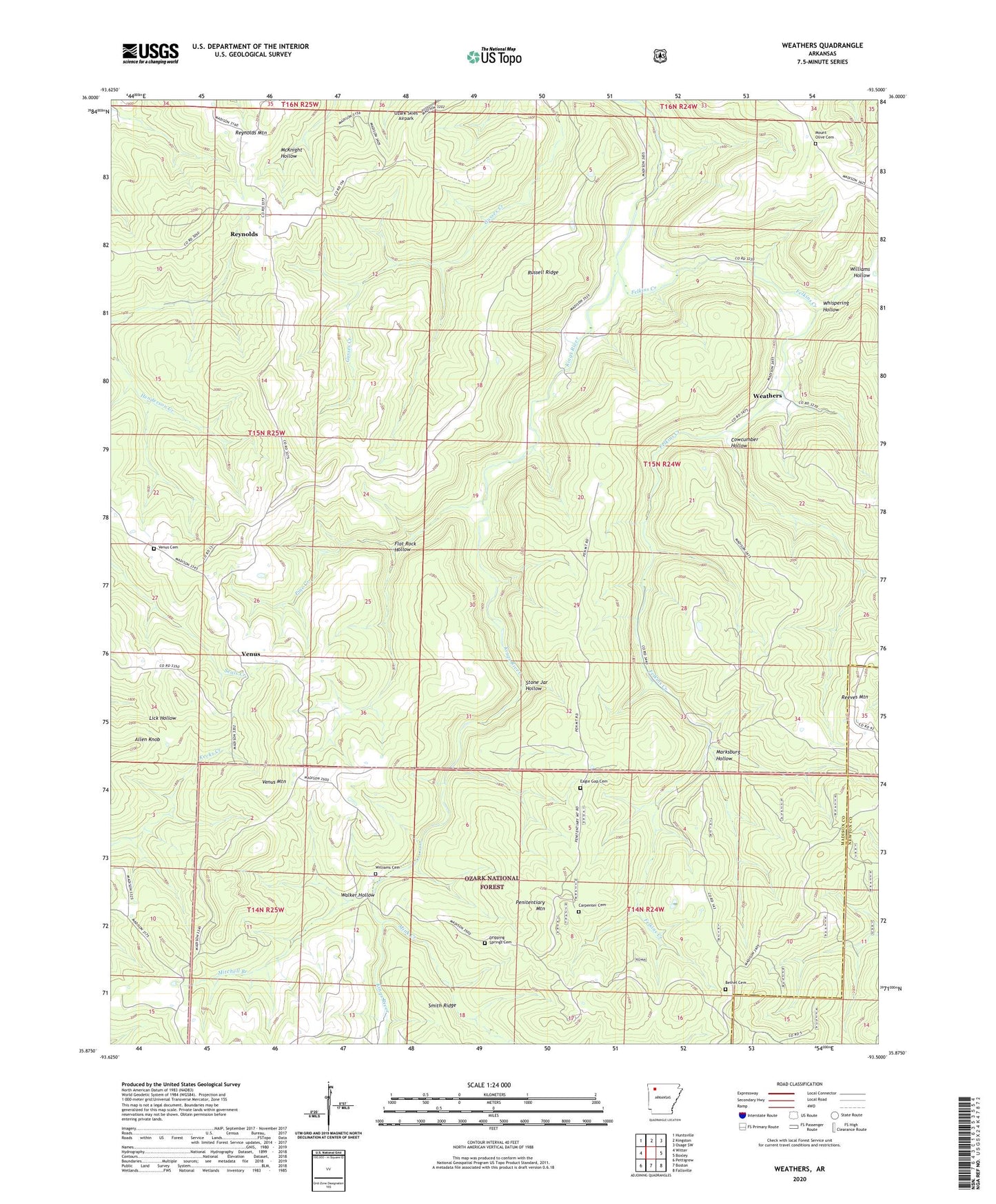
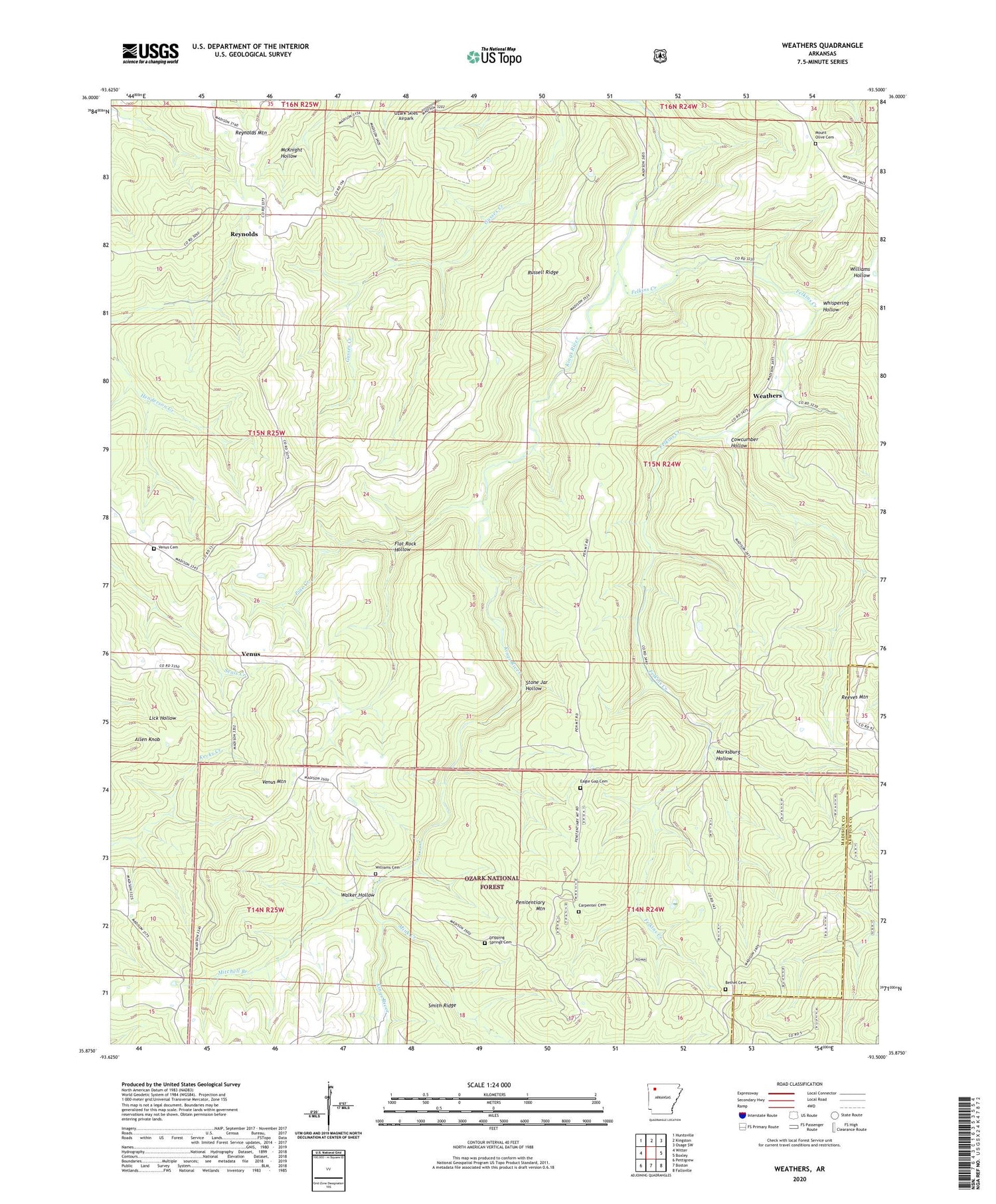
Weathers Arkansas US Topo Map
Couldn't load pickup availability
Also explore the Weathers Forest Service Topo of this same quad for updated USFS data
2024 topographic map quadrangle Weathers in the state of Arkansas. Scale: 1:24000. Based on the newly updated USGS 7.5' US Topo map series, this map is in the following counties: Madison, Newton. The map contains contour data, water features, and other items you are used to seeing on USGS maps, but also has updated roads and other features. This is the next generation of topographic maps. Printed on high-quality waterproof paper with UV fade-resistant inks.
Quads adjacent to this one:
West: Witter
Northwest: Huntsville
North: Kingston
Northeast: Osage SW
East: Boxley
Southeast: Fallsville
South: Boston
Southwest: Pettigrew
This map covers the same area as the classic USGS quad with code o35093h5.
Contains the following named places: Allen Knob, Bethel Cemetery, Carpenter Cemetery, Cowcumber Hollow, Dripping Springs Cemetery, Eagle Gap Cemetery, Felkins Creek, Flat Rock Hollow, Marksburg Hollow, Mink Creek, Mitchell Branch, Mount Olive Cemetery, Penitentiary Mountain, Pine Creek, Reynolds, Russell Ridge, Stone Jar Hollow, Township of Goodwill, Township of Venus, Townsley, Venus, Venus Cemetery, Venus Church, Venus Mountain, Walker Hollow, Weathers, Whispering Hollow, Williams Cemetery, Williams Hollow, ZIP Code: 72742