MyTopo
Kingston Arkansas US Topo Map
Couldn't load pickup availability
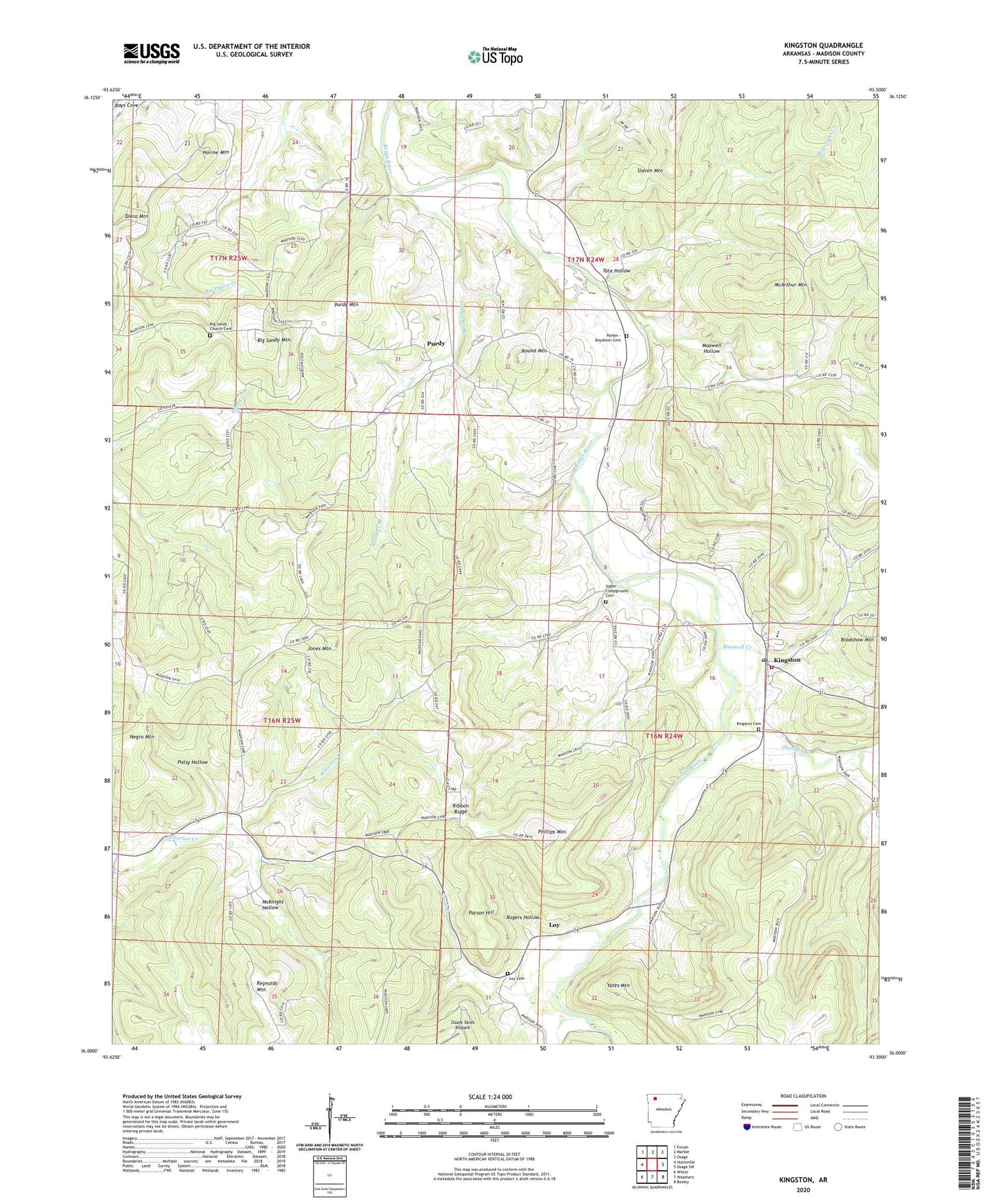
2024 topographic map quadrangle Kingston in the state of Arkansas. Scale: 1:24000. Based on the newly updated USGS 7.5' US Topo map series, this map is in the following counties: Madison. The map contains contour data, water features, and other items you are used to seeing on USGS maps, but also has updated roads and other features. This is the next generation of topographic maps. Printed on high-quality waterproof paper with UV fade-resistant inks.
Quads adjacent to this one:
West: Huntsville
Northwest: Forum
North: Marble
Northeast: Osage
East: Osage SW
Southeast: Boxley
South: Weathers
Southwest: Witter
This map covers the same area as the classic USGS quad with code o36093a5.
Contains the following named places: Big Sandy Church, Big Sandy Church Cemetery, Big Sandy Mountain, Boatright Creek, Dry Creek, Gusses Creek, Horine Mountain, Jones Mountain, KFAY-FM (Huntsville), Kingston, Kingston Cemetery, Kingston Census Designated Place, Kingston Elementary School, Kingston Fire Department, Kingston High School, Kingston Post Office, Long Branch, Loy, Loy Cemetery, Maxwell Creek, Maxwell Hollow, McArthur Mountain, McKnight Hollow, Negro Mountain, Ozark Skies Airpark, Parker - Boydston Cemetery, Parson Hill, Patsy Hollow, Phillips Mountain, Purdy, Purdy Mountain, Reynolds Mountain, Ribbon Ridge, Rogers Hollow, Round Mountain, Slaven Mountain, Spanker Branch, Sweden Creek, Tate Hollow, Township of Kings River, Township of Marble, Township of Purdy, Township of Wharton, Township of Wharton Creek, Truth, Upper Campground Cemetery, Upper Wharton Church, Yates Mountain