MyTopo
Zinc Arkansas US Topo Map
Couldn't load pickup availability
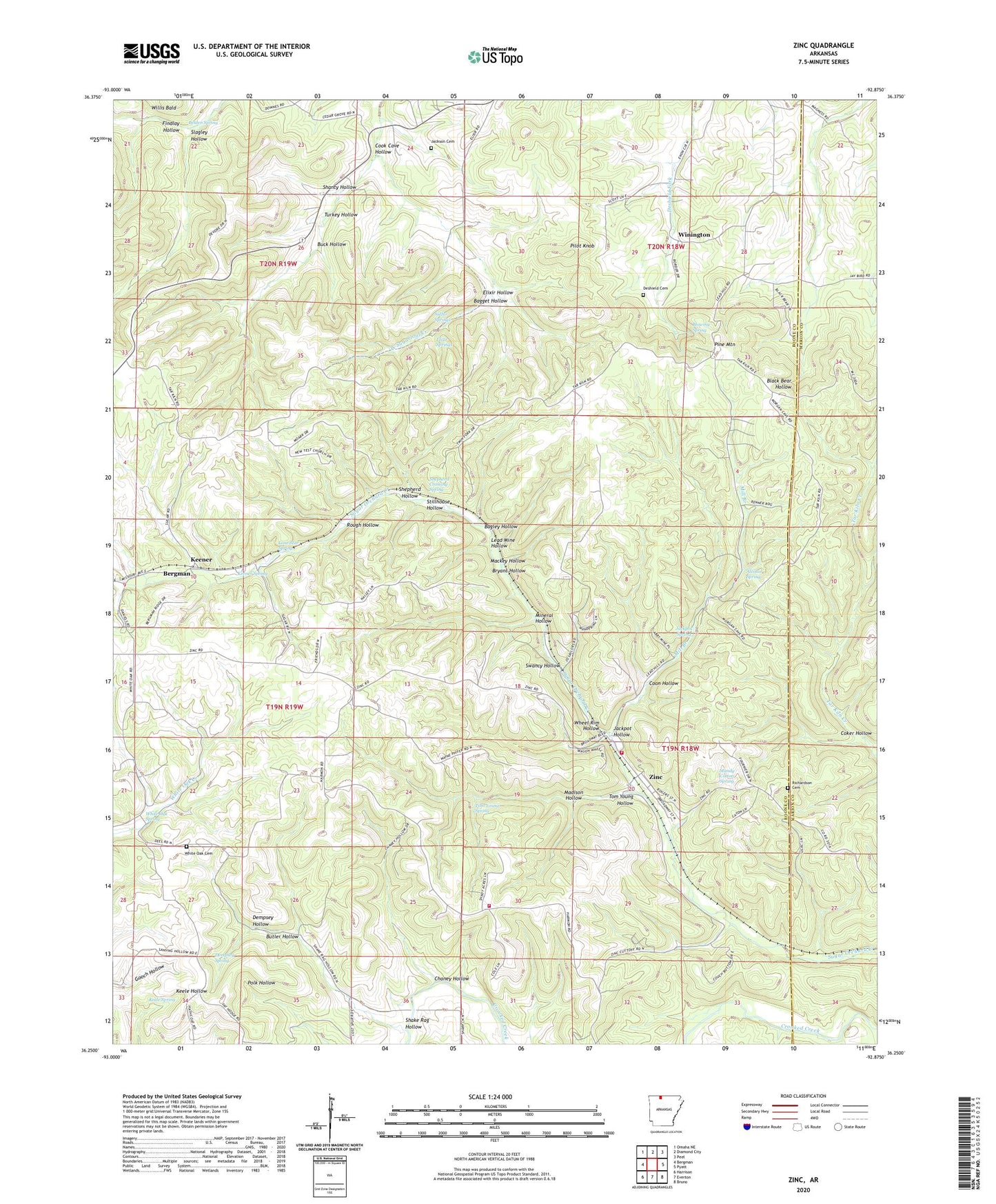
2024 topographic map quadrangle Zinc in the state of Arkansas. Scale: 1:24000. Based on the newly updated USGS 7.5' US Topo map series, this map is in the following counties: Boone, Marion. The map contains contour data, water features, and other items you are used to seeing on USGS maps, but also has updated roads and other features. This is the next generation of topographic maps. Printed on high-quality waterproof paper with UV fade-resistant inks.
Quads adjacent to this one:
West: Bergman
Northwest: Omaha NE
North: Diamond City
Northeast: Peel
East: Pyatt
Southeast: Bruno
South: Everton
Southwest: Harrison
This map covers the same area as the classic USGS quad with code o36092c8.
Contains the following named places: Alcohol Spring, Bagget Hollow, Bagley Hollow, Belden Spring, Blowing Spring, Bryant Hollow, Buck Hollow, Butler Hollow, Chaney Hollow, Coker Hollow, Cook Cave Hollow, Coon Hollow, Dempsey Hollow, Dempsey Spring, Deshield Cemetery, Elixir Hollow, Elixir Springs, Findlay Hollow, Jackpot Hollow, Jackpot Mine, Jackpot Spring, Jackson Cemetery, Keele Spring, Keener, Keener Spring, Lead Mine Hollow, Lone Star Spring, Mackey Hollow, Madison Hollow, Madison Mine, Mandy Cotton Spring, Mill Branch, Mineral Hollow, Pilot Knob, Pine Mountain, Richardson Cemetery, Rough Hollow, Shake Rag Hollow, Shanty Hollow, Shepherd Crossing Spring, Shepherd Hollow, Slagley Hollow, Stillhouse Hollow, Sulfur Springs, Swancy Hollow, Tom Young Hollow, Tom Young Spring, Town of Zinc, Township of Zinc, Turkey Hollow, Wheel Rim Hollow, White Oak Cemetery, White Oak Church, White Oak Spring, Willis Bald, Winington, Zinc, Zinc Volunteer Fire Department