MyTopo
Everton Arkansas US Topo Map
Couldn't load pickup availability
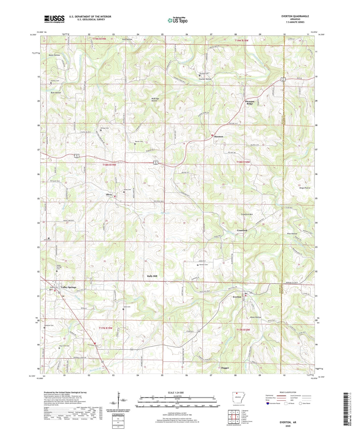
2024 topographic map quadrangle Everton in the state of Arkansas. Scale: 1:24000. Based on the newly updated USGS 7.5' US Topo map series, this map is in the following counties: Boone, Marion. The map contains contour data, water features, and other items you are used to seeing on USGS maps, but also has updated roads and other features. This is the next generation of topographic maps. Printed on high-quality waterproof paper with UV fade-resistant inks.
Quads adjacent to this one:
West: Harrison
Northwest: Bergman
North: Zinc
Northeast: Pyatt
East: Bruno
Southeast: Saint Joe
South: Western Grove
Southwest: Hasty
This map covers the same area as the classic USGS quad with code o36092b8.
Contains the following named places: Britton Cemetery, Buie Hollow, Cowvat Hollow, Crawford, Crawford Mountain, Crossroad Church, Davidson Cemetery, Davis Church, Dugger, Elm Branch, Everton, Everton Baptist Church, Everton Post Office, Hampton Cemetery, Harmon, Harmon Fire Department Station 1, Harmon Fire Department Station 2, Hog Creek, Hog Creek Cemetery, Huzzah Creek, Jones Cemetery, Jones Hollow, Keele Hollow, Kings Branch, Liberty Church, Marshall Branch, McBridge Hollow, Meeks Creek, Newton Cemetery, Olvey, Olvey Cemetery, Olvey Church, Pedlo, Pedlo Branch, Pine Hollow, Pine Hollow Creek, Pleasant Ridge, Polk Hollow, Rally Hill, Rowland Cemetery, Smith Cemetery, Snowball Branch, Starkey Cemetery, Town of Everton, Town of Valley Springs, Township of Blythe, Township of Jefferson, Township of Olvey, Township of Prairie, Valley Springs, Valley Springs Cemetery, Valley Springs Elementary School, Valley Springs Fire Department Station 1, Valley Springs Fire Department Station 2, Valley Springs Fire Department Station 4, Valley Springs High School, Valley Springs Middle School, Valley Springs Post Office, Warner Cemetery