MyTopo
Bergman Arkansas US Topo Map
Couldn't load pickup availability
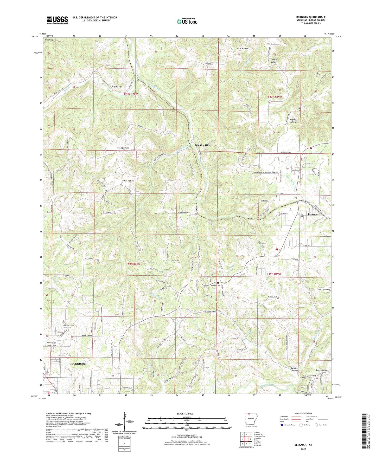
2024 topographic map quadrangle Bergman in the state of Arkansas. Scale: 1:24000. Based on the newly updated USGS 7.5' US Topo map series, this map is in the following counties: Boone. The map contains contour data, water features, and other items you are used to seeing on USGS maps, but also has updated roads and other features. This is the next generation of topographic maps. Printed on high-quality waterproof paper with UV fade-resistant inks.
Quads adjacent to this one:
West: Batavia
Northwest: Omaha
North: Omaha NE
Northeast: Diamond City
East: Zinc
Southeast: Everton
South: Harrison
Southwest: Gaither
This map covers the same area as the classic USGS quad with code o36093c1.
Contains the following named places: Bergman, Bergman Assembly of God Church, Bergman Elementary School, Bergman Fire Department Station 2, Bergman High School, Bergman Post Office, Bergman Volunteer Fire Department Station 1, Bethany Cemetery, Bog Hollow, Boone County, Cheatham Creek, Cottonwood Rural Fire Department Station 1, Evans Branch, Gooch Hollow, Harrison Christian Academy, Harrison Fire Department Station 2, Hopewell, Hopewell Baptist Church, KCWD-FM (Harrison), Marble Fork, Myrtle, Northvale Shopping Center, Norvell Spring, Oak Grove School, Open Door Baptist Church, Oregon, Oregon Flat Baptist Church, Ozark Mall Shopping Center, Sandsing Hollow, Summers Cemetery, Town of Bergman, Township of Elixir, Township of Lee, Township of Washington, Wesleyan Church, White Oak Creek, Wooden Hills, York Cemetery