MyTopo
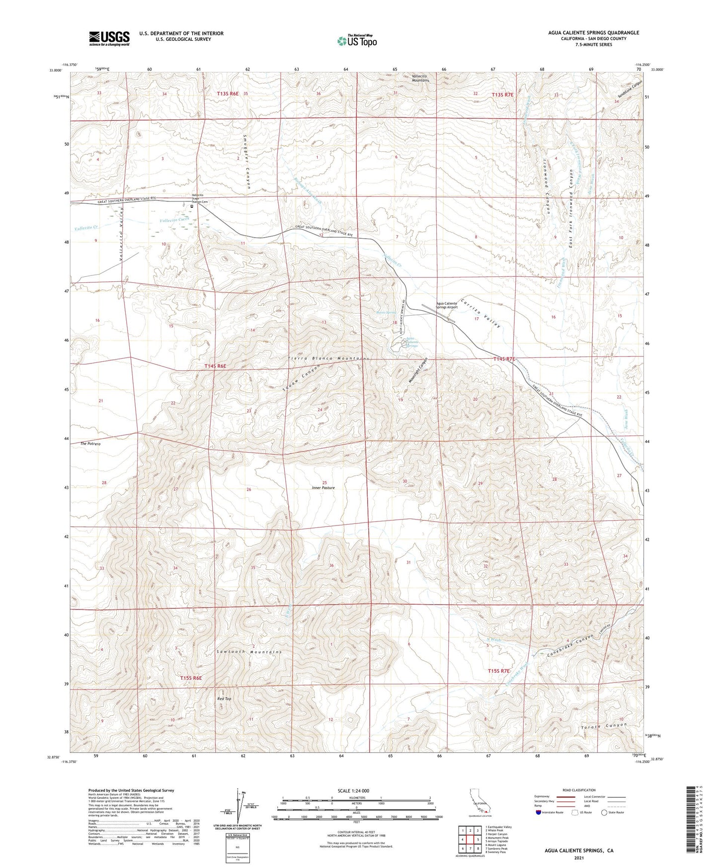
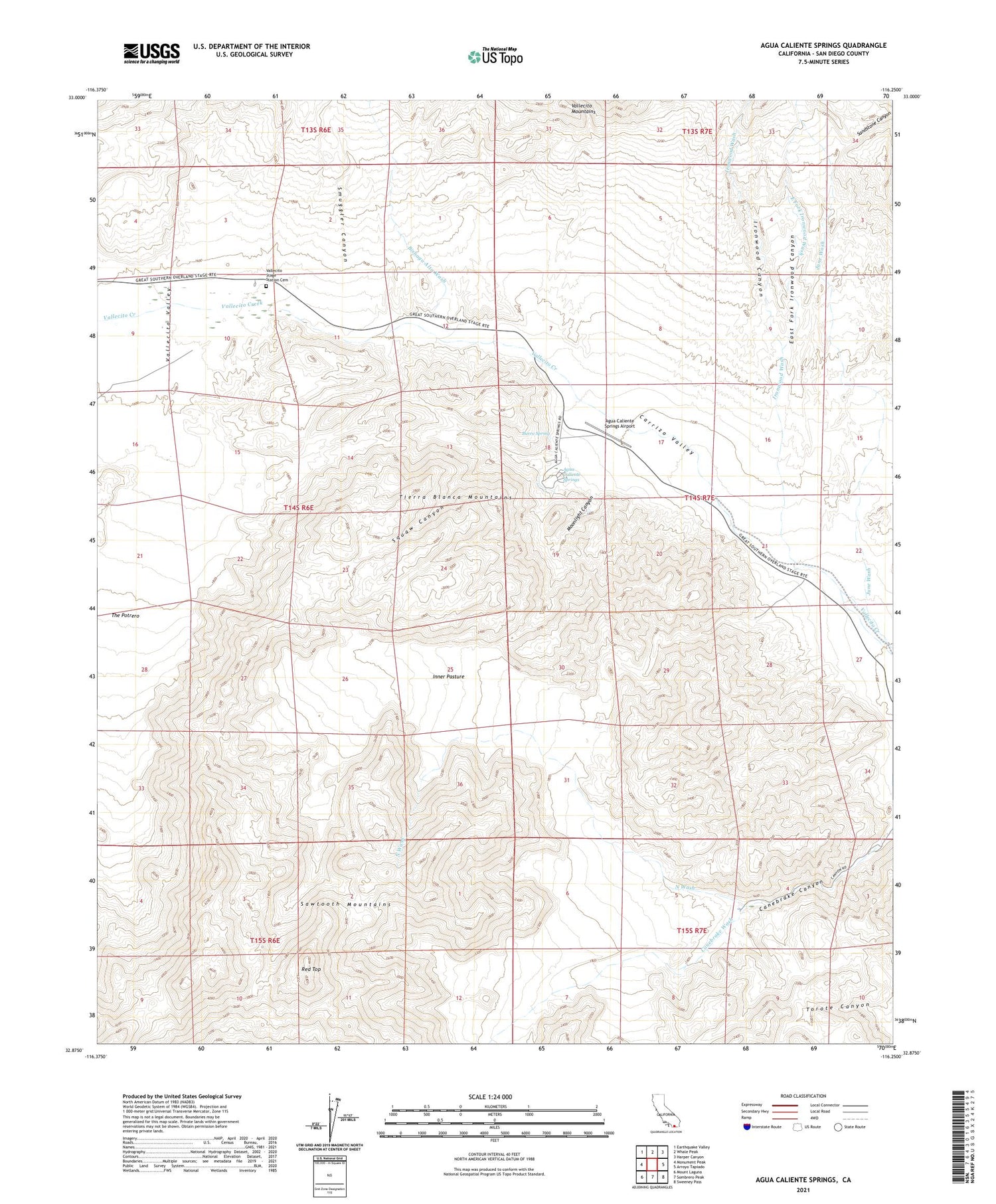
Agua Caliente Springs California US Topo Map
Couldn't load pickup availability
2023 topographic map quadrangle Agua Caliente Springs in the state of California. Scale: 1:24000. Based on the newly updated USGS 7.5' US Topo map series, this map is in the following counties: San Diego. The map contains contour data, water features, and other items you are used to seeing on USGS maps, but also has updated roads and other features. This is the next generation of topographic maps. Printed on high-quality waterproof paper with UV fade-resistant inks.
Quads adjacent to this one:
West: Monument Peak
Northwest: Earthquake Valley
North: Whale Peak
Northeast: Harper Canyon
East: Arroyo Tapiado
Southeast: Sweeney Pass
South: Sombrero Peak
Southwest: Mount Laguna
This map covers the same area as the classic USGS quad with code o32116h3.
Contains the following named places: Agua Caliente County Park, Agua Caliente Springs, Agua Caliente Springs Airport, Bisnaga Alta Wash, Burro Spring, Canebrake Canyon, Crawford Ranch, East Fork Ironwood Canyon, East Fork Ironwood Wash, Inner Pasture, Ironwood Canyon, Ironwood Wash, June Wash, Moonlight Canyon, North Wash, Red Top, Sawtooth Mountains, Sawtooth Mountains Wilderness, Smuggler Canyon, Squaw Canyon, Vallecito Stage Station Cemetery, Vallecito Stage Station County Park, Vallecito Valley