MyTopo
Aguanga California US Topo Map
Couldn't load pickup availability
Also explore the Aguanga Forest Service Topo of this same quad for updated USFS data
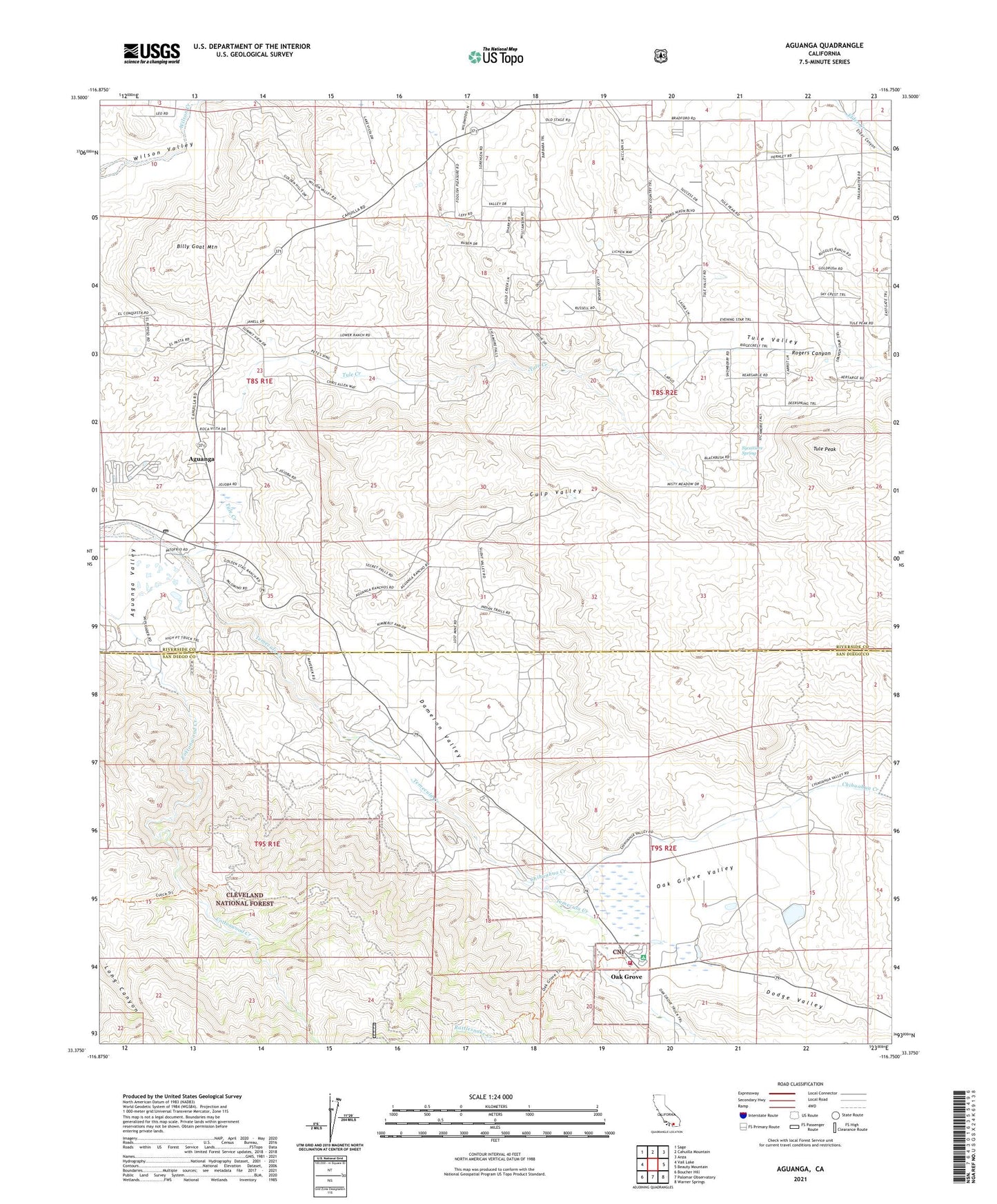
2021 topographic map quadrangle Aguanga in the state of California. Scale: 1:24000. Based on the newly updated USGS 7.5' US Topo map series, this map is in the following counties: Riverside, San Diego. The map contains contour data, water features, and other items you are used to seeing on USGS maps, but also has updated roads and other features. This is the next generation of topographic maps. Printed on high-quality waterproof paper with UV fade-resistant inks.
Quads adjacent to this one:
West: Vail Lake
Northwest: Sage
North: Cahuilla Mountain
Northeast: Anza
East: Beauty Mountain
Southeast: Warner Springs
South: Palomar Observatory
Southwest: Boucher Hill
This map covers the same area as the classic USGS quad with code o33116d7.
Contains the following named places: Aguanga, Aguanga Census Designated Place, Aguanga Post Office, Aguanga Trail, Billy Goat Mountain, Cahuilla Creek, Camp Wright Historical Marker, Chihuahua Creek, Culp Valley, Cutca Trail, Dameron Valley, Dodge Valley, Dry Ranch, High Point Truck Trail, Oak Grove, Oak Grove Campground, Oak Grove Census Designated Place, Oak Grove Fire Station, Oak Grove Stage Station Historical Marker, Oak Grove Valley, Rattlesnake Creek, Rogers Canyon, Sycamore Spring, Tule Creek, Tule Peak, Tule Valley, Ward Ranch Airport, ZIP Code: 92536