MyTopo
Sage California US Topo Map
Couldn't load pickup availability
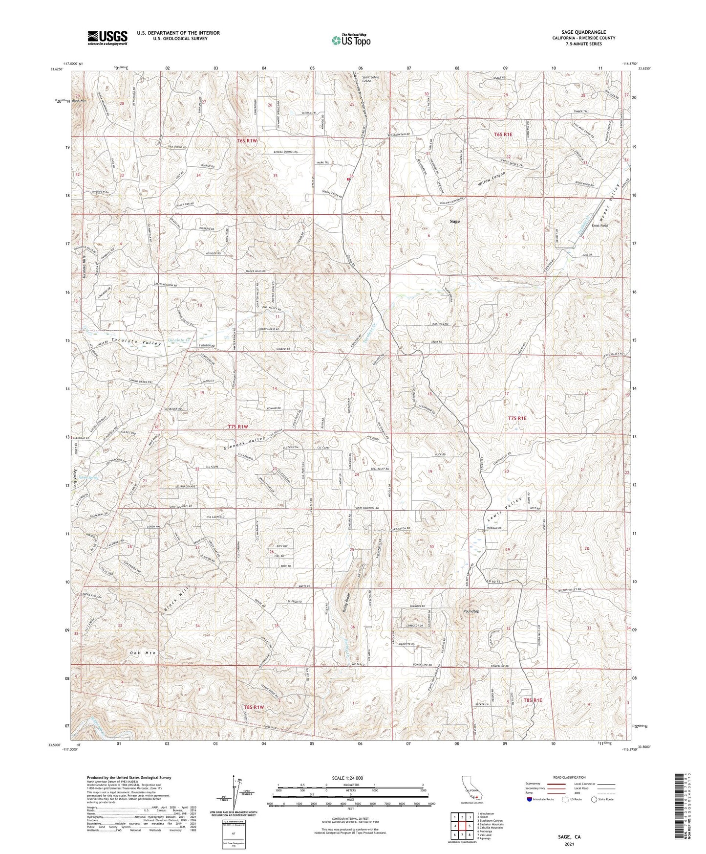
2021 topographic map quadrangle Sage in the state of California. Scale: 1:24000. Based on the newly updated USGS 7.5' US Topo map series, this map is in the following counties: Riverside. The map contains contour data, water features, and other items you are used to seeing on USGS maps, but also has updated roads and other features. This is the next generation of topographic maps. Printed on high-quality waterproof paper with UV fade-resistant inks.
Quads adjacent to this one:
West: Bachelor Mountain
Northwest: Winchester
North: Hemet
Northeast: Blackburn Canyon
East: Cahuilla Mountain
Southeast: Aguanga
South: Vail Lake
Southwest: Pechanga
This map covers the same area as the classic USGS quad with code o33116e8.
Contains the following named places: Adobe Spring, Black Hills, Clark Ranch Airpark, Crossroads New Life Educational Ministries, Ernst Field, Glenoak Hills, Glenoak Hills Park, Glenoak Valley, Indian Oaks Campground, Lewis Valley, Oak Mountain, Oakridge Ranches, Red Mountain Christian School, Riverside County Fire Department Station 28 Sage, Rocky Ridge, Roundtop, Sage, Sage Census Designated Place, Saint Johns Grade, San Ignacio School, Sycamore Hills, Sycamore Springs, Tucalota Valley, Weber Valley, Willow Canyon