MyTopo
Vail Lake California US Topo Map
Couldn't load pickup availability
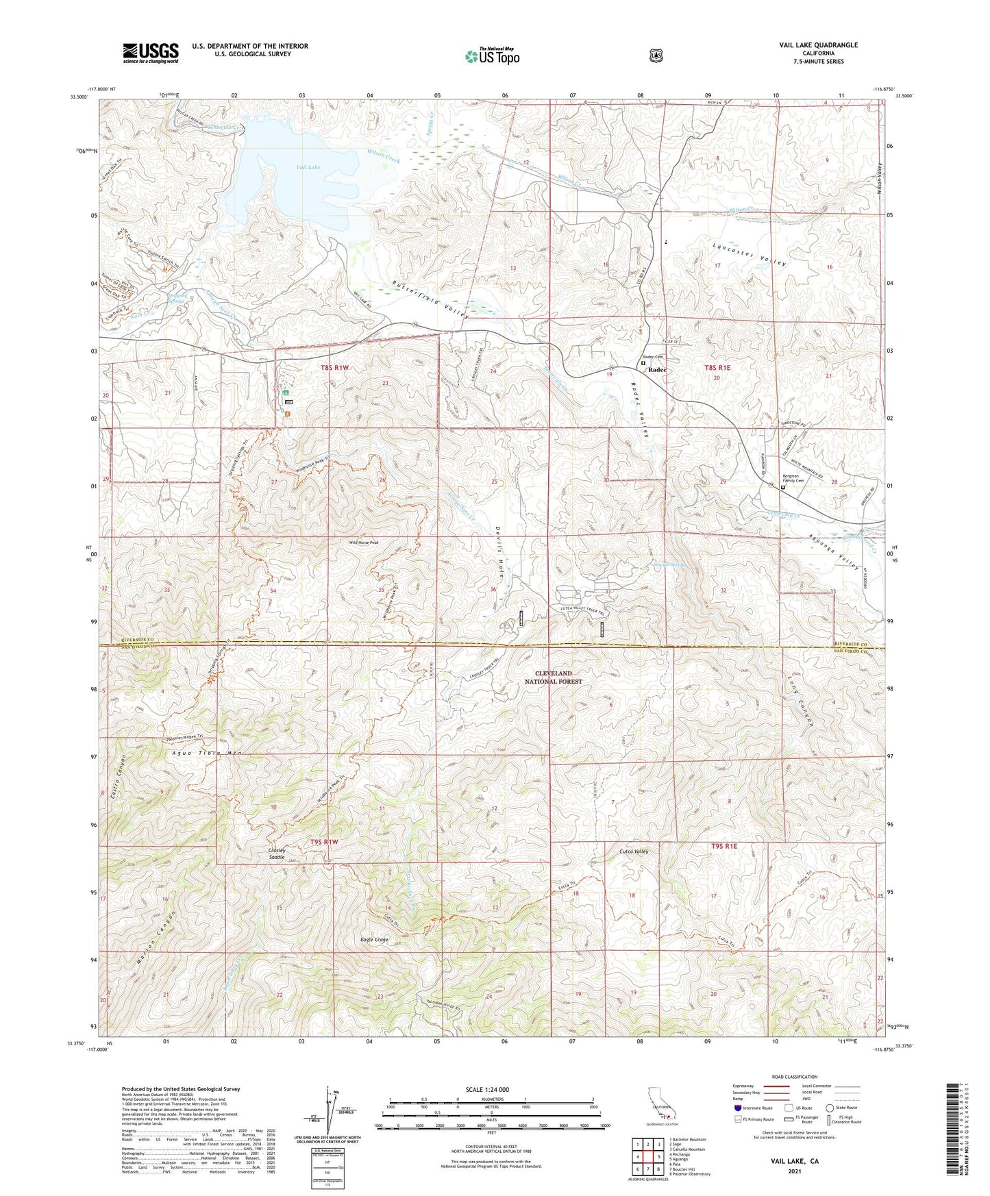
2021 topographic map quadrangle Vail Lake in the state of California. Scale: 1:24000. Based on the newly updated USGS 7.5' US Topo map series, this map is in the following counties: Riverside, San Diego. The map contains contour data, water features, and other items you are used to seeing on USGS maps, but also has updated roads and other features. This is the next generation of topographic maps. Printed on high-quality waterproof paper with UV fade-resistant inks.
Quads adjacent to this one:
West: Pechanga
Northwest: Bachelor Mountain
North: Sage
Northeast: Cahuilla Mountain
East: Aguanga
Southeast: Palomar Observatory
South: Boucher Hill
Southwest: Pala
This map covers the same area as the classic USGS quad with code o33116d8.
Contains the following named places: Agua Tibia Mountain, Agua Tibia Wilderness, Aguanga Valley, Arroyo Seco Creek, Bergman Family Cemetery, Butterfield County Recreational Vehicle Park, Butterfield Lake Estates, Butterfield Valley, Cottonwood Creek, Cottonwood K - 8 School, Crosley Homestead, Crosley Saddle, Crosley Truck Trail, Crossbar Oaks Campground, Cutca Valley, Cutca Valley Truck Trail, Devils Hole, Dripping Springs, Dripping Springs Campground, Dripping Springs Guard Station, Dripping Springs Trail, Dripping Springs Trailhead, Eagle Crage, Kolb Creek, Lancaster Valley, Long Canyon, Ormsby Campground, Palomar Mesa Campground, Radec, Radec Cemetery, Radec Valley, Rancho California Lake Club, Rincon Mesa Campground, Riverside County Fire Department Station 52 Cottonwood, Sawyer Spring, Spring Creek, United States Forest Service Cleveland National Forest Station - Dripping Springs, Vail 2028 Dam, Vail Lake, Vail Lake Boat Launch, Wild Horse Peak, Wilson Creek, Wilson Valley