MyTopo
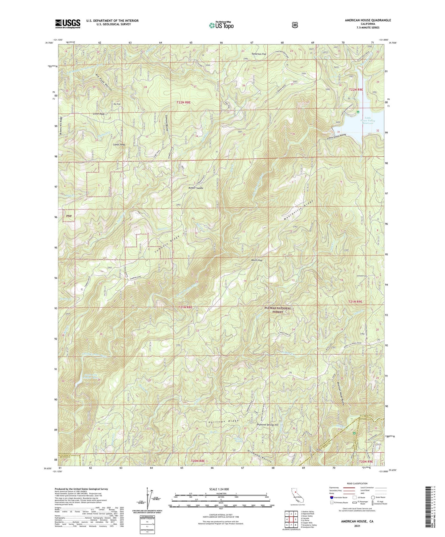
American House California US Topo Map
Couldn't load pickup availability
Also explore the American House Forest Service Topo of this same quad for updated USFS data
2021 topographic map quadrangle American House in the state of California. Scale: 1:24000. Based on the newly updated USGS 7.5' US Topo map series, this map is in the following counties: Plumas, Sierra, Yuba, Butte. The map contains contour data, water features, and other items you are used to seeing on USGS maps, but also has updated roads and other features. This is the next generation of topographic maps. Printed on high-quality waterproof paper with UV fade-resistant inks.
Quads adjacent to this one:
West: Cascade
Northwest: Haskins Valley
North: Dogwood Peak
Northeast: Onion Valley
East: La Porte
Southeast: Goodyears Bar
South: Strawberry Valley
Southwest: Clipper Mills
This map covers the same area as the classic USGS quad with code o39121f1.
Contains the following named places: American House, American House Ravine, Bear Creek, Big Peak, Big Peak Ravine, Black Rock Campground, Black Rock Creek, Boehme Ranch, Browns Hill Mine, Camel Peak, Davis Creek, Devils Gap, Diamond Ravine, Diamond Springs, Diamond Springs Hill, Harrison Ridge, Ice Creek, Lexington Hill, Little Grass Valley, Little Grass Valley 63-003 Dam, Little Peak, Lumpkin Ridge, McKintosh Ranch, McNair Saddle, Mooreville Ridge, Post Creek, Rocky Creek, Sanborn Mine, South Fork Diversion 63-004 Dam, South Fork Feather River, Steward Ravine, Tamarack Flat, Valley Creek, Valley Creek Special Interest Area, Willow Creek