MyTopo
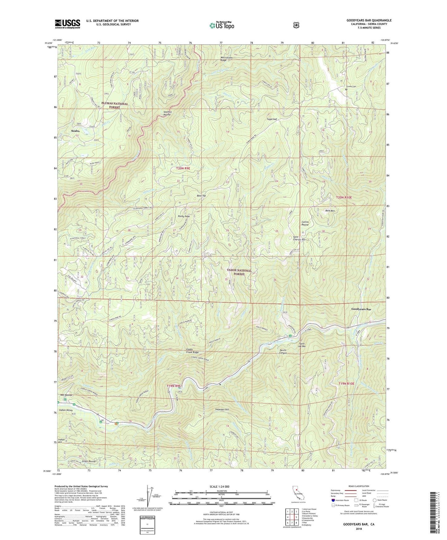
Goodyears Bar California US Topo Map
Couldn't load pickup availability
Also explore the Goodyears Bar Forest Service Topo of this same quad for updated USFS data
2022 topographic map quadrangle Goodyears Bar in the state of California. Scale: 1:24000. Based on the newly updated USGS 7.5' US Topo map series, this map is in the following counties: Sierra. The map contains contour data, water features, and other items you are used to seeing on USGS maps, but also has updated roads and other features. This is the next generation of topographic maps. Printed on high-quality waterproof paper with UV fade-resistant inks.
Quads adjacent to this one:
West: Strawberry Valley
Northwest: American House
North: La Porte
Northeast: Mount Fillmore
East: Downieville
Southeast: Alleghany
South: Pike
Southwest: Camptonville
This map covers the same area as the classic USGS quad with code o39120e8.
Contains the following named places: Bald Mountain, Bald Top, Bee Tree Borrow Pit, Bow Creek, Brown Bear Mine, Brush Creek Mine, Bunker Hill Mine, Collins Ravine, Colony Mine, Convict Flat Picnic Area, Devils Canyon, Eureka, Eureka Cemetery, Eureka Creek, Eureka Diggings, Fiddle Creek, Fiddle Creek Camp Ground, Fiddle Creek Ridge, Fiddle Creek Trail, Florida House, Golden Bear Mine, Goodyears Bar, Goodyears Bar Cemetery, Goodyears Bar Census Designated Place, Goodyears Creek, Grant Ravine, Halls Ranch, Halls Ranch Guard Station, Halls Ranch Trail, Head Dam, Humbug Creek, Indian Hill, Indian Rock Picnic Area, Indian Valley, Indian Valley Camp Ground, Little Canyon Creek, Little Fiddle Creek, Little Humbug Creek, Lower Carton Campground, Magnolia Mine, Marvin Ranch, McMahon Mine, McMahons, Mount Pleasant, Mount Pleasant Ranch, New Kirk Mine, Old Mountain House, Pipe Creek, Ramshorn Camp Ground, Ramshorn Creek, Ramshorn Trail, Rock Creek, Rocky Peak, Rocky Rest Campground, Saint Catherine Creek, Saint Charles Hill, Saint Charles Ranch, Saint Joe Bar, Sawmill Ravine, Scalan Mine, Scales, Scales Cemetery, Shower Branch, Snow Creek, Snowden Hill, Sugarloaf, Upper Carlton Campground, Wet Ravine, Woodruff Creek, Young America Creek