MyTopo
Apple Valley North California US Topo Map
Couldn't load pickup availability
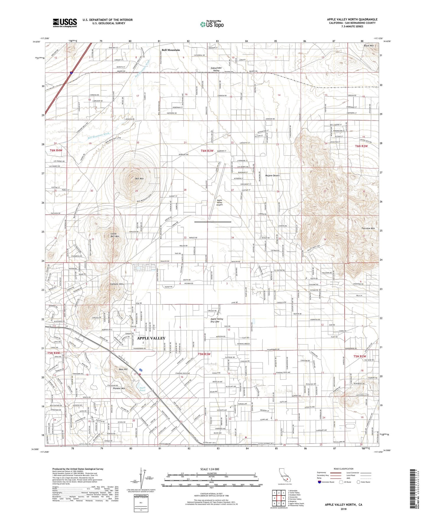
2021 topographic map quadrangle Apple Valley North in the state of California. Scale: 1:24000. Based on the newly updated USGS 7.5' US Topo map series, this map is in the following counties: San Bernardino. The map contains contour data, water features, and other items you are used to seeing on USGS maps, but also has updated roads and other features. This is the next generation of topographic maps. Printed on high-quality waterproof paper with UV fade-resistant inks.
Quads adjacent to this one:
West: Victorville
Northwest: Helendale
North: Turtle Valley
Northeast: Stoddard Well
East: Fairview Valley
Southeast: Fifteenmile Valley
South: Apple Valley South
Southwest: Hesperia
This map covers the same area as the classic USGS quad with code o34117e2.
Contains the following named places: Apple Pond, Apple Valley, Apple Valley Airport, Apple Valley Branch San Bernardino County Library, Apple Valley Dry Lake, Apple Valley Fire Center, Apple Valley Fire Protection District Station 331, Apple Valley Fire Protection District Station 333, Apple Valley Grange, Apple Valley Police Department, Apple Valley Yacht Club, Bass Hill, Bell Mountain, Catholic Hill, Desert Knolls Manor, Fairview Mountain, Highway 18 Park, KITH-AM (Apple Valley), KQKL-AM (Apple Valley), Little Bell Mountain, Mojave Mesa Elementary School, Pioneer Mountain, Rancho Verde Elementary School, Saint Timothys Preparatory School, Sidewinder Valley, Sidewinder Well, Sunset Hills Memorial Park, Town of Apple Valley, Victorville-Hesperia Division, Virginia Park, Vista Campana Middle School, William E Poole Heliport, ZIP Code: 92307