MyTopo
Apple Valley South California US Topo Map
Couldn't load pickup availability
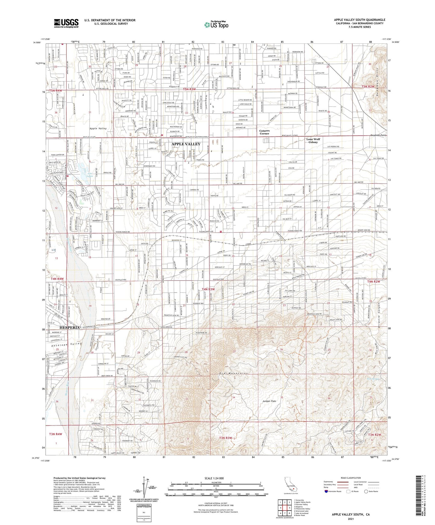
2021 topographic map quadrangle Apple Valley South in the state of California. Scale: 1:24000. Based on the newly updated USGS 7.5' US Topo map series, this map is in the following counties: San Bernardino. The map contains contour data, water features, and other items you are used to seeing on USGS maps, but also has updated roads and other features. This is the next generation of topographic maps. Printed on high-quality waterproof paper with UV fade-resistant inks.
Quads adjacent to this one:
West: Hesperia
Northwest: Victorville
North: Apple Valley North
Northeast: Fairview Valley
East: Fifteenmile Valley
Southeast: Butler Peak
South: Lake Arrowhead
Southwest: Silverwood Lake
This map covers the same area as the classic USGS quad with code o34117d2.
Contains the following named places: Antelope Valley, Apple Valley Adult School, Apple Valley Christian School, Apple Valley Community Center, Apple Valley Fire Protection District Station 334, Apple Valley Fire Protection District Station 335, Apple Valley Fire Protection District Station 336, Apple Valley Fire Protection District Station 337, Apple Valley High School, Apple Valley Highlands, Apple Valley Post Office, Apple Valley Senior Citizens Club, Bass Sports Center, Carmel Elementary School, Circle M Ranch, Cotners Corner, Hesperia Lake Park, High Desert Premier Academy, Horsemans Center Park, Jess Lakes, Jess Ranch, Juniper Flats, Kiowa Plaza Shopping Center, KZXY-FM (Apple Valley), Loma Park, Lone Wolf Colony, Mariana Academy, Mariana Ranchos, Mendel park, Ord Mountains, Quad Cities Shopping Center, Ranchos del Oro, Rock Springs, Sandia Academy, Sunset Hills, Victor Valley Museum, Willow Park High School, Yucca Loma Elementary School, ZIP Code: 92308