MyTopo
Fifteenmile Valley California US Topo Map
Couldn't load pickup availability
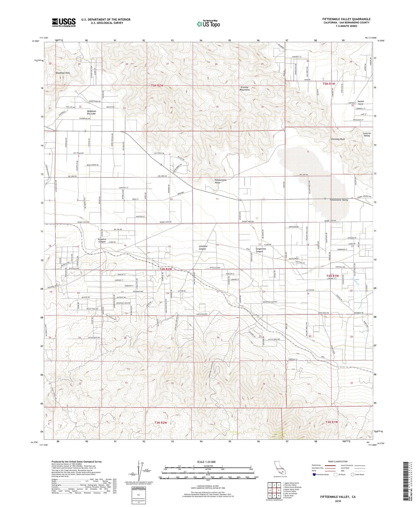
2021 topographic map quadrangle Fifteenmile Valley in the state of California. Scale: 1:24000. Based on the newly updated USGS 7.5' US Topo map series, this map is in the following counties: San Bernardino. The map contains contour data, water features, and other items you are used to seeing on USGS maps, but also has updated roads and other features. This is the next generation of topographic maps. Printed on high-quality waterproof paper with UV fade-resistant inks.
Quads adjacent to this one:
West: Apple Valley South
Northwest: Apple Valley North
North: Fairview Valley
Northeast: White Horse Mountain
East: Lucerne Valley
Southeast: Fawnskin
South: Butler Peak
Southwest: Lake Arrowhead
This map covers the same area as the classic USGS quad with code o34117d1.
Contains the following named places: Arrastre Canyon, Chimney Rock, Deadman Dry Lake, Deadman Hills, Deadman Point, Fifteenmile Point, Fifteenmile Valley, Fizzben Heights, Grapevine Canyon, Lovelace Canyon, Rabbit Lake, Rabbit Ranch Airport, Silver Creek, Sunset Cove, V P Mine