MyTopo
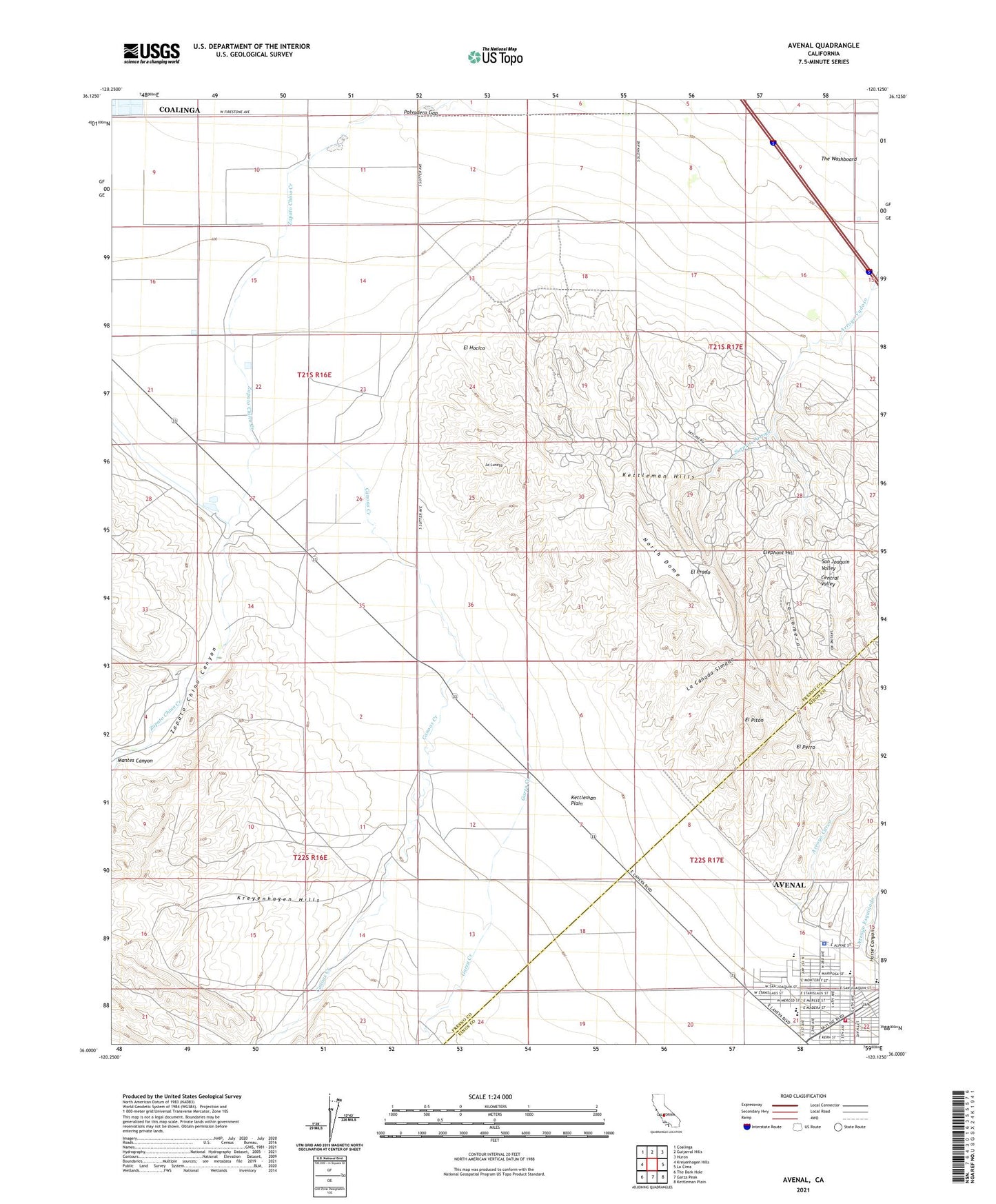
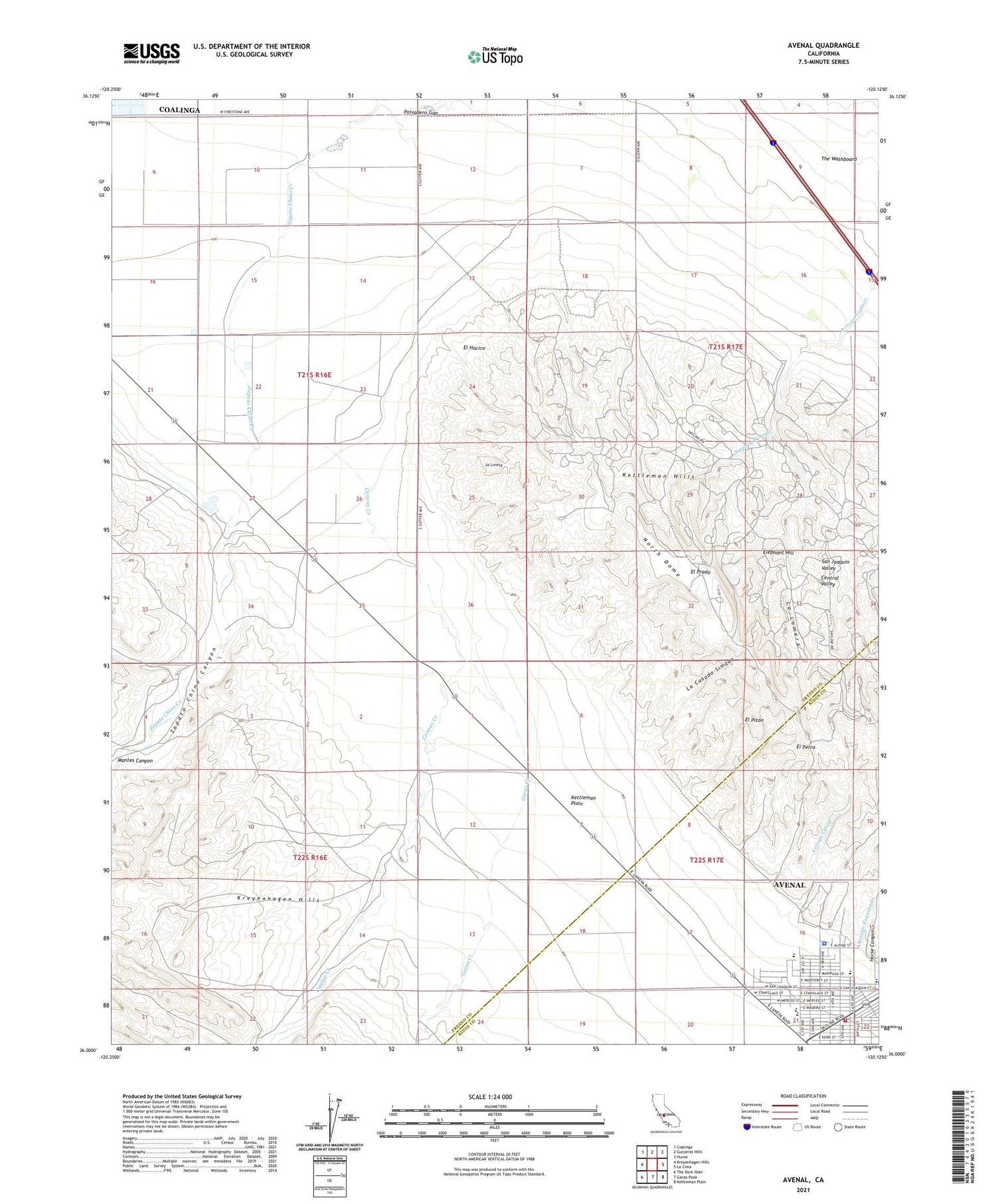
Avenal California US Topo Map
Couldn't load pickup availability
2021 topographic map quadrangle Avenal in the state of California. Scale: 1:24000. Based on the newly updated USGS 7.5' US Topo map series, this map is in the following counties: Fresno, Kings. The map contains contour data, water features, and other items you are used to seeing on USGS maps, but also has updated roads and other features. This is the next generation of topographic maps. Printed on high-quality waterproof paper with UV fade-resistant inks.
Quads adjacent to this one:
West: Kreyenhagen Hills
Northwest: Coalinga
North: Guijarral Hills
Northeast: Huron
East: La Cima
Southeast: Kettleman Plain
South: Garza Peak
Southwest: The Dark Hole
This map covers the same area as the classic USGS quad with code o36120a2.
Contains the following named places: Arroyo Corto, Arroyo Curvo, Arroyo Esquinado, Arroyo Larguito, Arroyo Recto, Arroyo Seco, Avenal, Avenal Airport, Avenal Branch Kings County Library, Avenal District Hospital Ambulance Service, Avenal Elementary School, Avenal High School, Avenal Hospital, Avenal Police Department, Canoas Creek, El Hocico, El Perro, El Piton, El Prado, Elephant Hill, Floyd Rice Park, Garza Creek, Kettleman Station, Kings County Fire Department Station 12 Avenal, La Canada Simada, La Lomera, La Luneta, Mantes Canyon, Polvadero Gap, Reef-Sunset Middle School, Starkey and Erwin Ranch, Sunrise High School, Surprise Arroyo, The Washboard, Weeth Ranch, Zapato Chino Canyon