MyTopo
La Cima California US Topo Map
Couldn't load pickup availability
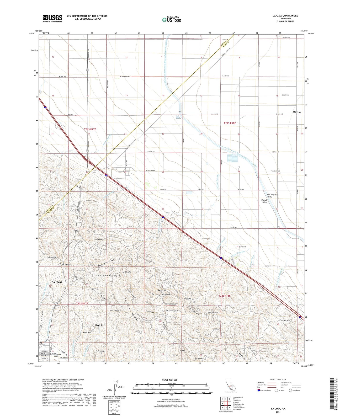
2021 topographic map quadrangle La Cima in the state of California. Scale: 1:24000. Based on the newly updated USGS 7.5' US Topo map series, this map is in the following counties: Kings, Fresno. The map contains contour data, water features, and other items you are used to seeing on USGS maps, but also has updated roads and other features. This is the next generation of topographic maps. Printed on high-quality waterproof paper with UV fade-resistant inks.
Quads adjacent to this one:
West: Avenal
Northwest: Guijarral Hills
North: Huron
Northeast: Westhaven
East: Kettleman City
Southeast: Los Viejos
South: Kettleman Plain
Southwest: Garza Peak
This map covers the same area as the classic USGS quad with code o36120a1.
Contains the following named places: Arroyo Bifido, Arroyo Doblegado, Arroyo Finito, Arroyo Hondo, Arroyo Largo, Arroyo Murado, Arroyo Pequeno, Arroyo Torcido, Arroyo Vadoso, Avenal City Hall, Avenal Landfill, Avenal Post Office, Cerro Lodoso, City of Avenal, Discovery Ridge, Double Hill, Eighteen Q Camp, El Chichon, El Pajaro, El Perno, El Piso, El Pulgar, El Rascador, El Serrijon, El Taco, El Tolete, Eleven P Office, Eleven P Plant, Horse Canyon, Hydril, Hydril Hill, Kettleman Compressor Station, Kettleman Hills, KNGS-FM (Coalinga), La Aleta, La Ceja, La Cima, La Clavija, La Cuesta, La Cumbre, La Cuna, La Loba, La Marmita, La Meseta, La Muralla, La Palomera, La Tusa, La Vega, Las Paredes, Los Jinetes, Murray, Murray Fire Control Station, North Dome, Three P Plant