MyTopo
Guijarral Hills California US Topo Map
Couldn't load pickup availability
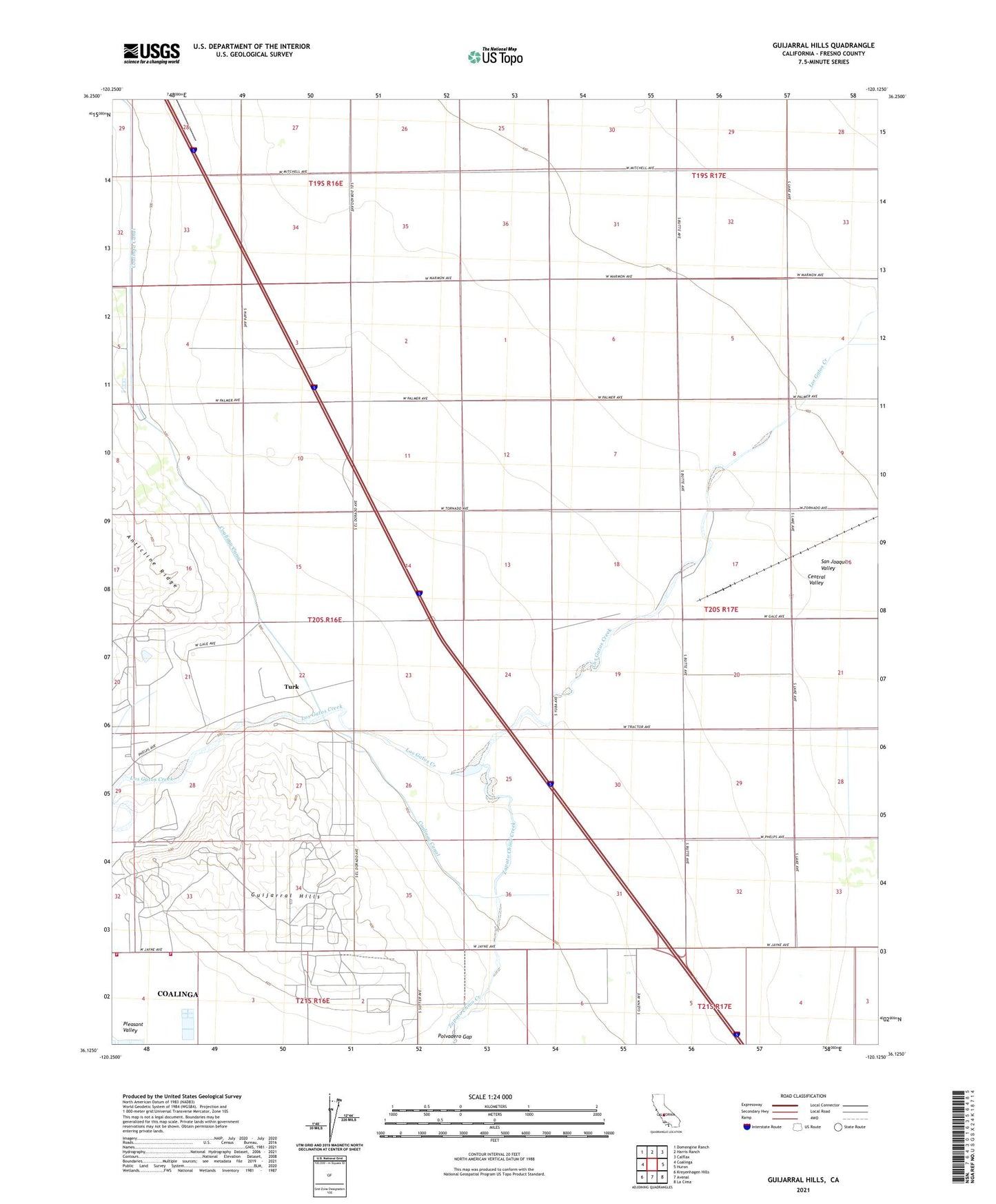
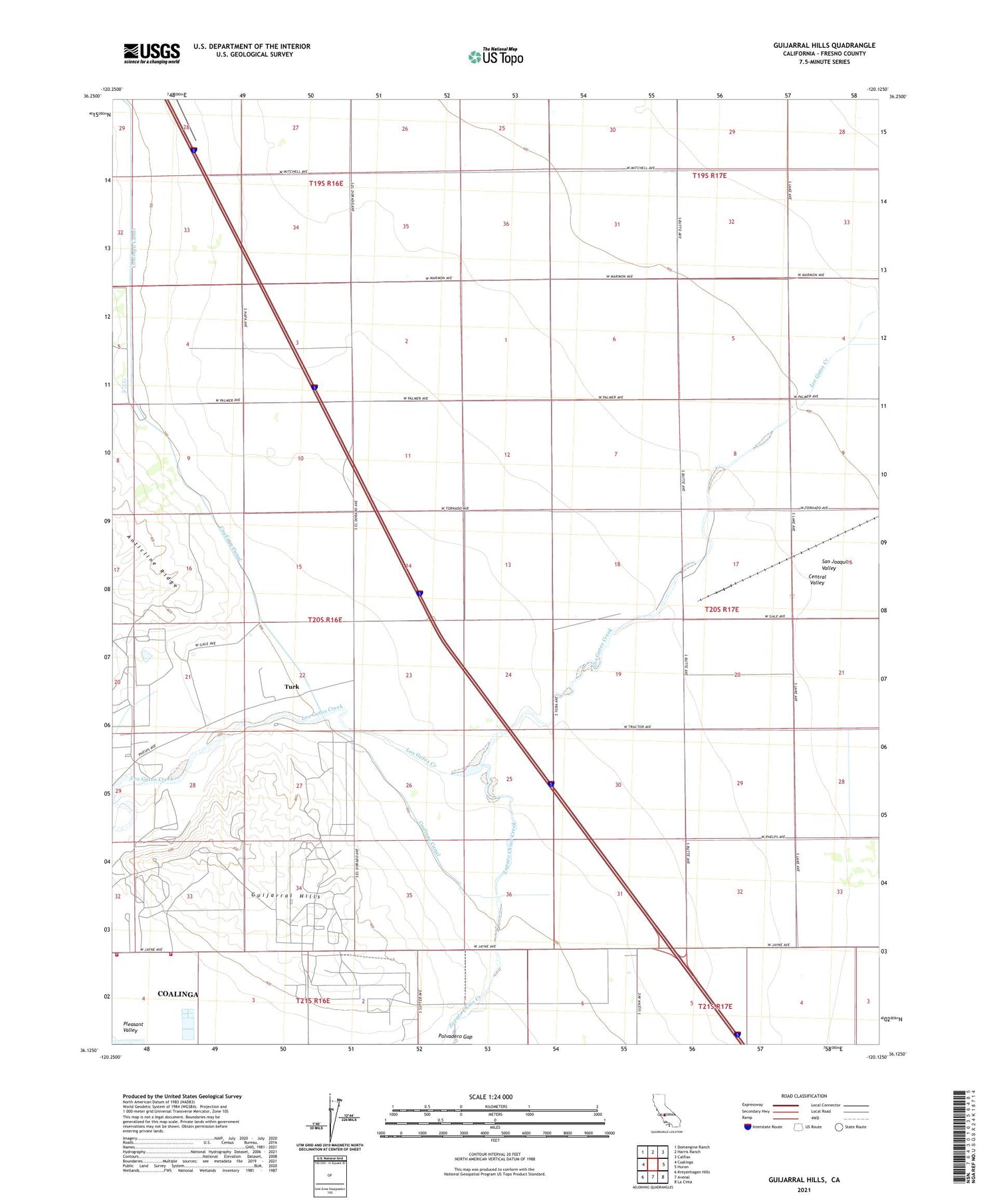
2021 topographic map quadrangle Guijarral Hills in the state of California. Scale: 1:24000. Based on the newly updated USGS 7.5' US Topo map series, this map is in the following counties: Fresno. The map contains contour data, water features, and other items you are used to seeing on USGS maps, but also has updated roads and other features. This is the next generation of topographic maps. Printed on high-quality waterproof paper with UV fade-resistant inks.
Quads adjacent to this one:
West: Coalinga
Northwest: Domengine Ranch
North: Harris Ranch
Northeast: Calflax
East: Huron
Southeast: La Cima
South: Avenal
Southwest: Kreyenhagen Hills
This map covers the same area as the classic USGS quad with code o36120b2.
Contains the following named places: Caliola Pumping Station, Coalinga Canal, Coalinga State Hospital, Coalinga State Hospital Fire Services, Gates Substation, Guijarral Hills, Guijarral Hills Oil Field, Pleasant Valley Oil Field, Pleasant Valley Ranch, Pleasant Valley State Prison Fire Department, Polvadero Country Club, Polvadero Ranch, Turk, Zapato Chino Creek