MyTopo
Badger Mountain California US Topo Map
Couldn't load pickup availability
Also explore the Badger Mountain Forest Service Topo of this same quad for updated USFS data
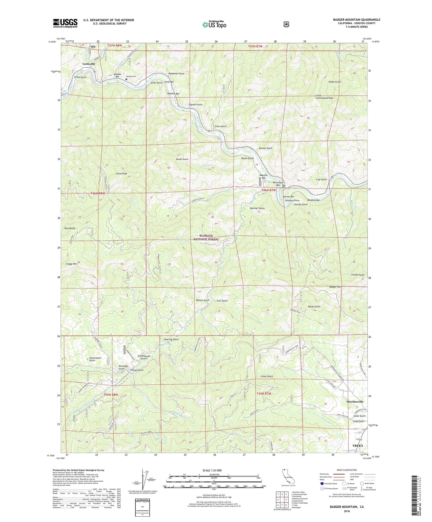
2021 topographic map quadrangle Badger Mountain in the state of California. Scale: 1:24000. Based on the newly updated USGS 7.5' US Topo map series, this map is in the following counties: Siskiyou. The map contains contour data, water features, and other items you are used to seeing on USGS maps, but also has updated roads and other features. This is the next generation of topographic maps. Printed on high-quality waterproof paper with UV fade-resistant inks.
Quads adjacent to this one:
West: McKinley Mountain
Northwest: Buckhorn Bally
North: Cottonwood Peak
Northeast: Hornbrook
East: Hawkinsville
Southeast: Montague
South: Yreka
Southwest: Indian Creek Baldy
This map covers the same area as the classic USGS quad with code o41122g6.
Contains the following named places: Badger Creek, Badger Mountain, Brushy Gulch, Butcher Gulch, Cayuse Gulch, Cayuse River Access, China Gulch, China Peak, Clear Creek, Clear Creek Trail, Craggy Mountain, Croy Gulch, Deadman Gulch, Dowling Gulch, Dunns Gulch, Dutch Creek, Empire Creek, Garvey Bar, Garvey Gulch, Gold Bar Mine, Gottsville, Honolulu School, Humbug Creek, Humbug Guard Station, Humbug Picnic Area, Humbug Point, Humbug Recreation Site, Hummingbird Mine, Kanaka Bar, Kanaka Cemetery, Keeler Creek, Kennebec Gulch, Lime Gulch, Little Cottonwood Peak, Lumgrey Creek, Masonic Bar, McConnell Bar, Middle Fork Humbug Creek, Mono Mine, Mono School, Montena Gulch, Punch Creek, Rattlesnake Gulch, Rider Gulch, Schoolhouse Gulch, Siskiyou Mine, Skeahan Bar, Skunk Creek, Skunk Gulch, South Fork Humbug Creek, Sucker Creek, Sweetwater Gulch, Swiss Bar, Swiss Gulch, Tincup Gulch, Trail Gulch, Tree of Heaven Campground, Whites Gulch, Wilson Mill, Woodrat Bar, ZIP Code: 96097