MyTopo
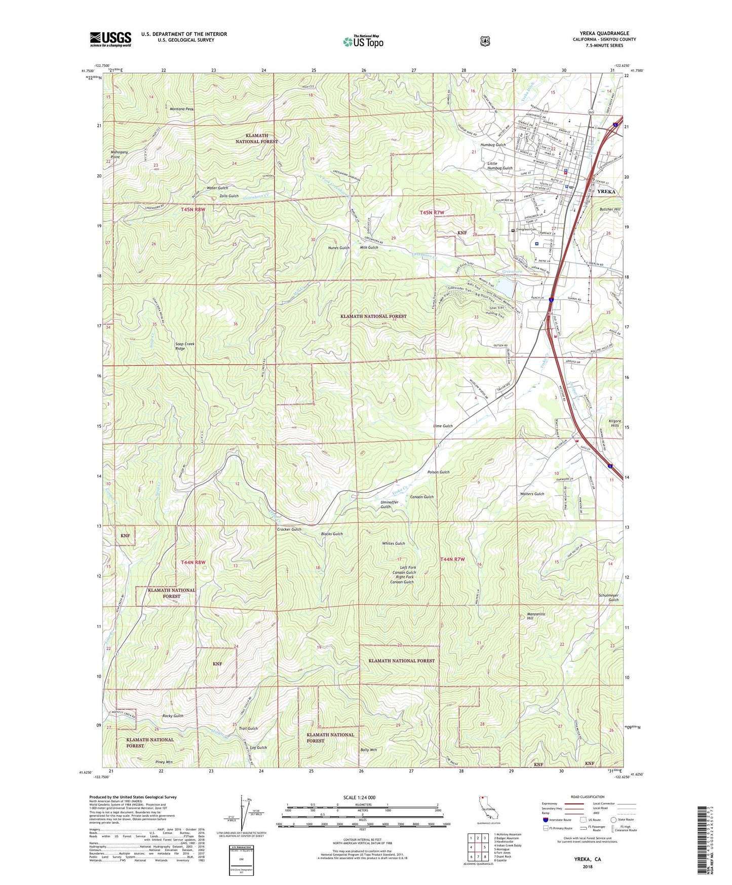
Yreka California US Topo Map
Couldn't load pickup availability
2022 topographic map quadrangle Yreka in the state of California. Scale: 1:24000. Based on the newly updated USGS 7.5' US Topo map series, this map is in the following counties: Siskiyou. The map contains contour data, water features, and other items you are used to seeing on USGS maps, but also has updated roads and other features. This is the next generation of topographic maps. Printed on high-quality waterproof paper with UV fade-resistant inks.
Quads adjacent to this one:
West: Indian Creek Baldy
Northwest: McKinley Mountain
North: Badger Mountain
Northeast: Hawkinsville
East: Montague
Southeast: Gazelle
South: Duzel Rock
Southwest: Fort Jones
This map covers the same area as the classic USGS quad with code o41122f6.
Contains the following named places: Bally Mountain, Berean Fundamental Church, Bethel Assembly of God Church, Blacks Gulch, Bottling Works Mall Shopping Center, Butcher Hill, California Department of Forestry and Fire Protection Yreka Fire Substation, California Highway Patrol Yreka, Canaan Gulch, Church of Christ, Church of the Nazarene, City of Yreka, Copper Creek, Cracker Gulch, Discovery High School, Discovery Park, Evergreen Cemetery, Evergreen Elementary School, Fairchild Medical Center, Faith Center Foursquare Church, First Baptist Church, First Church of Christ Scientist, First Southern Baptist Church, Forest House, Gold Street Elementary School, Greenhorn 1010 Dam, Greenhorn Creek, Greenhorn Park, Greenhorn Reservoir, Greenhorn School, Humbug Gulch, Jackson Street Elementary School, Juniper Creek, Klamath National Forest Supervisor Headquarters, KSYC-AM (Yreka), Left Fork Canaan Gulch, Lime Gulch, Little Humbug Gulch, Littrel Mine, Log Gulch, Mahogany Point, Manzanita Hill, Milk Gulch, Mill Creek, Montana Peak, Mount Vernon Mine, Mount Zion Lutheran Church, Newton Park, Nickels Mobile Park, North Fork Greenhorn Creek, Northern Siskiyou Ambulance, Nunes Gulch, Oak Ridge Mobile Estates, Osgood Mine, P.P. and L. Radio Repeater Station, Pegleg Mine, Poison Gulch, Ranch Mobile Home Park, Right Fork Canaan Gulch, Ringe Park, Rocky Gulch, Saint Josephs Catholic Church, Saint Marks Episcopal Church, Scorpion Mine, Siskiyou County Courthouse, Siskiyou County Fairgrounds, Siskiyou County Law Library, Siskiyou County Museum, Siskiyou County Public Library, Siskiyou County Sheriff, Soap Creek Ridge, South Yreka Fire Protection District Fire Station, The Church of Jesus Christ of Latter Day Saints, Trail Gulch, Uminoffer Gulch, Walters Gulch, Water Gulch, West Miner Street-Third Street Historic District, Whites Gulch, Yreka, Yreka City Hall, Yreka Ditch, Yreka Division, Yreka High School, Yreka Park, Yreka Police Department, Yreka Post Office, Yreka Volunteer Fire Department Ley Station, Zolls Gulch