MyTopo
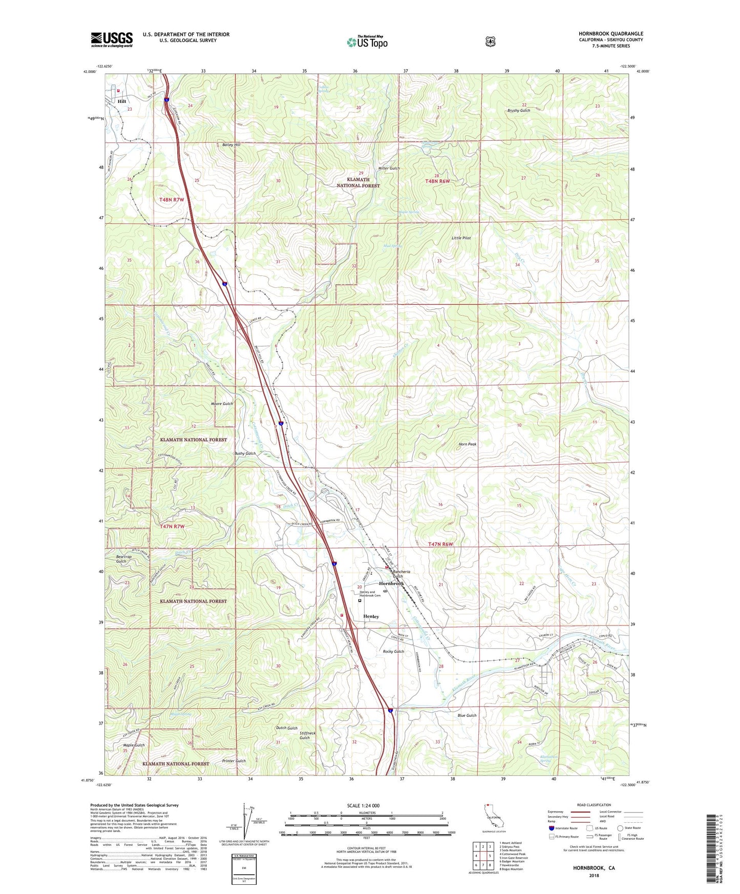
Hornbrook California US Topo Map
Couldn't load pickup availability
Also explore the Hornbrook Forest Service Topo of this same quad for updated USFS data
2022 topographic map quadrangle Hornbrook in the state of California. Scale: 1:24000. Based on the newly updated USGS 7.5' US Topo map series, this map is in the following counties: Siskiyou. The map contains contour data, water features, and other items you are used to seeing on USGS maps, but also has updated roads and other features. This is the next generation of topographic maps. Printed on high-quality waterproof paper with UV fade-resistant inks.
Quads adjacent to this one:
West: Cottonwood Peak
Northwest: Mount Ashland
North: Siskiyou Pass
Northeast: Soda Mountain
East: Iron Gate Reservoir
Southeast: Bogus Mountain
South: Hawkinsville
Southwest: Badger Mountain
This map covers the same area as the classic USGS quad with code o41122h5.
Contains the following named places: Alden Historical Marker, Andersons Spring, B R Alden Historical Marker, Bailey Hill, Beartrap Gulch, Blue Gulch, Bushy Gulch, California Department of Forestry and Fire Protection Hornbrook, Camp Lowe, Cape Horn Creek, Colestin Rural Fire District Station 2, Collins Spring, Cottonwood Creek, Ditch Creek, Hazel Mine, Henley, Henley and Hornbrook Cemetery, Hilt, Horn Peak, Hornbrook, Hornbrook Census Designated Place, Hornbrook Elementary School, Hornbrook Post Office, Hornbrook Volunteer Fire Station, Hutton Creek, Jefferson Davis Historical Monument, Jilson Mine, Klamathon, Klamathon Spring, Little Pilot, Maple Spring, McCavick Mine, Miller Gulch, Moore Gulch, Mud Spring, Olsen Mine, Osburger Gulch, Rancheria Gulch, Rocky Gulch, Shelton Creek, ZIP Code: 96044