MyTopo
Benton California US Topo Map
Couldn't load pickup availability
Also explore the Benton Forest Service Topo of this same quad for updated USFS data
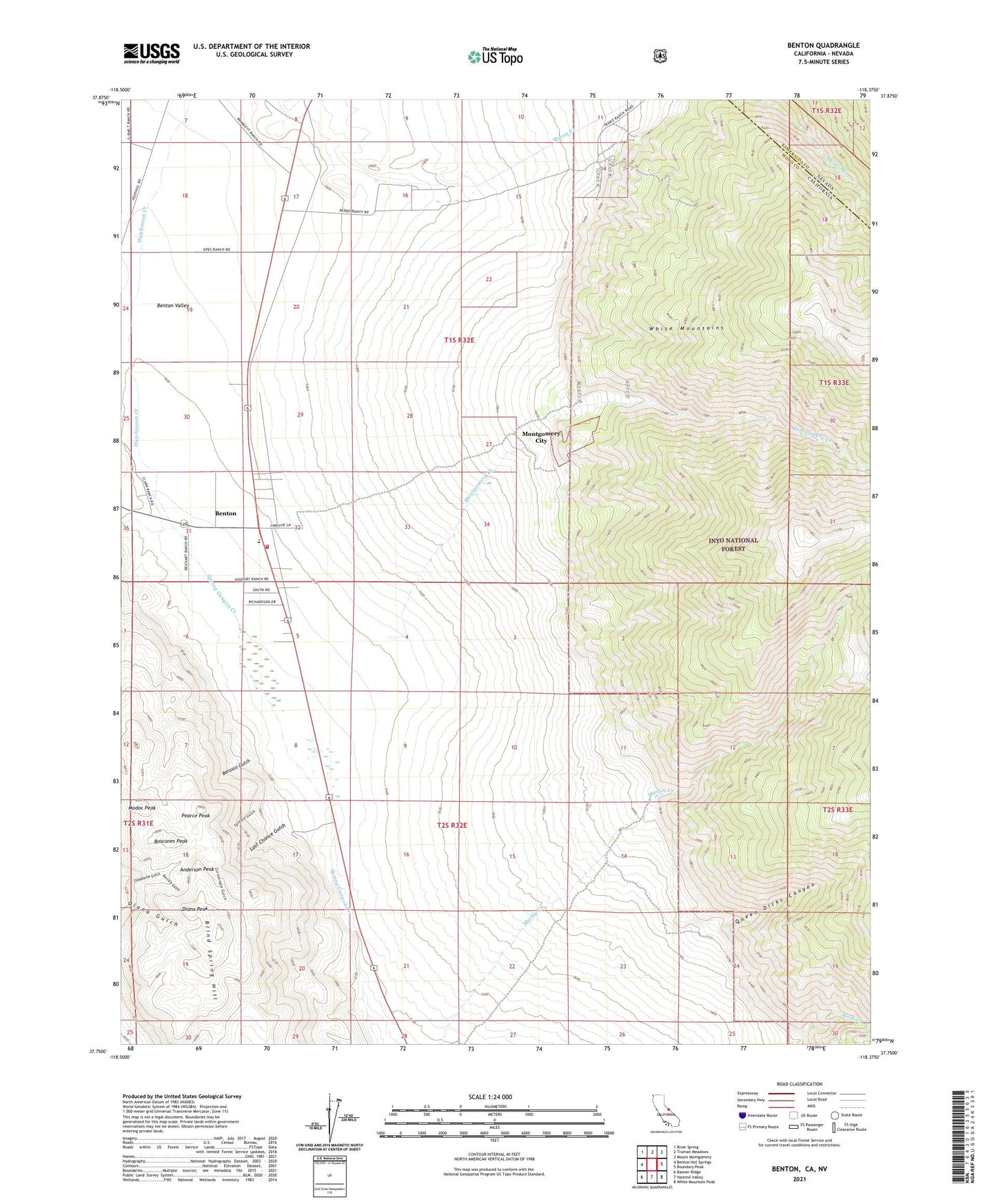
2021 topographic map quadrangle Benton in the states of California, Nevada. Scale: 1:24000. Based on the newly updated USGS 7.5' US Topo map series, this map is in the following counties: Mono, Esmeralda. The map contains contour data, water features, and other items you are used to seeing on USGS maps, but also has updated roads and other features. This is the next generation of topographic maps. Printed on high-quality waterproof paper with UV fade-resistant inks.
Quads adjacent to this one:
West: Benton Hot Springs
Northwest: River Spring
North: Truman Meadows
Northeast: Mount Montgomery
East: Boundary Peak
Southeast: White Mountain Peak
South: Hammil Valley
Southwest: Banner Ridge
Contains the following named places: Anderson Peak, Barasco Gulch, Benton, Benton Census Designated Place, Benton Valley, Black Warrior Mine, Blind Spring Hill, Buscones Peak, Comanche Mine, Cornucopia Gulch, Cornucopia Mine, Diana Peak, Edne Beaman Elementary School, Kerrick Gulch, Last Chance Gulch, Lynford Gulch, Modoc Peak, Montgomery City, Montgomery Creek, Morris Creek, Pearce Peak, Pedro Ranch, Queen Dicks, Queen Dicks Canyon, White Mountain Fire Protection District