MyTopo
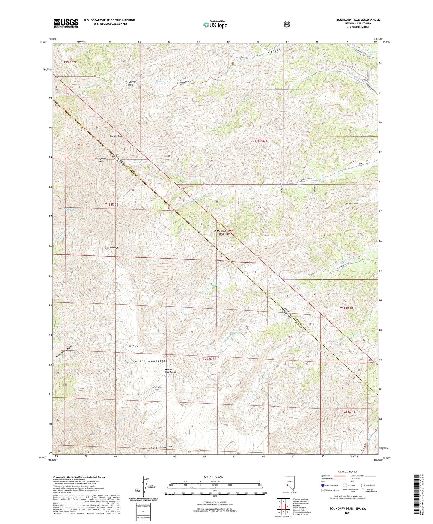
Boundary Peak Nevada US Topo Map
Couldn't load pickup availability
Also explore the Boundary Peak Forest Service Topo of this same quad for updated USFS data
2021 topographic map quadrangle Boundary Peak in the states of California, Nevada. Scale: 1:24000. Based on the newly updated USGS 7.5' US Topo map series, this map is in the following counties: Esmeralda, Mono. The map contains contour data, water features, and other items you are used to seeing on USGS maps, but also has updated roads and other features. This is the next generation of topographic maps. Printed on high-quality waterproof paper with UV fade-resistant inks.
Quads adjacent to this one:
West: Benton
Northwest: Truman Meadows
North: Mount Montgomery
Northeast: Volcanic Hills West
East: Davis Mountain
Southeast: Juniper Mountain
South: White Mountain Peak
Southwest: Hammil Valley
This map covers the same area as the classic USGS quad with code o37118g3.
Contains the following named places: Black Mountain, Boundary Peak, Boundary Peak Trailhead, Boundary Peak Wilderness, Container Mine, Montgomery Peak, Mount Dubois, North Fork Chiatovich Creek, Pellisier Flats, South Fork Chiatovich Creek, Sundown Mine, The Jumpoff, Trail Canyon Saddle