
MyTopo
Biggs California US Topo Map
Couldn't load pickup availability
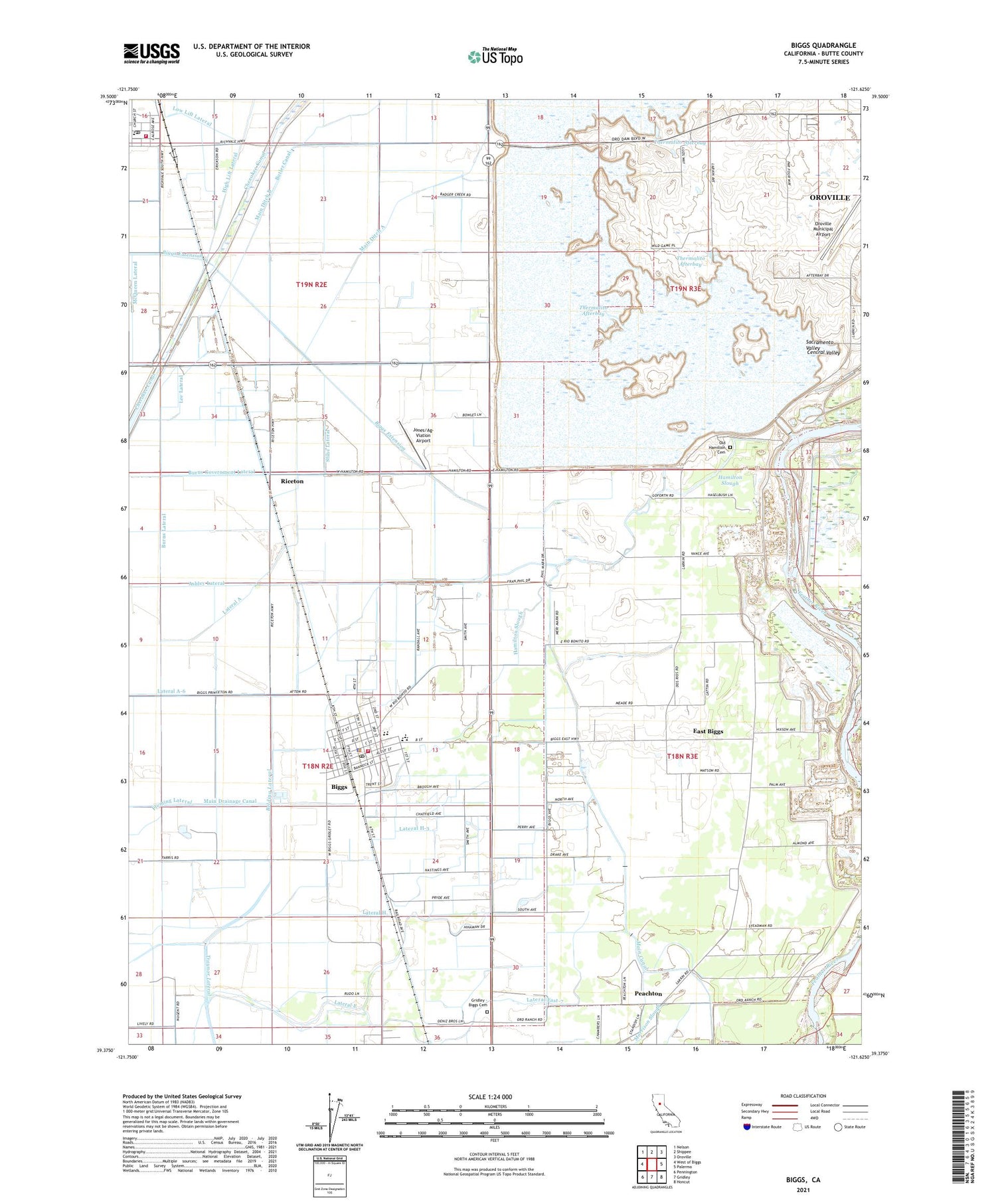
2021 topographic map quadrangle Biggs in the state of California. Scale: 1:24000. Based on the newly updated USGS 7.5' US Topo map series, this map is in the following counties: Butte. The map contains contour data, water features, and other items you are used to seeing on USGS maps, but also has updated roads and other features. This is the next generation of topographic maps. Printed on high-quality waterproof paper with UV fade-resistant inks.
Quads adjacent to this one:
West: West of Biggs
Northwest: Nelson
North: Shippee
Northeast: Oroville
East: Palermo
Southeast: Honcut
South: Gridley
Southwest: Pennington
This map covers the same area as the classic USGS quad with code o39121d6.
Contains the following named places: Biggs, Biggs Assembly of God Church, Biggs Branch Butte County Library, Biggs City Hall, Biggs Elementary School, Biggs Extension, Biggs Middle School, Biggs Police Department, Biggs Post Office, Biggs Station, Biggs United Methodist Church, Burns Government Lateral, Burns Lateral, Butler Canal, Butte County Fire Department Station 71, Butte County Fire Department Station 73, Cherokee Canal, City of Biggs, East Biggs, Evangelical Free Church, Fernandez, First Baptist Church, Fleming Lateral, Gridley - Biggs Cemetery, Hamilton Slough, Haselbusch, High Lift Lateral, Hume, Jones/Ag-Viation Airport, Lateral A, Lateral A-6, Lateral East, Lateral East-7, Lateral H, Lateral H-3, Lee Lateral, Lorraine, Low Lift Lateral, Main Canal, Main Ditch A, Main Ditch B, McQueen Lateral, Old Hamilton Cemetery, Onstott Ranch, Peachton, Riceton, Richland, Richvale, Richvale Elementary School, Richvale Post Office, River District School, Stine Lateral, Table Mountain Municipal Golf Course, Thermalito Afterbay, USDA Rice Experimental Station


