
MyTopo
Honcut California US Topo Map
Couldn't load pickup availability
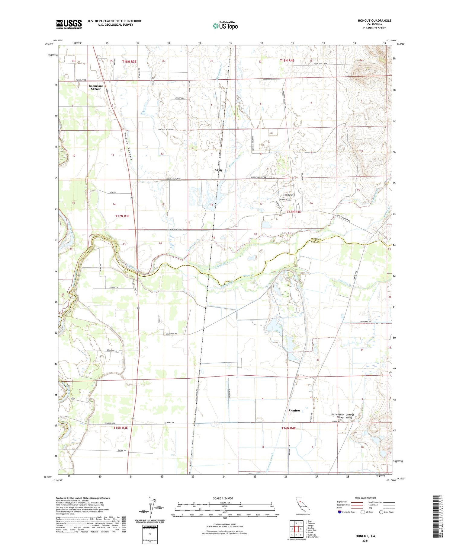
2021 topographic map quadrangle Honcut in the state of California. Scale: 1:24000. Based on the newly updated USGS 7.5' US Topo map series, this map is in the following counties: Butte, Yuba, Sutter. The map contains contour data, water features, and other items you are used to seeing on USGS maps, but also has updated roads and other features. This is the next generation of topographic maps. Printed on high-quality waterproof paper with UV fade-resistant inks.
Quads adjacent to this one:
West: Gridley
Northwest: Biggs
North: Palermo
Northeast: Bangor
East: Loma Rica
Southeast: Browns Valley
South: Yuba City
Southwest: Sutter
This map covers the same area as the classic USGS quad with code o39121c5.
Contains the following named places: Bliss, Central House, Central School, Coombs, Craig, Honcut, Honcut Census Designated Place, Honcut Creek, Honcut School, La Finca Orchards, North Honcut Creek, North Tree Fire Station, Pacific Ranch, Prairie School, Ramirez, Robinsons Corner, Section Seven Gun Club, South Honcut Creek, Wilson Creek, Wyandotte Creek, Wyman Ravine


