
MyTopo
Birds Landing California US Topo Map
Couldn't load pickup availability
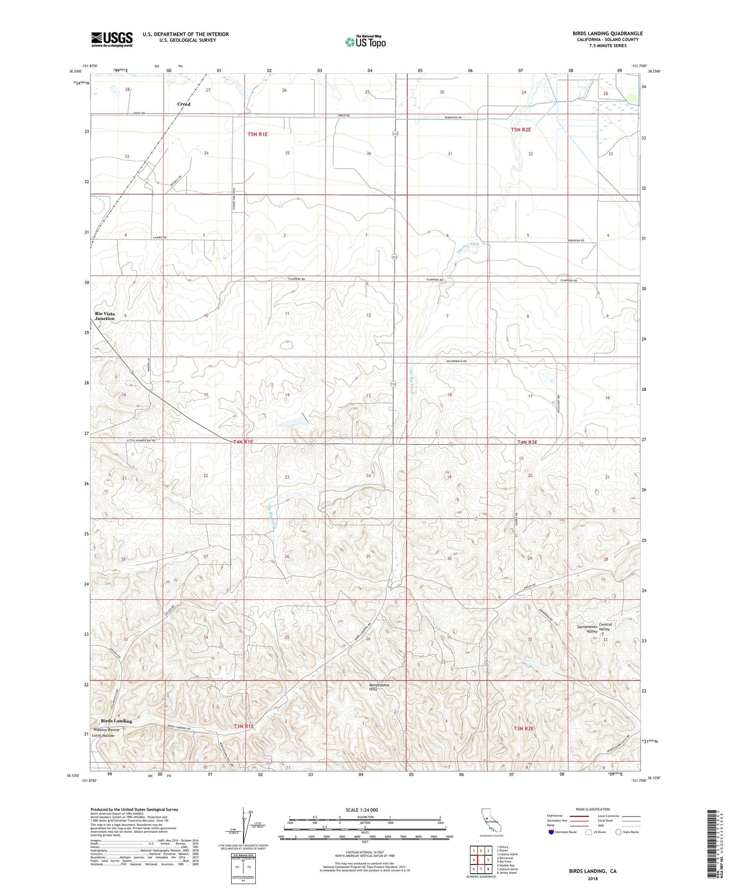
2022 topographic map quadrangle Birds Landing in the state of California. Scale: 1:24000. Based on the newly updated USGS 7.5' US Topo map series, this map is in the following counties: Solano. The map contains contour data, water features, and other items you are used to seeing on USGS maps, but also has updated roads and other features. This is the next generation of topographic maps. Printed on high-quality waterproof paper with UV fade-resistant inks.
Quads adjacent to this one:
West: Denverton
Northwest: Elmira
North: Dozier
Northeast: Liberty Island
East: Rio Vista
Southeast: Jersey Island
South: Antioch North
Southwest: Honker Bay
This map covers the same area as the classic USGS quad with code o38121b7.
Contains the following named places: Birds Landing, Creed, Hamilton Ranch, Hansen Ranch, Hierlihy Ranch, Hopkins Ravine, Lambie Ranch, Lucol Hollow, Peterson Ranch, Red School, Rio Vista Division, Solano City, Thompson Ranch, Willow Spring School, ZIP Code: 94512


