MyTopo
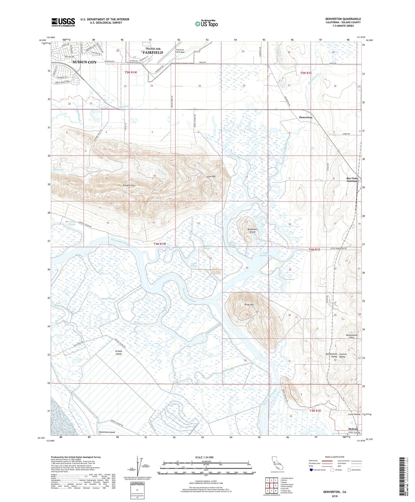
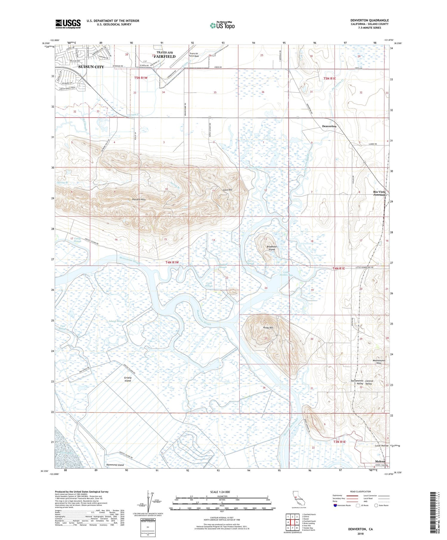
Denverton California US Topo Map
Couldn't load pickup availability
2021 topographic map quadrangle Denverton in the state of California. Scale: 1:24000. Based on the newly updated USGS 7.5' US Topo map series, this map is in the following counties: Solano. The map contains contour data, water features, and other items you are used to seeing on USGS maps, but also has updated roads and other features. This is the next generation of topographic maps. Printed on high-quality waterproof paper with UV fade-resistant inks.
Quads adjacent to this one:
West: Fairfield South
Northwest: Fairfield North
North: Elmira
Northeast: Dozier
East: Birds Landing
Southeast: Antioch North
South: Honker Bay
Southwest: Vine Hill
This map covers the same area as the classic USGS quad with code o38121b8.
Contains the following named places: Beldons Landing, Bradmoor Island, Cross Slough, Denverton, Denverton Creek, Denverton Slough, Frost Slough, Grizzly Island, Hasting Slough, Island Slough, Kirby Hill, KKIS-AM (Pittsburg), Lingos Landing, Little Honker Bay, Luco Hill, Luco Slough, Meins Landing, Molena, Montezuma, Nurse Slough, Potrero Hills, Potrero Hills Landfill, Quail Glen Park, Rio Vista Junction, Shilo Church, Shiloh Cemetery, Tree Slough, ZIP Code: 94585