MyTopo
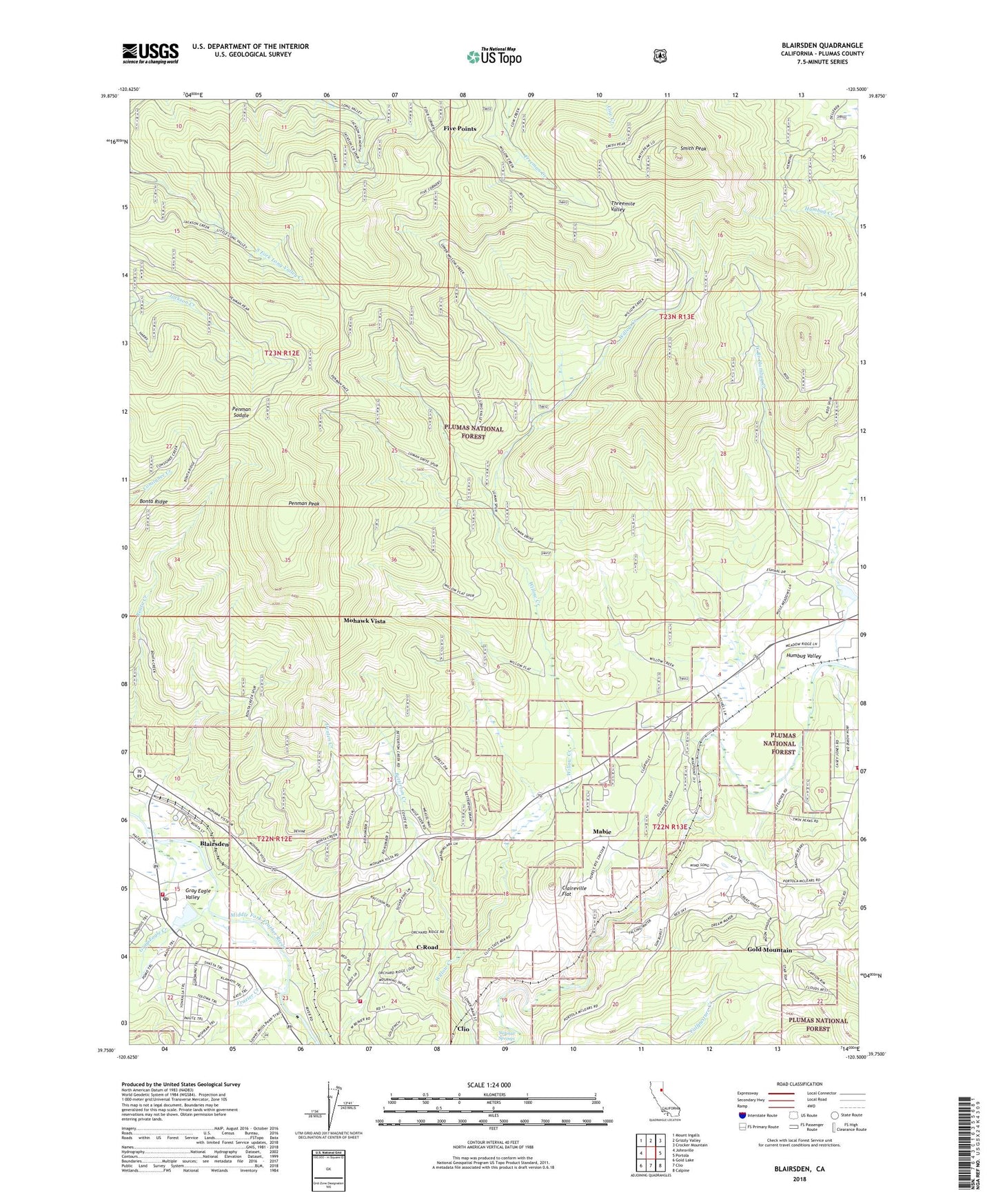
Blairsden California US Topo Map
Couldn't load pickup availability
Also explore the Blairsden Forest Service Topo of this same quad for updated USFS data
2022 topographic map quadrangle Blairsden in the state of California. Scale: 1:24000. Based on the newly updated USGS 7.5' US Topo map series, this map is in the following counties: Plumas. The map contains contour data, water features, and other items you are used to seeing on USGS maps, but also has updated roads and other features. This is the next generation of topographic maps. Printed on high-quality waterproof paper with UV fade-resistant inks.
Quads adjacent to this one:
West: Johnsville
Northwest: Mount Ingalls
North: Grizzly Valley
Northeast: Crocker Mountain
East: Portola
Southeast: Calpine
South: Clio
Southwest: Gold Lake
This map covers the same area as the classic USGS quad with code o39120g5.
Contains the following named places: Betterton Creek, Blairsden, Blairsden Census Designated Place, Blairsden Graeagle Post Office, Bonta Ridge, Bontes, C Road Fire Department, Claireville Flat, Clio Census Designated Place, C-Road Census Designated Place, Delaney, Denten Creek, Dentens, Eastern Plumas Rural Fire Protection District Station 3, Five Points, Frazier Creek, Gold Mountain Census Designated Place, Graeagle, Graeagle Fire Protection District Station 1, Graeagle Meadows Golf Course, Gray Eagle Creek, Humbug Creek, Mabie, Mabie Census Designated Place, Mohawk Vista, Mohawk Vista Census Designated Place, Otis Ranch, Penman Peak, Penman Saddle, Smith Peak, Sulphur Springs, West Branch Humbug Creek