MyTopo
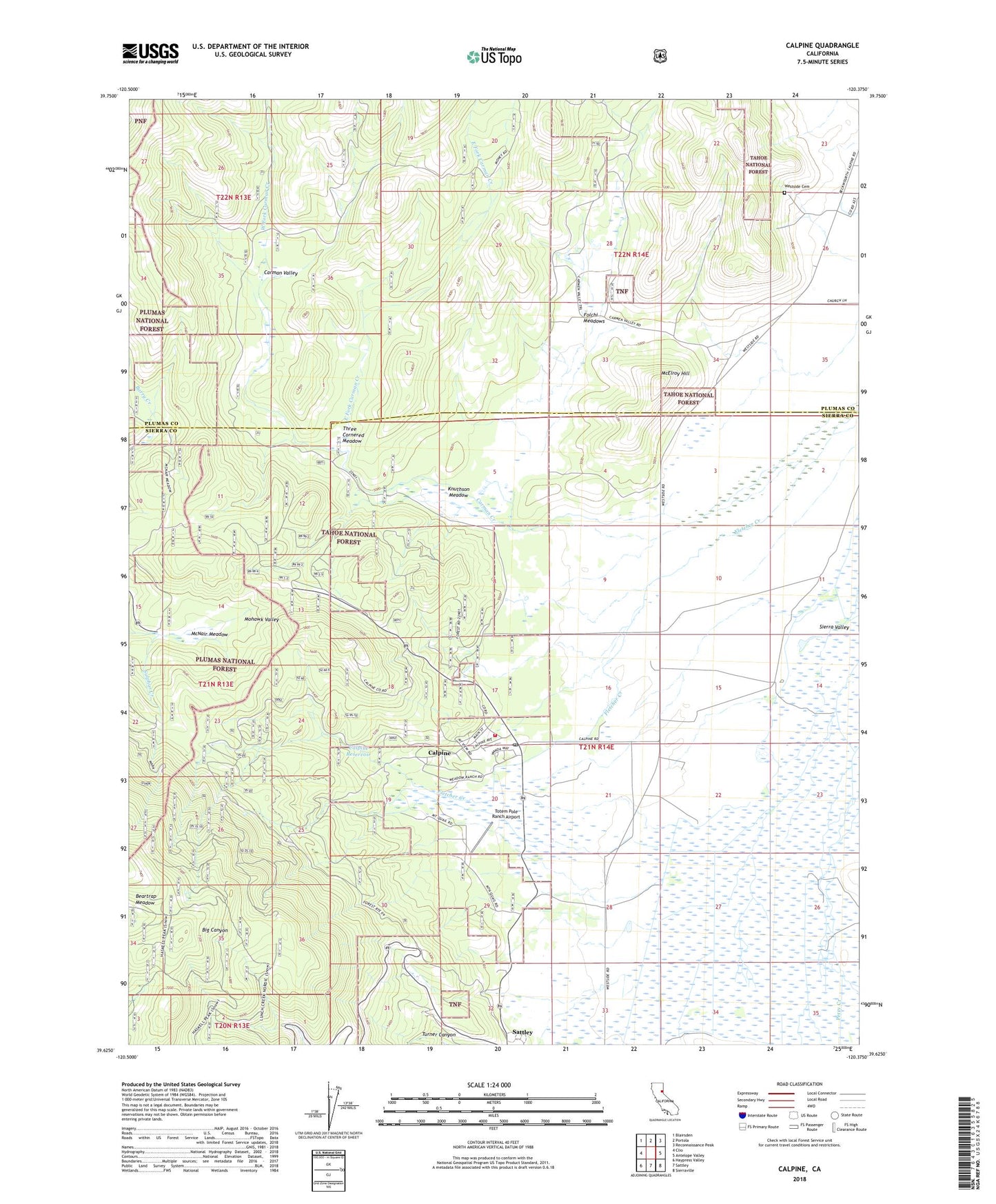
Calpine California US Topo Map
Couldn't load pickup availability
Also explore the Calpine Forest Service Topo of this same quad for updated USFS data
2022 topographic map quadrangle Calpine in the state of California. Scale: 1:24000. Based on the newly updated USGS 7.5' US Topo map series, this map is in the following counties: Sierra, Plumas. The map contains contour data, water features, and other items you are used to seeing on USGS maps, but also has updated roads and other features. This is the next generation of topographic maps. Printed on high-quality waterproof paper with UV fade-resistant inks.
Quads adjacent to this one:
West: Clio
Northwest: Blairsden
North: Portola
Northeast: Reconnaissance Peak
East: Antelope Valley
Southeast: Sierraville
South: Sattley
Southwest: Haypress Valley
This map covers the same area as the classic USGS quad with code o39120f4.
Contains the following named places: Calpine, Calpine Census Designated Place, Calpine Park, Calpine Post Office, Calpine Reservoir, Calpine Volunteer Fire Department, Carman Creek, Carman Valley, Coyote Canyon, East Fork Carman Creek, Fletcher Creek, Folchi Meadows, Haskell Peak Trail, Knuthson Meadow, McElroy Hill, McNair Meadow, McPherrin Camp, Perry Creek, Sattley Census Designated Place, Three Cornered Meadow, Totem Pole Ranch Airport, West Fork Carman Creek, Westside Cemetery, ZIP Code: 96124